Plan your visit
Getting here
51.94608, 1.07745
Visiting this summer
Seasonal nature notes and what to look for now
Visiting this summer
Seasonal nature notes and what to look for now
- 🐦83+ species recorded in this area — summer evenings are best for activity; watch for Carrion Crow and Black-headed Gull
- ✦Historic character is a year-round quality here — summer brings its own atmosphere to the setting
- ☕The Tea House at Mistley Quay — makes this an easy full-day family visit without needing to pack food
🌤️ Visiting this summer
- 🐦83+ species recorded in this area — summer evenings are best for activity; watch for Carrion Crow and Black-headed Gull
- ✦Historic character is a year-round quality here — summer brings its own atmosphere to the setting
- ☕The Tea House at Mistley Quay — makes this an easy full-day family visit without needing to pack food
Good to know
- 🐕Dogs welcome
Best for
Bird watching
Very strong match
Birds — Carrion Crow, Black-headed Gull, Woodpigeon +80 more · last seen 2025
Heritage
Very strong match
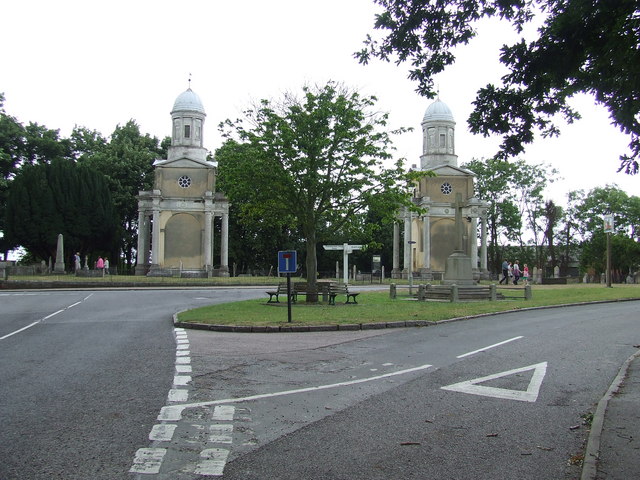
Grade I listed building: MISTLEY TOWERS, NORTH WEST TOWER; Historic site with public access
Wildlife
Strong match
Birds — Carrion Crow, Black-headed Gull, Woodpigeon +80 more · last seen 2025
Family friendly
Good match
café
Dog walks
Good match
Dogs allowed with public access
Hiking
Good match
Named hiking route nearby: Essex Way (Stratford St Mary to Ramsey); Named hiking route nearby: Essex Way (Stratford St Mary to Ramsey)
Trails nearby
Within roughly 5 km🚶Walking
8 signed routes nearby · 11 public paths nearby
Signed route nearbyPublic paths
Walking
Alton Water Red RouteWalking route
Stour Valley Path part 3Walking route
Flatford and Constable Country Walk, FlatfordWalking route11.2 km
4 miles (6.4km) return from Manningtree to Flatford. Optional loop to Dedham adds another 3 miles (4.8km). Generally flat grass and gravel paths with some moderate slopes.
St Edmund WayWalking route
Stour & Orwell WalkWalking route
The Greenpublic footpath · 96 m
Church Lanepublic footpath · 415 m
Church Lanepublic footpath · 42 m
🚴Cycling
6 signed routes nearby
Signed route nearby
Cycling
NCN 51Cycling route
South Suffolk Route BCycling route
Alton Water LoopCycling route
EuroVelo 2 - Capitals Route - part United Kingdom 8Cycling route
South Suffolk Route B2Cycling route
South Suffolk Route B1Cycling route
Wildlife to spot
Photos
Weather for this location
Loading local forecast…
Nearby places
Useful places within 5 km