Plan your visit
🦉 Wildlife🦅 Birds🍄 Fungi
Free entry Dogs welcome 4 ha
Places › England › Eastern › East Cambridgeshire Getting here
52.21419, 0.43685
Open directionsv Visiting this summer
Seasonal nature notes and what to look for now
▾ ☀️ June — canopy now fully closed, creating cool dappled shade even on warm days 🍄 Mushroom foraging is at its best in summer here 🐕 Dogs welcome — bring water in summer; the site has enough space to find shade on hot days 🌤️ Visiting this summer
☀️ June — canopy now fully closed, creating cool dappled shade even on warm days 🍄 Mushroom foraging is at its best in summer here 🐕 Dogs welcome — bring water in summer; the site has enough space to find shade on hot days £ Free to visit — no entry charge🐕 Dogs welcome🦉 Wildlife
Very strong match
Multi-group wildlife — Amphibians, Birds, Mammals; Multi-group wildlife — Amphibians, Birds, Mammals
Free
🦅 Bird watching
Very strong match
Birds — Chaffinch, Dunnock, Woodpigeon +66 more · last seen 2025; Birds — Chaffinch, Dunnock, Woodpigeon +66 more · last seen 2025
Free
🍄 Mushroom foraging
Strong match
Fungi — Hypotrachyna afrorevoluta, Diploicia canescens, Alyxoria varia +39 more · last seen 2013; Fungi — Hypotrachyna afrorevoluta, Diploicia canescens, Alyxoria varia +39 more · last seen 2013
Varies
🍂 Seasonal nature
Strong match
Plants — Forked Veilwort, White-tipped Bristle-moss, Clustered Feather-moss +107 more · last seen 2020; Plants — Forked Veilwort, White-tipped Bristle-moss, Clustered Feather-moss +107 more · last seen 2020
Free
🦋 Insect spotting
Strong match
Insects — Painted Lady, Large White, Small White +35 more · last seen 2025; Insects — Painted Lady, Large White, Small White +35 more · last seen 2025
Free
Deciduous woodland — fungi, berries and wild garlic; Plants — Hawthorn, Hazel, Bramble +4 more foraging species
Varies
Trails nearby Within roughly 5 km 3 signed routes nearby · 1 public path nearby
Signed route nearby Public paths
Icknield Way Path Walking route 169 km ▾
long distance footpath 169 km
Named route Length 169 km Regional walking route
Show on map Stour Valley Path part 2 Walking route ▾
Named route Regional walking route
Show on map Stour Valley Path part 1 Walking route ▾
Named route Regional walking route
Show on map 30 signed routes nearby
Signed route nearby
NCN 51 Cycling route ▾
Named route Ref 51 National Cycle Network
Show on map Main Route Cycling route 5.2 km ▾
Named route Ref 51 Length 5.2 km National Cycle Network On-road Surface asphalt
Show on map Main Route Cycling route 196 m ▾
Named route Ref 51 Length 196 m National Cycle Network On-road Surface asphalt
Show on map Main Route Cycling route 63 m ▾
Named route Ref 51 Length 63 m National Cycle Network Traffic-free Surface concrete
Show on map Main Route Cycling route 41 m ▾
Named route Ref 51 Length 41 m National Cycle Network On-road Surface asphalt
Show on map Main Route Cycling route 125 m ▾
Named route Ref 51 Length 125 m National Cycle Network Traffic-free Surface pavementslabs
Show on map 1 signed route nearby
Signed route nearby
Icknield Way Cycle Trail Mountain bike route 226 km ▾
This is the off-road or mountain cycling route of the Icknield Way Trail.
Named route Length 226 km Regional cycle route
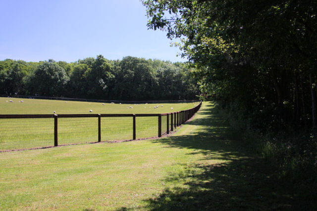
Show on map Photos Moorley Plantation and paddocks
‹ ›
Weather for this location Next 14 days Nearby places Useful places within 5 km
All Historic
Own or manage this place?
Claim this listing to keep details accurate, add photos, and highlight what makes it special — free.
Claim this page→ How useful was the information on this page?
id: 1bfd554f-f006-43ca-a9af-9a46370c67a8
UK green spaces mapped from open public data — so anyone can find the woodland, trail, or nature reserve closest to them.
© 2026 Glade · Made with care for UK green spaces
Wildlife to spot
4,709 records · National Biodiversity Network
▾
Wildlife to spot 4,709 records · National Biodiversity Network Blackbird · Great Tit · Wren · Chaffinch · Skylark +41
Blackbird Turdus merula2024 Great Tit Parus major2024 Wren Troglodytes troglodytes2024 Chaffinch Fringilla coelebs2024 Skylark Alauda arvensis2024 Pheasant Phasianus colchicus2024 Rook Corvus frugilegus2024 Blackcap Sylvia atricapilla2024 Dunnock Prunella modularis2024 Linnet Linaria cannabina2024 Goldcrest Regulus regulus2024 Blue Tit Cyanistes caeruleus2024 Swift Apus apus2024 Woodpigeon Columba palumbus2024 Carrion Crow Corvus corone2024 Robin Erithacus rubecula2024 Spotted Flycatcher Muscicapa striata Jackdaw Coloeus monedula2024 Song Thrush Turdus philomelos2024 Collared Dove Streptopelia decaocto2024 Goldfinch Carduelis carduelis2024 Chiffchaff Phylloscopus collybita2024 Mallard Anas platyrhynchos2024 Starling Sturnus vulgaris2022 Greenfinch Chloris chloris2021 Grey Partridge Perdix perdix2024 Whitethroat Curruca communis2024 Pied Wagtail Motacilla alba2022 Herring Gull Larus argentatus2022 Curlew Numenius arquata2022 Tawny Owl Strix aluco2022 Stock Dove Columba oenas2021 Kestrel Falco tinnunculus2021 Bullfinch Pyrrhula pyrrhula2020 Muscicapa striata striata Muscicapa striata striata2024 House Martin Delichon urbicum2024 Wheatear Oenanthe oenanthe2024 Red-legged Partridge Alectoris rufa2024 Cuckoo Cuculus canorus2023 Long-tailed Tit Aegithalos caudatus2022 Swallow Hirundo rustica2022 Willow Warbler Phylloscopus trochilus2021 White Stork Ciconia ciconia2020 Mistle Thrush Turdus viscivorus2020 Jay Garrulus glandarius2020 Magpie Pica pica2020 🦌 Mammals 8 species
spring summer
2024 ▾
Brown Hare · Grey Squirrel · Rabbit · Hedgehog · Muntjac +3
Brown Hare Lepus europaeus Grey Squirrel Sciurus carolinensis2022 Rabbit Oryctolagus cuniculus2022 Hedgehog Erinaceus europaeus2020 Muntjac Muntiacus reevesi Pipistrelle Bat species Pipistrellus 🐝 Insects 11 species
spring summer
2025 ▾
Red-tailed Bumblebee · Bombus lucorum · Common Carder Bee · White/Buff-tailed Bumblebee workers · Small Garden Bumblebee +6
Red-tailed Bumblebee Bombus lapidarius2022 Bombus lucorum Bombus lucorum2022 Common Carder Bee Bombus pascuorum2022 White/Buff-tailed Bumblebee workers Bombus lucorum/terrestris2022 Small Garden Bumblebee Bombus hortorum2022 🌿 Plants 2 species
spring summer
2021 ▾
Mistletoe · Wood Melick
Mistletoe Viscum album Wood Melick Melica uniflora2020 Species observations from the last 10 years via NBN Atlas
2022
2022
Red Fox Vulpes vulpes2022
Red Fox Vulpes vulpes2022
Common Pipistrelle Pipistrellus pipistrellus2021
Common Pipistrelle Pipistrellus pipistrellus2021
Tree Bumblebee Bombus hypnorum2022
Tree Bumblebee Bombus hypnorum2022
Box Bug Gonocerus acuteangulatus
Box Bug Gonocerus acuteangulatus
Western Honey Bee Apis mellifera2022
Western Honey Bee Apis mellifera2022
Forest Cuckoo Bee Bombus sylvestris2022
Forest Cuckoo Bee Bombus sylvestris2022
Early Bumblebee Bombus pratorum2022
Early Bumblebee Bombus pratorum2022
Rosemary Beetle Chrysolina americana2020
Rosemary Beetle Chrysolina americana2020 Events & activities nearby Switch provider to compare local events, tours and bookable activities.
Bookable tours GetYourGuide Promote here