🌞Midsummer — early morning visits most comfortable; look for deer fawns in quieter clearings
🐕Early mornings are best for dog walks in summer — visit before 9am to avoid the heat and find quieter trails
🅿️Parking on site — 18 car parks within reach
🌤️ Visiting this summer
🌞Midsummer — early morning visits most comfortable; look for deer fawns in quieter clearings
🐕Early mornings are best for dog walks in summer — visit before 9am to avoid the heat and find quieter trails
🅿️Parking on site — 18 car parks within reach
Good to know
£Free to visit — no entry charge
🐕Dogs welcome
🅿️Parking· Paid
Best for
8 activities
🦅
Bird watching
Strong match
Nature reserve
Free
🦉
Wildlife
Strong match
Nature reserve
Free
🐶
Dog walks
Strong match
Dogs allowed — nature reserve
Free
🌲
Forest walks
Strong match
Nature reserve
Free
🍂
Seasonal nature
Good match
Nature reserve — seasonal wildlife and habitats
Free
🥾
Hiking
Good match
Named hiking route nearby: Midshires Way
Free
Trails nearby
Within roughly 5 km
🚶
Walking
▾
32 signed routes nearby · 56 public paths nearby
Signed route nearbyPublic paths
Midshires WayWalking route370 km▾
Multi-use trail links the Ridgeway National Trail with the Trans Pennine Trail
Named routeLength 370 kmRegional walking route
GM Ringway Stage 6Walking route13.4 km▾
GM Ringway Stage 6 - Strines to Marple
Named routeLength 13.4 kmRegional walking route
A walk to The Cage, LymeWalking route1.9 km▾
If you're looking for short walk with a big payoff, a walk to The Cage is essential on your visit to Lyme. Walk up the steep but short hill for views of the Manchester skyline, Peak District and deer sanctuary.
Named routeLength 1.9 kmDuration 00:30Round tripLocal walking route
A Walk to the Lantern at LymeWalking route2.7 km▾
You'll be rewarded with glorious views on this walk to a lesser visited areas of the park. You may also be able to see Lyme's red deer, who often spend their time in the east of the park.
Named routeLength 2.7 kmDuration 01:30Round tripLocal walking route
Paddock Cottage WalkWalking route2 km▾
This enjoyable walk to Paddock Cottage, which also takes in Knightslow Wood, Pursfield Wood and Drinkwater Meadow, will reward you with memorable views of the surrounding area on a clear day.
Named routeLength 2 kmDuration 01:00Round tripLocal walking route
Station Roadpublic footpath · 79 m▾
Public pathpublic footpathLength 79 mPath type: unclassified
Torrvale Roadpublic footpath · 64 m▾
Public pathpublic footpathLength 64 mPath type: unclassified
Station Roadpublic footpath · 59 m▾
Public pathpublic footpathLength 59 mSurface asphaltPath type: unclassified
🚴
Cycling
▾
38 signed routes nearby
Signed route nearby
Alan Newton WayCycling route▾
Named routeLocal cycle route
High Peak CyclewayCycling route▾
Named routeLocal cycle route
Middlewood WayCycling route▾
Named route
Peak Forest Tramway TrailCycling route▾
Named routeLocal cycle route
Sett Valley TrailCycling route▾
Named routeLocal cycle route
Peak Forest CanalCycling route▾
Named routeLocal cycle route
🚵
Mountain biking
▾
2 signed routes nearby
Signed route nearby
Great North Trail (Peak District and South Pennines)Mountain bike route130.4 km▾
Named routeLength 130.4 kmNational Cycle Network
Riding the RidgesMountain bike route▾
Named route
🐴
Horse riding
▾
1 public path nearby
Public paths
Redmoor Lanebridleway · 399 m▾
Public pathbridlewayLength 399 mPath type: service
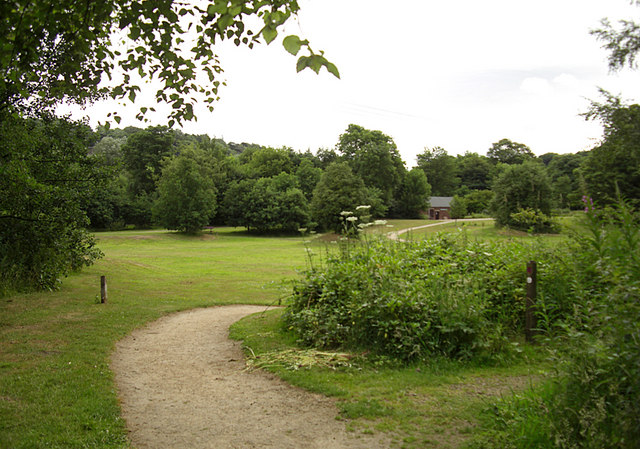
About this nature reserve
Mousley Bottom is an 11-hectare Local Nature Reserve in High Peak, East Midlands, England. Visitors can enjoy woodland and pasture habitats that attract diverse wildlife, including birds and butterflies, amidst a network of walking trails.