Birds — Robin, Blackbird, Blue Tit +56 more · last seen 2025; Birds — Robin, Blackbird, Blue Tit +56 more · last seen 2025
Free
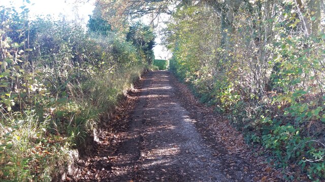
🍂
Seasonal nature
Strong match
Ancient woodland — bluebells, fungi and autumn colour; Plants — Violet Helleborine, Dog's Mercury, Bluebell +13 more · last seen 2024
Free
🦋
Insect spotting
Strong match
Priority ponds — dragonflies, damselflies and aquatic invertebrates; Insects — Large Red Damselfly, Common Darter, Emperor Dragonfly +174 more · last seen 2025
Free
🐶
Dog walks
Strong match
Dogs allowed — public woodland
Free
🚲
Cycling
Good match
Named cycling route nearby: National Cycle Network Route 5
Varies
Trails nearby
Within roughly 5 km
🚶
Walking
▾
5 signed routes nearby · 30 public paths nearby
Signed route nearbyPublic paths
The RidgewayWalking route140 km▾
Named routeRef RWLength 140 kmNational walking route
Oxfordshire WayWalking route110 km▾
a traverse of Oxfordshire from the Cotswolds to the Chilterns
Named routeRef OWLength 110 kmRegional walking route
The Chiltern Way Southern ExtensionWalking route▾
Long distance path
Named routeRef CWSRegional walking route
Estate Walk, Greys CourtWalking route3 km▾
Greys Court is a picturesque 16th-century mansion with tranquil gardens owned by the National Trust. This walk takes you around the Greys Court Estate, through classic Chilterns scenery of beech woodlands and open countryside with lovely views.
Named routeLength 3 kmDuration 00:45Round tripLocal walking route
Sir Felix's Gentle Walk, Greys CourtWalking route1.2 km▾
An easy waymarked walk around Greys Court. Sir Felix Brunner was especially fond of the woodlands on the estate, and in his later years Lady Brunner suggested that he should create a short walk from which he could obtain views across the Estate.
Named routeLength 1.2 kmDuration 00:30Round tripLocal walking route
Thornfieldspublic footpath · 72 m▾
Public pathpublic footpathLength 72 mPath type: track
School Lanepublic footpath · 202 m▾
Public pathpublic footpathLength 202 mPath type: residential
🚴
Cycling
▾
3 signed routes nearby
Signed route nearby
National Cycle Network Route 5Cycling route▾
Named routeRef 5National Cycle Network
Chilterns CyclewayCycling route▾
Named routeRound tripRegional cycle route
Main RouteCycling route18.5 km▾
Named routeRef 5Length 18.5 kmNational Cycle NetworkOn-roadSurface asphalt
🚵
Mountain biking
▾
2 signed routes nearby
Signed route nearby
Judges' RideMountain bike route▾
Named route
King Alfred's WayMountain bike route▾
King Alfreds Way is 350km (220 miles) off road route designed to be ridden clockwise. It starts & ends in Winchester. It is suitable for gravel or cross-country bikes.
Named routeRegional cycle route
🐴
Horse riding
▾
23 public paths nearby
Public paths
Judges Roadbridleway · 833 m▾
Public pathbridlewayLength 833 mSurface unpavedPath type: track
Neals Lanebridleway · 571 m▾
Public pathbridlewayLength 571 mSurface pavedPath type: track
Lime Avenuebridleway · 333 m▾
Public pathbridlewayLength 333 mPath type: residential
Baron Waybridleway · 126 m▾
Public pathbridlewayLength 126 mPath type: residential