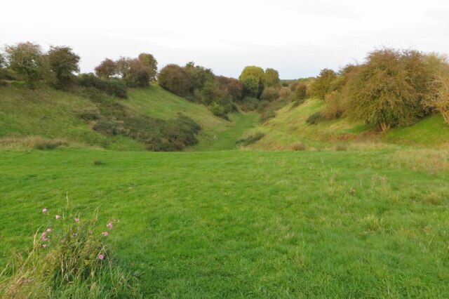
Newton Picnic Site
Getting here
52.40400, -1.22065
Visiting this summer
Seasonal nature notes and what to look for now
Visiting this summer
Seasonal nature notes and what to look for now
- 🌞Midsummer — early morning visits most comfortable; look for deer fawns in quieter clearings
- 🧺Good picnic destination in summer — open space and facilities for a relaxed day out
- 🐕Dogs welcome — bring water in summer; the site has enough space to find shade on hot days
🌤️ Visiting this summer
- 🌞Midsummer — early morning visits most comfortable; look for deer fawns in quieter clearings
- 🧺Good picnic destination in summer — open space and facilities for a relaxed day out
- 🐕Dogs welcome — bring water in summer; the site has enough space to find shade on hot days
Good to know
- £Free to visit — no entry charge
- 🐕Dogs welcome
Best for
Picnic day out
Strong match
picnic area, car park; Urban park — open green space
Wildlife
Strong match
Deciduous woodland priority habitat; Birds — Jackdaw, Blackbird, Magpie +42 more · last seen 2025
Bird watching
Strong match
Birds — Jackdaw, Blackbird, Magpie +42 more · last seen 2025; Birds — Jackdaw, Blackbird, Magpie +42 more · last seen 2025
Dog walks
Strong match
Dogs allowed with public access
Family friendly
Good match
picnic area; Urban park — family destination
Foraging
Good match
Deciduous woodland — fungi, berries and wild garlic
Trails nearby
Within roughly 5 km🚶Walking
3 signed routes nearby · 5 public paths nearby
Signed route nearbyPublic paths
Walking
Oxford Canal WalkWalking route
Shakespeare's Avon WayWalking route142 km
From the source at Naseby, Northamptonshire to the Severn at Tewkesbury
Rail Trail: The Avon Valley from Rugby CircularWalking route4.8 km
A 3-mile walk sampling a different side of Rugby, with an amble along the Avon Valley through peace and quiet to the village of Clifton-upon-Dunsmore. Duration: 1.5 hours Distance: 3 miles
🚴Cycling
29 signed routes nearby
Signed route nearby
Cycling
Route 41Cycling route
Route 50Cycling route
Viaduct CyclewayCycling route
Ways signed by route signs as part of the Viaduct Cycleway
Route 53Cycling route
Main RouteCycling route36 m
Main RouteCycling route2.5 km
🐴Horse riding
4 public paths nearby
Public paths
Horse riding
No named routes yet. Public paths are shown on the map.
Wildlife to spot
Photos
Weather for this location
Loading local forecast…
Nearby places
Useful places within 5 km
Own or manage this place?
Claim this listing to keep details accurate, add photos, and highlight what makes it special — free.
Claim this pageHow was your visit?
How useful was the information on this page?
id: 0e30276a-56e6-4288-80ad-4dfd0f9fe7bf