🦅 Birds🦉 Wildlife🍂 Seasonal
↑ Share
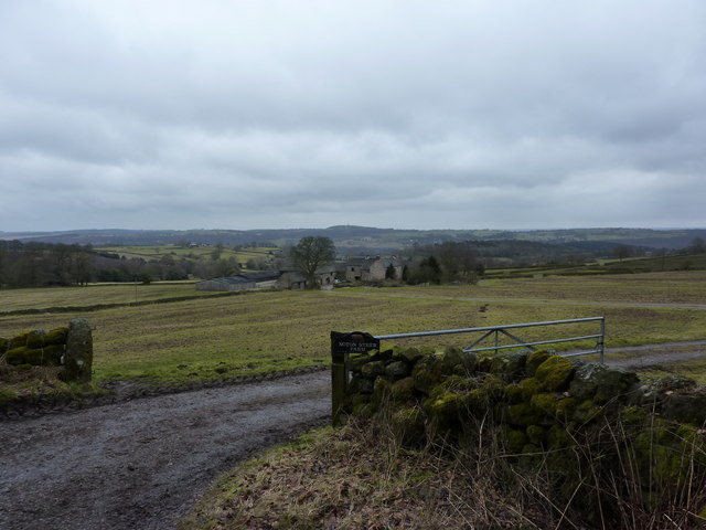
Public access Free entry Dogs welcome 4 ha
Places › England › East Midlands › Amber Valley Getting here
53.07375, -1.54292
Open directionsv Visiting this summer
Seasonal nature notes and what to look for now
▾ 🐦 86+ species recorded in this area — summer evenings are best for activity; watch for Robin and Blackbird 🐕 Early mornings are best for dog walks in summer — visit before 9am to avoid the heat and find quieter trails 📍 Open access throughout summer — no booking required 🌤️ Visiting this summer
🐦 86+ species recorded in this area — summer evenings are best for activity; watch for Robin and Blackbird 🐕 Early mornings are best for dog walks in summer — visit before 9am to avoid the heat and find quieter trails 📍 Open access throughout summer — no booking required £ Free to visit — no entry charge🐕 Dogs welcome🦅 Bird watching
Very strong match
Birds — Robin, Blackbird, Woodpigeon +83 more · last seen 2025; Birds — Robin, Blackbird, Woodpigeon +83 more · last seen 2025
Free
🦉 Wildlife
Very strong match
Multi-group wildlife — Birds, Mammals; Multi-group wildlife — Birds, Mammals
Free
🍂 Seasonal nature
Strong match
Plants — Lesser Celandine, Opposite-leaved Golden-saxifrage, Narrow Buckler-fern +65 more · last seen 2025; Plants — Lesser Celandine, Opposite-leaved Golden-saxifrage, Narrow Buckler-fern +65 more · last seen 2025
Free
Dogs allowed — public woodland
Free
Plants — Common Nettle, Meadowsweet, Bramble +8 more foraging species; Deciduous woodland — fungi, berries and wild garlic
Varies
Trails nearby Within roughly 5 km 14 signed routes nearby · 16 public paths nearby
Signed route nearby Public paths
Midshires Way Walking route 370 km ▾
Multi-use trail links the Ridgeway National Trail with the Trans Pennine Trail
Named route Length 370 km Regional walking route
Show on map Limestone Way Walking route 74 km ▾
Castleton to Rocester
Named route Length 74 km Point-to-point Regional walking route
Show on map High Peak Trail Walking route 27 km ▾
Named route Length 27 km Regional walking route
Show on map Derwent Valley Heritage Way Walking route 89 km ▾
Named route Length 89 km Regional walking route
Show on map Amber Valley Routeway Walk 14 Walking route ▾
Named route Local walking route
Show on map 11 signed routes nearby
Signed route nearby
Route 54 Cycling route ▾
Named route Ref 54 National Cycle Network
Show on map Route 547 Cycling route ▾
Named route Ref 547 National Cycle Network
Show on map Main Route Cycling route 194 m ▾
Named route Ref 547 Length 194 m National Cycle Network Traffic-free Surface unsealedfirm
Show on map Main Route Cycling route 3.5 km ▾
Named route Ref 54 Length 3.5 km National Cycle Network Traffic-free Surface unsealedfirm
Show on map Main Route Cycling route 97 m ▾
Named route Ref 54 Length 97 m National Cycle Network Traffic-free Surface unsealedfirm
Show on map Alternative Route Cycling route 1.4 km ▾
Named route Ref 547 Length 1.4 km National Cycle Network On-road Surface asphalt
Show on map 3 signed routes nearby
Signed route nearby
High Peak Trail Mountain bike route 27 km ▾
Named route Ref High Peak Trail Length 27 km Point-to-point Local cycle route
Show on map Carsington Water Cycle Route Mountain bike route ▾
Great North Trail (Peak District and South Pennines) Mountain bike route 130.4 km ▾
Named route Length 130.4 km National Cycle Network
Show on map
Weather for this location Next 14 days Nearby places Useful places within 5 km
All Historic
Own or manage this place?
Claim this listing to keep details accurate, add photos, and highlight what makes it special — free.
Claim this page→ How useful was the information on this page?
Something wrong on this page?
id: 861e705b-b5c4-459f-95fa-bbd39d22b7ae
UK green spaces mapped from open public data — so anyone can find the woodland, trail, or nature reserve closest to them.
© 2026 Glade · Made with care for UK green spaces
Wildlife to spot
6,939 records · National Biodiversity Network
▾
Wildlife to spot 6,939 records · National Biodiversity Network 🐦 Birds 53 species
spring summer autumn
2025 ▾
Robin · Blackbird · Coal Tit · Blue Tit · Woodpigeon +48
Robin Erithacus rubecula Blackbird Turdus merula Coal Tit Periparus ater Blue Tit Cyanistes caeruleus Woodpigeon Columba palumbus Carrion Crow Corvus corone Wren Troglodytes troglodytes Nuthatch Sitta europaea Goldfinch Carduelis carduelis Magpie Pica pica Starling Sturnus vulgaris Jackdaw Coloeus monedula Goldcrest Regulus regulus Grey Wagtail Motacilla cinerea Canada Goose Branta canadensis Long-tailed Tit Aegithalos caudatus Mallard Anas platyrhynchos Treecreeper Certhia familiaris Great Tit Parus major Spotted Flycatcher Muscicapa striata Moorhen Gallinula chloropus Chiffchaff Phylloscopus collybita House Martin Delichon urbicum Blackcap Sylvia atricapilla Lesser Black-backed Gull Larus fuscus Black-headed Gull Chroicocephalus ridibundus Chaffinch Fringilla coelebs Pied Wagtail Motacilla alba yarrellii Dunnock Prunella modularis Bullfinch Pyrrhula pyrrhula Rook Corvus frugilegus Mute Swan Cygnus olor Jay Garrulus glandarius Stock Dove Columba oenas Meadow Pipit Anthus pratensis Stonechat Saxicola rubicola Raven Corvus corax Lapwing Vanellus vanellus Skylark Alauda arvensis Kestrel Falco tinnunculus Linnet Linaria cannabina Pheasant Phasianus colchicus Swallow Hirundo rustica Kingfisher Alcedo atthis Siskin Spinus spinus Tree Pipit Anthus trivialis Redstart Phoenicurus phoenicurus Pied Flycatcher Ficedula hypoleuca Swift Apus apus Great Spotted Woodpecker Dendrocopos major Song Thrush Turdus philomelos Willow Warbler Phylloscopus trochilus Wheatear Oenanthe oenanthe 🌿 Plants 62 species
spring summer
2025 ▾
Common Nettle · Sweet Vernal-grass · Ribwort Plantain · Hogweed · Centaurea nigra +57
Common Nettle Urtica dioica Sweet Vernal-grass Anthoxanthum odoratum Ribwort Plantain Plantago lanceolata Hogweed Heracleum sphondylium Centaurea nigra Centaurea nigra Creeping Buttercup Ranunculus repens Species observations from the last 10 years via NBN Atlas
Marsh Thistle
Marsh Thistle
Cirsium palustre
Cirsium palustre
Lesser Celandine Ficaria verna
Lesser Celandine Ficaria verna
Opposite-leaved Golden-saxifrage Chrysosplenium oppositifolium
Opposite-leaved Golden-saxifrage Chrysosplenium oppositifolium
Wood Anemone Anemone nemorosa
Wood Anemone Anemone nemorosa
Meadow Buttercup Ranunculus acris
Meadow Buttercup Ranunculus acris
Yarrow Achillea millefolium
Yarrow Achillea millefolium
Common Vetch Vicia sativa
Common Vetch Vicia sativa
Crested Dog's-tail Cynosurus cristatus
Crested Dog's-tail Cynosurus cristatus
Selfheal Prunella vulgaris
Selfheal Prunella vulgaris
False Oat-grass Arrhenatherum elatius
False Oat-grass Arrhenatherum elatius
Broad-leaved Dock Rumex obtusifolius
Broad-leaved Dock Rumex obtusifolius
Spear Thistle Cirsium vulgare
Spear Thistle Cirsium vulgare
White Dead-nettle Lamium album
White Dead-nettle Lamium album
Wild Teasel Dipsacus fullonum
Wild Teasel Dipsacus fullonum
Common Ragwort Jacobaea vulgaris
Common Ragwort Jacobaea vulgaris
Bugle Ajuga reptans
Bugle Ajuga reptans
Red Clover Trifolium pratense
Red Clover Trifolium pratense
Bush Vetch Vicia sepium
Bush Vetch Vicia sepium
Creeping Thistle Cirsium arvense
Creeping Thistle Cirsium arvense
Festuca rubra Festuca rubra
Festuca rubra Festuca rubra
Rosebay Willowherb Chamaenerion angustifolium
Rosebay Willowherb Chamaenerion angustifolium
Curled Dock Rumex crispus
Curled Dock Rumex crispus
Cock's-foot Dactylis glomerata
Cock's-foot Dactylis glomerata
Meadow Vetchling Lathyrus pratensis
Meadow Vetchling Lathyrus pratensis
Common Sorrel Rumex acetosa
Common Sorrel Rumex acetosa
Perennial Rye-grass Lolium perenne
Perennial Rye-grass Lolium perenne
White Stonecrop Sedum album
White Stonecrop Sedum album
Yellow Pimpernel Lysimachia nemorum
Yellow Pimpernel Lysimachia nemorum
Creeping Soft-grass Holcus mollis
Creeping Soft-grass Holcus mollis
Wavy Bitter-cress Cardamine flexuosa
Wavy Bitter-cress Cardamine flexuosa
Meadowsweet Filipendula ulmaria
Meadowsweet Filipendula ulmaria
Remote Sedge Carex remota
Remote Sedge Carex remota
Narrow Buckler-fern Dryopteris carthusiana
Narrow Buckler-fern Dryopteris carthusiana
Tufted Hair-grass Deschampsia cespitosa
Tufted Hair-grass Deschampsia cespitosa
Cleavers Galium aparine
Cleavers Galium aparine
Annual Meadow-grass Poa annua
Annual Meadow-grass Poa annua
Marsh-marigold Caltha palustris
Marsh-marigold Caltha palustris
Goat Willow Salix caprea
Goat Willow Salix caprea
Marsh-bedstraw Galium palustre
Marsh-bedstraw Galium palustre
Floating Sweet-grass Glyceria fluitans
Floating Sweet-grass Glyceria fluitans
Soft-rush Juncus effusus
Soft-rush Juncus effusus
Yellow Archangel Lamiastrum galeobdolon
Yellow Archangel Lamiastrum galeobdolon
Wood Dock Rumex sanguineus
Wood Dock Rumex sanguineus
Herb-Robert Geranium robertianum
Herb-Robert Geranium robertianum
Marsh Foxtail Alopecurus geniculatus
Marsh Foxtail Alopecurus geniculatus
Red Campion Silene dioica
Red Campion Silene dioica
Wood Forget-me-not Myosotis sylvatica
Wood Forget-me-not Myosotis sylvatica
Ivy-leaved Speedwell Veronica hederifolia
Ivy-leaved Speedwell Veronica hederifolia
Ground-ivy Glechoma hederacea
Ground-ivy Glechoma hederacea
Bluebell Hyacinthoides non-scripta
Bluebell Hyacinthoides non-scripta
Caper Spurge Euphorbia lathyris
Caper Spurge Euphorbia lathyris
Ramsons Allium ursinum
Ramsons Allium ursinum
Field Wood-rush Luzula campestris
Field Wood-rush Luzula campestris
Wood-sorrel Oxalis acetosella
Wood-sorrel Oxalis acetosella
Barren Strawberry Potentilla sterilis
Barren Strawberry Potentilla sterilis
Wood Speedwell Veronica montana
Wood Speedwell Veronica montana Events & activities nearby Switch provider to compare local events, tours and bookable activities.
Bookable tours GetYourGuide Promote here