Plan your visit
🦉 Wildlife🍄 Fungi🌿 Foraging
Free entry Dogs welcome 74 ha
Places › England › Eastern › West Suffolk Getting here
52.25605, 0.45005
Open directionsv Visiting this summer
Seasonal nature notes and what to look for now
▾ 🌞 Midsummer — early morning visits most comfortable; look for deer fawns in quieter clearings 🍄 Mushroom foraging is at its best in summer here 🐕 Dogs welcome — bring water in summer; the site has enough space to find shade on hot days 🌤️ Visiting this summer
🌞 Midsummer — early morning visits most comfortable; look for deer fawns in quieter clearings 🍄 Mushroom foraging is at its best in summer here 🐕 Dogs welcome — bring water in summer; the site has enough space to find shade on hot days £ Free to visit — no entry charge🐕 Dogs welcome🦉 Wildlife
Very strong match
Multi-group wildlife — Birds, Mammals, Reptiles; Multi-group wildlife — Birds, Mammals, Reptiles
Free
🍄 Mushroom foraging
Strong match
Fungi — Melanelixia subaurifera, Arthonia radiata, Punctelia jeckeri +41 more · last seen 2016; Fungi — Melanelixia subaurifera, Arthonia radiata, Punctelia jeckeri +41 more · last seen 2016
Varies
Plants — Common Sorrel, Dandelion, Pedunculate Oak +16 more foraging species; Deciduous woodland — fungi, berries and wild garlic
Varies
🍂 Seasonal nature
Strong match
Plants — Common Sorrel, White Clover, Meadow Vetchling +147 more · last seen 2023; Plants — Common Sorrel, White Clover, Meadow Vetchling +147 more · last seen 2023
Free
🦅 Bird watching
Strong match
Birds — Kestrel, Woodpigeon, Carrion Crow +25 more · last seen 2024; Birds — Kestrel, Woodpigeon, Carrion Crow +25 more · last seen 2024
Free
🦋 Insect spotting
Strong match
Insects — Small White, Large White, Red Admiral +42 more · last seen 2025; Insects — Small White, Large White, Red Admiral +42 more · last seen 2025
Free
Trails nearby Within roughly 5 km 2 signed routes nearby
Signed route nearby
Icknield Way Path Walking route 169 km ▾
long distance footpath 169 km
Named route Length 169 km Regional walking route
Show on map Stour Valley Path part 1 Walking route ▾
Named route Regional walking route
Show on map 37 signed routes nearby
Signed route nearby
NCN 51 Cycling route ▾
Named route Ref 51 National Cycle Network
Show on map Main Route Cycling route 217 m ▾
Named route Ref 51 Length 217 m National Cycle Network On-road Surface asphalt
Show on map Main Route Cycling route 196 m ▾
Named route Ref 51 Length 196 m National Cycle Network On-road Surface asphalt
Show on map Main Route Cycling route 63 m ▾
Named route Ref 51 Length 63 m National Cycle Network Traffic-free Surface concrete
Show on map Main Route Cycling route 41 m ▾
Named route Ref 51 Length 41 m National Cycle Network On-road Surface asphalt
Show on map N/A Cycling route 50 m ▾
Named route Length 50 m National Cycle Network Traffic-free Surface asphalt
Show on map 1 signed route nearby
Signed route nearby
Icknield Way Cycle Trail Mountain bike route 226 km ▾
This is the off-road or mountain cycling route of the Icknield Way Trail.
Named route Length 226 km Regional cycle route
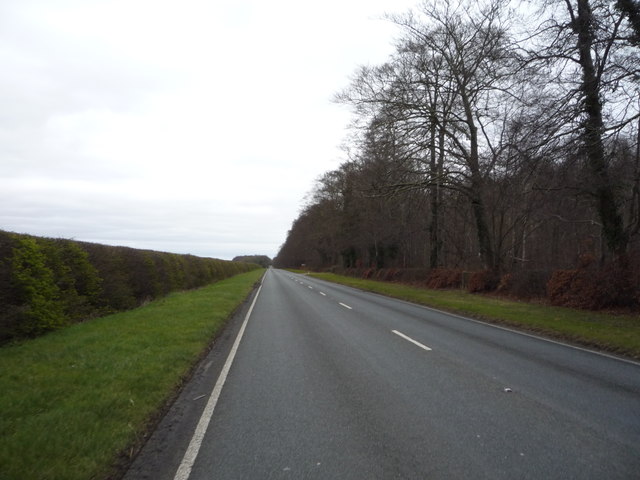
Show on map Photos Heading north east on Well Bottom (B1506)
‹ ›
Weather for this location Next 14 days Nearby places Useful places within 5 km
All Historic
Own or manage this place?
Claim this listing to keep details accurate, add photos, and highlight what makes it special — free.
Claim this page→ How useful was the information on this page?
id: 4951d069-4205-45ca-bae3-1e85811465f9
UK green spaces mapped from open public data — so anyone can find the woodland, trail, or nature reserve closest to them.
© 2026 Glade · Made with care for UK green spaces
Wildlife to spot
4,015 records · National Biodiversity Network
▾
Wildlife to spot 4,015 records · National Biodiversity Network Kestrel · Carrion Crow · Woodpigeon · Robin · Magpie +21
Kestrel Falco tinnunculus Carrion Crow Corvus corone Woodpigeon Columba palumbus Robin Erithacus rubecula Magpie Pica pica Chiffchaff Phylloscopus collybita Blue Tit Cyanistes caeruleus Rook Corvus frugilegus Goldcrest Regulus regulus Wren Troglodytes troglodytes Goldfinch Carduelis carduelis Blackbird Turdus merula Green Woodpecker Picus viridis Pheasant Phasianus colchicus Lesser Whitethroat Curruca curruca Red-legged Partridge Alectoris rufa Blackcap Sylvia atricapilla Jackdaw Coloeus monedula Long-tailed Tit Aegithalos caudatus Song Thrush Turdus philomelos Great Spotted Woodpecker Dendrocopos major Chaffinch Fringilla coelebs Common Gull Larus canus2023 Skylark Alauda arvensis2022 Meadow Pipit Anthus pratensis2022 Quail Coturnix coturnix2022 🦌 Mammals 2 species
spring autumn
2025 ▾
Common Pipistrelle · Muntjac
Common Pipistrelle Pipistrellus pipistrellus Muntjac Muntiacus reevesi2023 Adder
🐝 Insects 3 species
spring summer
2025 ▾
Azure Damselfly · Common Blue Damselfly · Rosemary Beetle
Azure Damselfly Coenagrion puella Common Blue Damselfly Enallagma cyathigerum Rosemary Beetle Chrysolina americana2022 Burnet-saxifrage · White Clover · Smaller Cat's-tail · Greater Knapweed · Yorkshire-fog +100
Burnet-saxifrage Pimpinella saxifraga2022 White Clover Trifolium repens2022 Smaller Cat's-tail Phleum bertolonii2022 Greater Knapweed Centaurea scabiosa2022 Yorkshire-fog Holcus lanatus2022 Quaking-grass Briza media Species observations from the last 10 years via NBN Atlas
2022
2022
Perennial Rye-grass Lolium perenne2022
Perennial Rye-grass Lolium perenne2022
Common Bent Agrostis capillaris2022
Common Bent Agrostis capillaris2022
Common Restharrow Ononis repens2022
Common Restharrow Ononis repens2022
Common Sorrel Rumex acetosa2022
Common Sorrel Rumex acetosa2022
Agrimony Agrimonia eupatoria2022
Agrimony Agrimonia eupatoria2022
Red Clover Trifolium pratense2022
Red Clover Trifolium pratense2022
Creeping Cinquefoil Potentilla reptans2022
Creeping Cinquefoil Potentilla reptans2022
Rough Hawkbit Leontodon hispidus2022
Rough Hawkbit Leontodon hispidus2022
Holly Ilex aquifolium2022
Holly Ilex aquifolium2022
Sweet Vernal-grass Anthoxanthum odoratum2022
Sweet Vernal-grass Anthoxanthum odoratum2022
Meadow Vetchling Lathyrus pratensis2022
Meadow Vetchling Lathyrus pratensis2022
Dwarf Thistle Cirsium acaule2022
Dwarf Thistle Cirsium acaule2022
Bulbous Buttercup Ranunculus bulbosus2022
Bulbous Buttercup Ranunculus bulbosus2022
Salad Burnet Poterium sanguisorba subsp. sanguisorba2022
Salad Burnet Poterium sanguisorba subsp. sanguisorba2022
Common Bird's-foot-trefoil Lotus corniculatus2022
Common Bird's-foot-trefoil Lotus corniculatus2022
Hoary Plantain Plantago media2022
Hoary Plantain Plantago media2022
Lady's Bedstraw Galium verum2022
Lady's Bedstraw Galium verum2022
Perforate St John's-wort Hypericum perforatum2022
Perforate St John's-wort Hypericum perforatum2022
Yarrow Achillea millefolium2022
Yarrow Achillea millefolium2022
Common Knapweed Centaurea nigra2022
Common Knapweed Centaurea nigra2022
Silver Birch Betula pendula2022
Silver Birch Betula pendula2022
Dandelion Taraxacum2022
Dandelion Taraxacum2022
Ribwort Plantain Plantago lanceolata2022
Ribwort Plantain Plantago lanceolata2022
Festuca rubra Festuca rubra2022
Festuca rubra Festuca rubra2022
Pedunculate Oak Quercus robur2022
Pedunculate Oak Quercus robur2022
Red Bartsia Odontites vernus2022
Red Bartsia Odontites vernus2022
Cock's-foot Dactylis glomerata2022
Cock's-foot Dactylis glomerata2022
Hawthorn Crataegus monogyna2022
Hawthorn Crataegus monogyna2022
Honeysuckle Lonicera periclymenum2022
Honeysuckle Lonicera periclymenum2022
Rubus halsteadensis Rubus halsteadensis2021
Rubus halsteadensis Rubus halsteadensis2021
Bloody Crane's-bill Geranium sanguineum
Bloody Crane's-bill Geranium sanguineum
Cypress Spurge Euphorbia cyparissias2022
Cypress Spurge Euphorbia cyparissias2022
Upright Brome Bromopsis erecta2022
Upright Brome Bromopsis erecta2022
Germander Speedwell Veronica chamaedrys2022
Germander Speedwell Veronica chamaedrys2022
Dropwort Filipendula vulgaris2022
Dropwort Filipendula vulgaris2022
Meadow Oat Helictochloa pratensis2022
Meadow Oat Helictochloa pratensis2022
Cowslip Primula veris2022
Cowslip Primula veris2022
Sycamore Acer pseudoplatanus2022
Sycamore Acer pseudoplatanus2022
Oregon-grape Mahonia aquifolium2022
Oregon-grape Mahonia aquifolium2022
Creeping Thistle Cirsium arvense2022
Creeping Thistle Cirsium arvense2022
Ash Fraxinus excelsior2022
Ash Fraxinus excelsior2022
Yellow Oat-grass Trisetum flavescens2022
Yellow Oat-grass Trisetum flavescens2022
Oxeye Daisy Leucanthemum vulgare2022
Oxeye Daisy Leucanthemum vulgare2022
Scots Pine Pinus sylvestris2022
Scots Pine Pinus sylvestris2022
Box Buxus sempervirens2022
Box Buxus sempervirens2022
Sheep's Fescue agg. Festuca ovina2022
Sheep's Fescue agg. Festuca ovina2022
Common Toadflax Linaria vulgaris2022
Common Toadflax Linaria vulgaris2022
Wild Mignonette Reseda lutea2022
Wild Mignonette Reseda lutea2022
Wild Basil Clinopodium vulgare2022
Wild Basil Clinopodium vulgare2022
Traveller's-joy Clematis vitalba2022
Traveller's-joy Clematis vitalba2022
Common Vetch Vicia sativa2022
Common Vetch Vicia sativa2022
False Oat-grass Arrhenatherum elatius2022
False Oat-grass Arrhenatherum elatius2022
Beech Fagus sylvatica2022
Beech Fagus sylvatica2022
Field Scabious Knautia arvensis2022
Field Scabious Knautia arvensis2022
Meadow Buttercup Ranunculus acris2022
Meadow Buttercup Ranunculus acris2022
Garlic Mustard Alliaria petiolata2022
Garlic Mustard Alliaria petiolata2022
Common Rock-rose Helianthemum nummularium2022
Common Rock-rose Helianthemum nummularium2022
Selfheal Prunella vulgaris2022
Selfheal Prunella vulgaris2022
Herb-Robert Geranium robertianum2022
Herb-Robert Geranium robertianum2022
Rowan Sorbus aucuparia2022
Rowan Sorbus aucuparia2022
Garden Privet Ligustrum ovalifolium2022
Garden Privet Ligustrum ovalifolium2022
Field Wood-rush Luzula campestris2022
Field Wood-rush Luzula campestris2022
Dogwood Cornus sanguinea2022
Dogwood Cornus sanguinea2022
Cleavers Galium aparine2022
Cleavers Galium aparine2022
Field Bindweed Convolvulus arvensis2022
Field Bindweed Convolvulus arvensis2022
Wild Privet Ligustrum vulgare2022
Wild Privet Ligustrum vulgare2022
Ground-ivy Glechoma hederacea2022
Ground-ivy Glechoma hederacea2022
Kidney Vetch Anthyllis vulneraria2022
Kidney Vetch Anthyllis vulneraria2022
Smooth Meadow-grass Poa pratensis2022
Smooth Meadow-grass Poa pratensis2022
Greater Plantain Plantago major2022
Greater Plantain Plantago major2022
Lesser Hawkbit Leontodon saxatilis2022
Lesser Hawkbit Leontodon saxatilis2022
Crested Hair-grass Koeleria macrantha2022
Crested Hair-grass Koeleria macrantha2022
Silverweed Potentilla anserina2022
Silverweed Potentilla anserina2022
Black Medick Medicago lupulina2022
Black Medick Medicago lupulina2022
Hogweed Heracleum sphondylium2022
Hogweed Heracleum sphondylium2022
Goat's-beard Tragopogon pratensis2022
Goat's-beard Tragopogon pratensis2022
Ivy Hedera helix2022
Ivy Hedera helix2022
Wild Cherry Prunus avium2022
Wild Cherry Prunus avium2022
Bramble Rubus fruticosus2022
Bramble Rubus fruticosus2022
Fairy Flax Linum catharticum2022
Fairy Flax Linum catharticum2022
Sweet Chestnut Castanea sativa2022
Sweet Chestnut Castanea sativa2022
Glaucous Sedge Carex flacca2022
Glaucous Sedge Carex flacca2022
Buckthorn Rhamnus cathartica2022
Buckthorn Rhamnus cathartica2022
Common Nettle Urtica dioica2022
Common Nettle Urtica dioica2022
Spiked Sedge Carex spicata2022
Spiked Sedge Carex spicata2022
Elm Ulmus2022
Elm Ulmus2022
European Larch Larix decidua2022
European Larch Larix decidua2022
Dewberry Rubus caesius2022
Dewberry Rubus caesius2022
Mouse-ear-hawkweed Pilosella officinarum2022
Mouse-ear-hawkweed Pilosella officinarum2022
Rosa micrantha x rubiginosa = R. x gremlii Rosa micrantha x rubiginosa = R. x gremlii2021
Rosa micrantha x rubiginosa = R. x gremlii Rosa micrantha x rubiginosa = R. x gremlii2021
Small-flowered Sweet-briar Rosa micrantha2021
Small-flowered Sweet-briar Rosa micrantha2021
Round-leaved Crane's-bill Geranium rotundifolium2021
Round-leaved Crane's-bill Geranium rotundifolium2021
Harebell Campanula rotundifolia2021
Harebell Campanula rotundifolia2021
Small-flowered Crane's-bill Geranium pusillum2021
Small-flowered Crane's-bill Geranium pusillum2021
Pineappleweed Matricaria discoidea2021
Pineappleweed Matricaria discoidea2021
Tufted Vetch Vicia cracca2021
Tufted Vetch Vicia cracca2021
Enchanter's-nightshade Circaea lutetiana2021
Enchanter's-nightshade Circaea lutetiana2021
Common Poppy Papaver rhoeas2021
Common Poppy Papaver rhoeas2021
Petty Spurge Euphorbia peplus2021
Petty Spurge Euphorbia peplus2021 Events & activities nearby Switch provider to compare local events, tours and bookable activities.
Bookable tours GetYourGuide Promote here