Oakhall Coppice
✦ Ancient woodland284 ha
🦉Wildlife🦅Birds🍂Seasonal
Public accessFree entryDogs welcome284 ha
Getting here
51.58709, -2.37344
Open directionsv
Visiting this summer
Seasonal nature notes and what to look for now
- 🌞Midsummer — early morning visits most comfortable; look for deer fawns in quieter clearings
- 🐕Early mornings are best for dog walks in summer — visit before 9am to avoid the heat and find quieter trails
- 🅿️Parking on site — 6 car parks within reach
🌤️ Visiting this summer
- 🌞Midsummer — early morning visits most comfortable; look for deer fawns in quieter clearings
- 🐕Early mornings are best for dog walks in summer — visit before 9am to avoid the heat and find quieter trails
- 🅿️Parking on site — 6 car parks within reach
- £Free to visit — no entry charge
- 🐕Dogs welcome
- 🌿Ancient woodland — rare wildlife habitat
- 🌳Large woodland — room to roam
🦉Wildlife
Very strong match
Multi-group wildlife — Birds, Mammals, Reptiles; Multi-group wildlife — Birds, Mammals, Reptiles
Free
🦅Bird watching
Very strong match
Birds — Blue Tit, Blackbird, Robin +56 more · last seen 2026; Birds — Blue Tit, Blackbird, Robin +56 more · last seen 2026
Free
🍂Seasonal nature
Strong match
Ancient woodland — bluebells, fungi and autumn colour; Plants — Great Scented Liverwort · last seen 2025
Free
🦋Insect spotting
Strong match
Chalk and limestone grassland — chalkhill blue, adonis blue and rare moths; Insects — Speckled Wood, Meadow Brown, Ringlet +36 more · last seen 2025
Free
Dogs allowed — public woodland
Free
Traditional orchard — seasonal fruit, fungi and wild plants
Varies
Trails nearby
Within roughly 5 km11 signed routes nearby · 52 public paths nearby
Signed route nearbyPublic paths
Monarch's WayWalking route990 km▾
approximate route of Charles II's escape
Named routeRef MWLength 990 kmRegional walking route
Little Avon CircuitWalking route1.5 km▾
Much is on grass, but the riverside walk is steeper with roots and steps.
Named routeLength 1.5 kmRound tripLocal walking route
Newark Park Pink TrailWalking route▾
Named routeRound tripLocal walking route
Newark Park Purple TrailWalking route▾
Named routeRound tripLocal walking route
Cotswold WayWalking route164 km▾
Named routeRef CWLength 164 kmNational walking route
Roman Bridgepublic footpath · 251 m▾
Public pathpublic footpathLength 251 mSurface grassPath type: footway
Roman Bridgepublic footpath · 7 m▾
Public pathpublic footpathLength 7 mSurface concretePath type: footway
Roman Bridgepublic footpath · 38 m▾
Public pathpublic footpathLength 38 mSurface dirtPath type: service
3 signed routes nearby
Signed route nearby
Avon CyclewayCycling route▾
Named routeRegional cycle route
Chipping Sodbury LinkCycling route▾
Named routeRef 10Local cycle route
Yate LinkCycling route▾
Named routeRef 10Local cycle route
3 public paths nearby
Public paths
Vinney Lanerestricted byway · 363 m▾
Public pathrestricted bywayLength 363 mSurface unpavedPath type: bridleway
Horton Great Trenchbridleway · 15 m▾
Public pathbridlewayLength 15 mPath type: bridleway
Photos
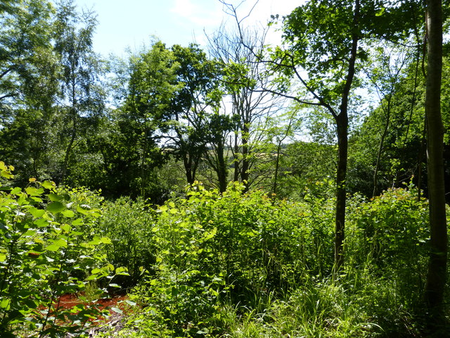
Tree obscured view from Sturt Coppice
Weather for this location
Next 14 daysNearby places
Useful places within 5 km
Own or manage this place?
Claim this listing to keep details accurate, add photos, and highlight what makes it special — free.
Claim this page→How useful was the information on this page?
id: 5177ddf5-6fcb-4ec4-9764-bb3189a787ec
Wildlife to spot
27,932 records · National Biodiversity Network
Wildlife to spot
27,932 records · National Biodiversity NetworkRobin · Blue Tit · Great Tit · Raven · Nuthatch +46
- RobinErithacus rubecula2025
- Blue TitCyanistes caeruleus2025
- Great TitParus major2025
- RavenCorvus corax2025
- NuthatchSitta europaea
- Song ThrushTurdus philomelos2025
- BlackbirdTurdus merula2025
- WoodpigeonColumba palumbus2025
- ChiffchaffPhylloscopus collybita2025
- WrenTroglodytes troglodytes2025
- GoldcrestRegulus regulus2025
- Great Spotted WoodpeckerDendrocopos major2025
- Carrion CrowCorvus corone2025
- BlackcapSylvia atricapilla2025
- DunnockPrunella modularis2025
- ChaffinchFringilla coelebs2025
- BullfinchPyrrhula pyrrhula2025
- Long-tailed TitAegithalos caudatus2025
- PheasantPhasianus colchicus2025
- Coal TitPeriparus ater2025
- Marsh TitPoecile palustris2025
- JayGarrulus glandarius2025
- Green WoodpeckerPicus viridis2025
- House SparrowPasser domesticus2025
- SwiftApus apus2025
- GoldfinchCarduelis carduelis2025
- JackdawColoeus monedula2025
- SwallowHirundo rustica2025
- GreenfinchChloris chloris2025
- Mistle ThrushTurdus viscivorus2025
- Pied WagtailMotacilla alba yarrellii2025
- LinnetLinaria cannabina2025
- Stock DoveColumba oenas2025
- Collared DoveStreptopelia decaocto2025
- StarlingSturnus vulgaris2025
- SkylarkAlauda arvensis2025
- WhitethroatCurruca communis2025
- Lesser Black-backed GullLarus fuscus2025
- House MartinDelichon urbicum2025
- RookCorvus frugilegus2025
- RedwingTurdus iliacus2025
- FieldfareTurdus pilaris2025
- KingfisherAlcedo atthis2025
- KestrelFalco tinnunculus2025
- MallardAnas platyrhynchos2025
- StonechatSaxicola rubicola2025
- Herring GullLarus argentatus2025
- Willow WarblerPhylloscopus trochilus2025
- Spotted FlycatcherMuscicapa striata2025
- MagpiePica pica2025
- YellowhammerEmberiza citrinella2025
🦌Mammals2 species
summerwinter
2025▾
Muntjac · Grey Squirrel
- MuntjacMuntiacus reevesi
- Grey SquirrelSciurus carolinensis
🐝Insects15 species
springsummer
2025▾
Green Shieldbug · Swollen-thighed Beetle · Dark Bush-cricket · Red-legged Shieldbug · Meadow Grasshopper +10
- Green ShieldbugPalomena prasina
- Swollen-thighed BeetleOedemera nobilis
- Dark Bush-cricketPholidoptera griseoaptera
- Red-legged ShieldbugPentatoma rufipes
- Meadow GrasshopperPseudochorthippus parallelus
- Cheilosia bergenstammiCheilosia bergenstammi
Great Scented Liverwort
- Great Scented LiverwortConocephalum conicum
Species observations from the last 10 years via NBN Atlas
Events & activities nearby
Switch provider to compare local events, tours and bookable activities.