Plan your visit
🦉 Wildlife🦅 Birds🌿 Foraging
Public access Free entry Dogs welcome 5 ha
Places › England › North West › South Ribble Getting here
53.74984, -2.72360
Open directionsv Visiting this summer
Seasonal nature notes and what to look for now
▾ ☀️ June — canopy now fully closed, creating cool dappled shade even on warm days 🌿 Foraging is at its best in summer here 🐕 Dogs welcome — bring water in summer; the site has enough space to find shade on hot days 🌤️ Visiting this summer
☀️ June — canopy now fully closed, creating cool dappled shade even on warm days 🌿 Foraging is at its best in summer here 🐕 Dogs welcome — bring water in summer; the site has enough space to find shade on hot days £ Free to visit — no entry charge🐕 Dogs welcome🦉 Wildlife
Very strong match
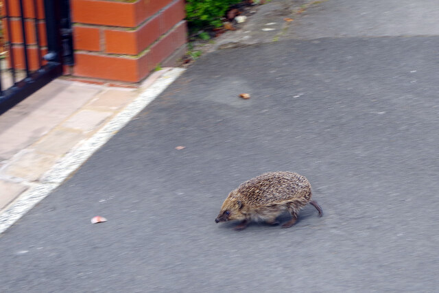
Multi-group wildlife — Amphibians, Birds, Mammals; Multi-group wildlife — Amphibians, Birds, Mammals
Free
🦅 Bird watching
Very strong match
Birds — Black-headed Gull, Rock Dove, Herring Gull +66 more · last seen 2026; Birds — Black-headed Gull, Rock Dove, Herring Gull +66 more · last seen 2026
Free
Plants — Yellow-flowered Strawberry, Rubus tuberculatus, Elder +29 more foraging species; Deciduous woodland — fungi, berries and wild garlic
Varies
🍂 Seasonal nature
Strong match
Plants — Oxford Ragwort, Herb-Robert, Butterfly-bush +240 more · last seen 2026; Plants — Oxford Ragwort, Herb-Robert, Butterfly-bush +240 more · last seen 2026
Free
Dogs allowed — public woodland
Free
🦋 Insect spotting
Strong match
Insects — Western Honey Bee, Eristalis tenax, 7-spot Ladybird +21 more · last seen 2026; Insects — Western Honey Bee, Eristalis tenax, 7-spot Ladybird +21 more · last seen 2026
Free
Trails nearby Within roughly 5 km 2 signed routes nearby · 25 public paths nearby
Signed route nearby Public paths
Ribble Way Walking route 114 km ▾
The Ribble Way follows the valley of the River Ribble from the mouth to the source near to the Pennine Way National Trail on Gayle Moor.
Named route Length 114 km Regional walking route
Show on map Preston Guild Wheel Walking route ▾
Relation for walking route. The Cycling relation is separately mapped as NCN 622
Named route Round trip Local walking route
Show on map Hill Road public footpath · 85 m ▾
Public path public footpath Length 85 m Path type: unclassified
Show on map Holme Road public footpath · 1.1 km ▾
Public path public footpath Length 1.1 km Path type: unclassified
Show on map Holme Road public footpath · 203 m ▾
Public path public footpath Length 203 m Surface compacted Path type: unclassified
Show on map 249 signed routes nearby
Signed route nearby
Penwortham to Leyland Cycling route ▾
Named route Local cycle route
Show on map NCN 622 Preston Guild Wheel Cycling route ▾
Named route Ref 622 National Cycle Network
Show on map Route 62 Cycling route ▾
Named route Ref 62 National Cycle Network
Show on map NCN 622 (Low gradient route avoiding steep slope) Cycling route ▾
Named route Ref 622 National Cycle Network
Show on map NCN 622 (Steep gradient route) Cycling route ▾
Named route Ref 622 National Cycle Network
Show on map Route 6 Cycling route ▾
Named route Ref 6 National Cycle Network
Show on map 5 public paths nearby
Public paths
Valley Road bridleway · 169 m ▾
Public path bridleway Length 169 m Surface unpaved Path type: residential
Show on map
Weather for this location Next 14 days Nearby places Useful places within 5 km
All Historic
How useful was the information on this page?
id: 910cfa45-84ce-4663-b7a5-9632f1525899
UK green spaces mapped from open public data — so anyone can find the woodland, trail, or nature reserve closest to them.
© 2026 Glade · Made with care for UK green spaces
Events & activities nearby Switch provider to compare local events, tours and bookable activities.
Bookable tours Wildlife to spot
51,514 records · National Biodiversity Network
▾
Wildlife to spot 51,514 records · National Biodiversity Network 🐦 Birds 51 species
autumn winter
2026 ▾
Black-headed Gull · Rock Dove · Magpie · Herring Gull · Carrion Crow +46
Black-headed Gull Chroicocephalus ridibundus Rock Dove Columba livia2025 Magpie Pica pica Herring Gull Larus argentatus2025 Carrion Crow Corvus corone2025 Woodpigeon Columba palumbus Blue Tit Cyanistes caeruleus Robin Erithacus rubecula Coal Tit Periparus ater2025 Long-tailed Tit Aegithalos caudatus2025 Great Tit Parus major2025 Jackdaw Coloeus monedula2025 Moorhen Gallinula chloropus2025 Mallard Anas platyrhynchos2025 Lesser Black-backed Gull Larus fuscus2025 Teal Anas crecca Blackbird Turdus merula2025 Dunnock Prunella modularis2025 Goldfinch Carduelis carduelis2025 Nuthatch Sitta europaea2025 Great Crested Grebe Podiceps cristatus Great Spotted Woodpecker Dendrocopos major2025 Starling Sturnus vulgaris2025 Song Thrush Turdus philomelos2025 House Sparrow Passer domesticus2025 Wren Troglodytes troglodytes2025 Treecreeper Certhia familiaris2025 Great Black-backed Gull Larus marinus2025 Collared Dove Streptopelia decaocto Grey Heron Ardea cinerea Blackcap Sylvia atricapilla2025 Goldcrest Regulus regulus2025 Bullfinch Pyrrhula pyrrhula2025 Pied Wagtail Motacilla alba2025 Lapwing Vanellus vanellus2025 Redshank Tringa totanus2025 Goosander Mergus merganser2025 Stock Dove Columba oenas2025 Greenfinch Chloris chloris2025 Chaffinch Fringilla coelebs2025 Jay Garrulus glandarius2025 Podiceps cristatus cristatus Podiceps cristatus cristatus2025 carbo cormorant Phalacrocorax carbo carbo2025 British Lesser Black-Backed Gull Larus fuscus graellsii2025 Erithacus rubecula melophilus Erithacus rubecula melophilus2025 Larus argentatus argenteus Larus argentatus argenteus2025 Fulica atra atra Fulica atra atra2025 Pica pica pica Pica pica pica2025 Falco tinnunculus tinnunculus Falco tinnunculus tinnunculus2025 Cormorant Phalacrocorax carbo2025 Coot Fulica atra2025 🦌 Mammals 2 species
autumn winter
2025 ▾
Grey Squirrel · Mole
Grey Squirrel Sciurus carolinensis Mole Talpa europaea 🐸 Amphibians 1 species
winter
2026 ▾
Common Frog
Common Frog Rana temporaria Buff-tailed Bumblebee
Buff-tailed Bumblebee Bombus terrestris 🌿 Plants 22 species
winter spring
2026 ▾
Daisy · Coltsfoot · Primrose · Common Field-speedwell · Field Forget-me-not +17
Daisy Bellis perennis Coltsfoot Tussilago farfara Primrose Primula vulgaris Common Field-speedwell Veronica persica Field Forget-me-not Myosotis arvensis Dog's Mercury Mercurialis perennis Species observations from the last 10 years via NBN Atlas
Shining Crane's-bill
Shining Crane's-bill
Geranium lucidum
Geranium lucidum
Sticky Mouse-ear Cerastium glomeratum
Sticky Mouse-ear Cerastium glomeratum
Common Whitlowgrass Erophila verna
Common Whitlowgrass Erophila verna
Creeping Buttercup Ranunculus repens
Creeping Buttercup Ranunculus repens
Hedge Mustard Sisymbrium officinale
Hedge Mustard Sisymbrium officinale
Lesser Celandine Ficaria verna
Lesser Celandine Ficaria verna
Early Crocus Crocus tommasinianus
Early Crocus Crocus tommasinianus
Capillary Thread-moss Bryum capillare
Capillary Thread-moss Bryum capillare
Annual Meadow-grass Poa annua
Annual Meadow-grass Poa annua
Petty Spurge Euphorbia peplus
Petty Spurge Euphorbia peplus
Senecio vulgaris subsp. vulgaris Senecio vulgaris subsp. vulgaris
Senecio vulgaris subsp. vulgaris Senecio vulgaris subsp. vulgaris
Dandelion Taraxacum
Dandelion Taraxacum
Shepherd's-purse Capsella bursa-pastoris
Shepherd's-purse Capsella bursa-pastoris
Pot Marigold Calendula officinalis2025
Pot Marigold Calendula officinalis2025
Californian Poppy Eschscholzia californica2025
Californian Poppy Eschscholzia californica2025
Black Nightshade Solanum nigrum2025
Black Nightshade Solanum nigrum2025