Offa's Dyke: section immediately north east of Sedbury sewage works 0 ha
🦉 Wildlife🦅 Birds🍄 Fungi
↑ Share
Free entry Dogs welcome 0 ha
Places › England › South West › Forest of Dean Getting here
51.63696, -2.66223
Open directionsv ✦ Scheduled Ancient Monument — Nationally protected archaeological site on the National Heritage List for England (NHLE). Scheduled monuments represent the best surviving examples of England's irreplaceable archaeological heritage.
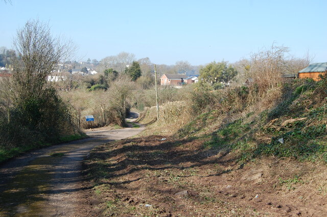
Levee scheduled monument
Visiting this summer
Seasonal nature notes and what to look for now
▾ 🌞 Midsummer — early morning visits most comfortable; look for deer fawns in quieter clearings 🍄 Mushroom foraging is at its best in summer here 🛝 Playground 237m away — built-in entertainment for younger visitors alongside the wider site 🌤️ Visiting this summer
🌞 Midsummer — early morning visits most comfortable; look for deer fawns in quieter clearings 🍄 Mushroom foraging is at its best in summer here 🛝 Playground 237m away — built-in entertainment for younger visitors alongside the wider site £ Free to visit — no entry charge🐕 Dogs welcome🦉 Wildlife
Very strong match
Multi-group wildlife — Amphibians, Birds, Mammals, Reptiles; Multi-group wildlife — Amphibians, Birds, Mammals, Reptiles
Free
🦅 Bird watching
Very strong match
Birds — Peregrine, Woodpigeon, Herring Gull +69 more · last seen 2026; Birds — Peregrine, Woodpigeon, Herring Gull +69 more · last seen 2026
Free
🍄 Mushroom foraging
Strong match
Fungi — Chicken Of The Woods, King Alfred's Cakes, Turkeytail +11 more · last seen 2025; Fungi — Chicken Of The Woods, King Alfred's Cakes, Turkeytail +11 more · last seen 2025
Varies
🦋 Insect spotting
Strong match
Insects — Harlequin Ladybird, Common Carder Bee, Green Shieldbug +111 more · last seen 2026; Insects — Harlequin Ladybird, Common Carder Bee, Green Shieldbug +111 more · last seen 2026
Free
🍂 Seasonal nature
Strong match
Plants — Yew, Pellitory-of-the-wall, Ivy-leaved Toadflax +169 more · last seen 2025; Plants — Yew, Pellitory-of-the-wall, Ivy-leaved Toadflax +169 more · last seen 2025
Free
Plants — Garlic Mustard, Ramsons, Hogweed +14 more foraging species
Varies
Trails nearby Within roughly 5 km 8 signed routes nearby · 3 public paths nearby
Signed route nearby Public paths
Gloucestershire Way Walking route 161 km ▾
Named route Length 161 km Regional walking route
Show on map Severn Way (3) Worcester to Bristol Walking route 153 km ▾
Named route Ref SW (3) Length 153 km Regional walking route
Show on map Offa's Dyke Path Walking route 285 km ▾
Named route Ref ODP Length 285 km National walking route
Show on map Wye Valley Walk Walking route 218 km ▾
Named route Ref WVW Length 218 km Regional walking route
Show on map Caldicot & Black Rock Loop Walking route 8.5 km ▾
A circular route from Caldicote Castle to the coast near the Prince of Wales Bridge, then along the Wales Coast path to the Iron Age Fort near Sudbrook, then on to the Black Rock before heading back to Caldicot Castle.
Named route Length 8.5 km Round trip Local walking route
Show on map Buttington Terrace public footpath · 156 m ▾
Private, except for access to public footpath to the shore.
Public path public footpath Length 156 m Surface unpaved Path type: service
Show on map 60 signed routes nearby
Signed route nearby
EuroVelo 1 - Atlantic Coast Route - part United Kingdom 2 Cycling route ▾
Named route Ref EV1 International cycle route
Show on map National Cycle Network Route 42 Cycling route ▾
Named route Ref 42 National Cycle Network
Show on map National Cycle Network Route 4 Cycling route ▾
Named route Ref 4 National Cycle Network
Show on map EuroVelo 2 - Capitals Route - part United Kingdom 2 Cycling route ▾
Named route Ref EV2 International cycle route
Show on map Wye Valley Greenway Cycling route ▾
Named route Local cycle route
Show on map EuroVelo 2 - Capitals Route - part United Kingdom 3 Cycling route ▾
Named route Ref EV2 International cycle route
Show on map
Weather for this location Next 14 days Nearby places Useful places within 5 km
All Historic
Own or manage this place?
Claim this listing to keep details accurate, add photos, and highlight what makes it special — free.
Claim this page→ How useful was the information on this page?
Something wrong on this page?
id: 33204d26-9ccc-433a-861c-c8e25ed1ea26
UK green spaces mapped from open public data — so anyone can find the woodland, trail, or nature reserve closest to them.
© 2026 Glade · Made with care for UK green spaces
Brandt's Bat
Brandt's Bat
Myotis brandtii2024
Myotis brandtii2024
Lesser Horseshoe Bat Rhinolophus hipposideros2024
Lesser Horseshoe Bat Rhinolophus hipposideros2024
Brown Long-eared Bat Plecotus auritus2024
Brown Long-eared Bat Plecotus auritus2024
Whiskered Bat Myotis mystacinus2024
Whiskered Bat Myotis mystacinus2024
Squirrel Sciurus
Squirrel Sciurus
Indet. Deer Cervidae
Indet. Deer Cervidae
Bechstein's Bat Myotis bechsteinii2024
Bechstein's Bat Myotis bechsteinii2024 2025
2025
Dark-edged Bee-fly Bombylius major
Dark-edged Bee-fly Bombylius major
Eristalis tenax Eristalis tenax2025
Eristalis tenax Eristalis tenax2025
Hydropsyche Hydropsyche2025
Hydropsyche Hydropsyche2025
Meliscaeva cinctella Meliscaeva cinctella2025
Meliscaeva cinctella Meliscaeva cinctella2025
Xylota segnis Xylota segnis2025
Xylota segnis Xylota segnis2025
Western Honey Bee Apis mellifera2025
Western Honey Bee Apis mellifera2025
Hornet Vespa crabro2025
Hornet Vespa crabro2025
Red-headed Cardinal Beetle Pyrochroa serraticornis2025
Red-headed Cardinal Beetle Pyrochroa serraticornis2025
Mystacides longicornis Mystacides longicornis2025
Mystacides longicornis Mystacides longicornis2025
Meliscaeva auricollis Meliscaeva auricollis2025
Meliscaeva auricollis Meliscaeva auricollis2025
Chrysogaster solstitialis Chrysogaster solstitialis2025
Chrysogaster solstitialis Chrysogaster solstitialis2025
Batman Hoverfly Myathropa florea2025
Batman Hoverfly Myathropa florea2025
Common Darter Sympetrum striolatum2025
Common Darter Sympetrum striolatum2025
Panorpa germanica Panorpa germanica2025
Panorpa germanica Panorpa germanica2025
Orange-tailed Mining Bee Andrena haemorrhoa2025
Orange-tailed Mining Bee Andrena haemorrhoa2025
Chocolate Mining Bee Andrena scotica2025
Chocolate Mining Bee Andrena scotica2025
Common Cockchafer Melolontha melolontha2025
Common Cockchafer Melolontha melolontha2025
Buff-tailed Bumblebee Bombus terrestris2025
Buff-tailed Bumblebee Bombus terrestris2025
Oedemera femoralis Oedemera femoralis
Oedemera femoralis Oedemera femoralis
Birch Shieldbug Elasmostethus interstinctus2025
Birch Shieldbug Elasmostethus interstinctus2025
Limnephilus affinis Limnephilus affinis2025
Limnephilus affinis Limnephilus affinis2025
Red-legged Shieldbug Pentatoma rufipes2025
Red-legged Shieldbug Pentatoma rufipes2025
Dark Bush-cricket Pholidoptera griseoaptera2025
Dark Bush-cricket Pholidoptera griseoaptera2025
Hairy Shieldbug Dolycoris baccarum2025
Hairy Shieldbug Dolycoris baccarum2025
Common Rose Fusehorn Arge pagana2025
Common Rose Fusehorn Arge pagana2025
10-spot Ladybird Adalia decempunctata2025
10-spot Ladybird Adalia decempunctata2025
Common Wasp Vespula vulgaris2025
Common Wasp Vespula vulgaris2025
Volucella inanis Volucella inanis2025
Volucella inanis Volucella inanis2025
Hornet Hoverfly Volucella zonaria2025
Hornet Hoverfly Volucella zonaria2025
Common Red Soldier Beetle Rhagonycha fulva2025
Common Red Soldier Beetle Rhagonycha fulva2025
Rutpela maculata Rutpela maculata2025
Rutpela maculata Rutpela maculata2025
Cryptonevra flavitarsis Cryptonevra flavitarsis2025
Cryptonevra flavitarsis Cryptonevra flavitarsis2025
Lipara lucens Lipara lucens2025
Lipara lucens Lipara lucens2025
Otiorhynchus Otiorhynchus2025
Otiorhynchus Otiorhynchus2025
Panorpa Panorpa2025
Panorpa Panorpa2025
Platycheirus albimanus Platycheirus albimanus2025
Platycheirus albimanus Platycheirus albimanus2025
Phaonia Phaonia2025
Phaonia Phaonia2025
Early Bumblebee Bombus pratorum2025
Early Bumblebee Bombus pratorum2025
Cosnard's Net-winged Beetle Erotides cosnardi2025
Cosnard's Net-winged Beetle Erotides cosnardi2025
Black-headed Cardinal Beetle Pyrochroa coccinea2025
Black-headed Cardinal Beetle Pyrochroa coccinea2025
Varied Carpet Beetle Anthrenus verbasci2025
Varied Carpet Beetle Anthrenus verbasci2025
Limnephilus lunatus Limnephilus lunatus2024
Limnephilus lunatus Limnephilus lunatus2024
Harmonia axyridis form spectabilis Harmonia axyridis form spectabilis2024
Harmonia axyridis form spectabilis Harmonia axyridis form spectabilis2024
Volucella pellucens Volucella pellucens2024
Volucella pellucens Volucella pellucens2024
Sphaerophoria Sphaerophoria2024
Sphaerophoria Sphaerophoria2024
Bombus lucorum Bombus lucorum2024
Bombus lucorum Bombus lucorum2024
Rugged Oil-beetle Meloe rugosus2025
Rugged Oil-beetle Meloe rugosus2025
Common Earwig Forficula auricularia/dentata agg.2025
Common Earwig Forficula auricularia/dentata agg.2025
Limnephilus rhombicus Limnephilus rhombicus2025
Limnephilus rhombicus Limnephilus rhombicus2025
Glyphotaelius pellucidus Glyphotaelius pellucidus2025
Glyphotaelius pellucidus Glyphotaelius pellucidus2025
Southern Oak Bush-cricket Meconema meridionale2025
Southern Oak Bush-cricket Meconema meridionale2025
Violet Ground Beetle Carabus violaceus2025
Violet Ground Beetle Carabus violaceus2025
Long-winged Cone-head Conocephalus fuscus2025
Long-winged Cone-head Conocephalus fuscus2025
Lesser Stag Beetle Dorcus parallelipipedus2025
Lesser Stag Beetle Dorcus parallelipipedus2025
Acrossus rufipes Acrossus rufipes2025
Acrossus rufipes Acrossus rufipes2025
Geotrupes mutator Geotrupes mutator2025
Geotrupes mutator Geotrupes mutator2025
Hydrobius fuscipes Hydrobius fuscipes2025
Hydrobius fuscipes Hydrobius fuscipes2025
5-spot Ladybird Coccinella quinquepunctata2025
5-spot Ladybird Coccinella quinquepunctata2025
Emperor Dragonfly Anax imperator2025
Emperor Dragonfly Anax imperator2025
Lygus Lygus2025
Lygus Lygus2025
Gelis Gelis2025
Gelis Gelis2025
Anomoia purmunda Anomoia purmunda2025
Anomoia purmunda Anomoia purmunda2025
Leucozona laternaria Leucozona laternaria2025
Leucozona laternaria Leucozona laternaria2025
Cheilosia pagana Cheilosia pagana2025
Cheilosia pagana Cheilosia pagana2025
Eristalis pertinax Eristalis pertinax2025
Eristalis pertinax Eristalis pertinax2025
Hill Cuckoo Bee Bombus rupestris2025
Hill Cuckoo Bee Bombus rupestris2025
Chrysogaster cemiteriorum Chrysogaster cemiteriorum2025
Chrysogaster cemiteriorum Chrysogaster cemiteriorum2025
Epistrophe grossulariae Epistrophe grossulariae2025
Epistrophe grossulariae Epistrophe grossulariae2025
Syritta pipiens Syritta pipiens2025
Syritta pipiens Syritta pipiens2025
Ichneumonid Ichneumonidae2025
Ichneumonid Ichneumonidae2025
Leucozona glaucia Leucozona glaucia2025
Leucozona glaucia Leucozona glaucia2025
Stripe-legged Robberfly Dioctria baumhaueri2025
Stripe-legged Robberfly Dioctria baumhaueri2025
Lapposyrphus lapponicus Lapposyrphus lapponicus2025
Lapposyrphus lapponicus Lapposyrphus lapponicus2025
Red-tailed Bumblebee Bombus lapidarius2025
Red-tailed Bumblebee Bombus lapidarius2025
Patchwork Leafcutter Bee Megachile centuncularis2025
Patchwork Leafcutter Bee Megachile centuncularis2025
Azure Damselfly Coenagrion puella2025
Azure Damselfly Coenagrion puella2025
Lipara rufitarsis Lipara rufitarsis2025
Lipara rufitarsis Lipara rufitarsis2025
Anthomyza collini Anthomyza collini2025
Anthomyza collini Anthomyza collini2025
Blue Mason Bee Osmia caerulescens2025
Blue Mason Bee Osmia caerulescens2025
Hairy Yellow-face Hylaeus hyalinatus2025
Hairy Yellow-face Hylaeus hyalinatus2025
Field Cuckoo Bee Bombus campestris2025
Field Cuckoo Bee Bombus campestris2025
Buffish Mining Bee Andrena nigroaenea2025
Buffish Mining Bee Andrena nigroaenea2025
Graphomya maculata Graphomya maculata2025
Graphomya maculata Graphomya maculata2025
Common Flower Bug Anthocoris nemorum2025
Common Flower Bug Anthocoris nemorum2025
Dolichopus Dolichopus2025
Dolichopus Dolichopus2025
Syrphus Syrphus2025
Syrphus Syrphus2025
Ctenophora pectinicornis Ctenophora pectinicornis2025
Ctenophora pectinicornis Ctenophora pectinicornis2025
Chrysopa Chrysopa2025
Chrysopa Chrysopa2025
Lucilia Lucilia2025
Lucilia Lucilia2025
Scathophaga stercoraria Scathophaga stercoraria2025
Scathophaga stercoraria Scathophaga stercoraria2025
Agriotes lineatus Agriotes lineatus2025
Agriotes lineatus Agriotes lineatus2025
Hazel Leaf-roller Apoderus coryli2025
Hazel Leaf-roller Apoderus coryli2025
Athous haemorrhoidalis Athous haemorrhoidalis2025
Athous haemorrhoidalis Athous haemorrhoidalis2025
Bluebottle Calliphora2025
Bluebottle Calliphora2025
Stenocorus meridianus Stenocorus meridianus2025
Stenocorus meridianus Stenocorus meridianus2025
Epiphragma ocellare Epiphragma ocellare2025
Epiphragma ocellare Epiphragma ocellare2025
Criorhina floccosa Criorhina floccosa2025
Criorhina floccosa Criorhina floccosa2025
Oil Beetle Meloe2025
Oil Beetle Meloe2025
Rhagium mordax Rhagium mordax2025
Rhagium mordax Rhagium mordax2025
Trioza centranthi Trioza centranthi2025
Trioza centranthi Trioza centranthi2025
Eupeodes Eupeodes2025
Eupeodes Eupeodes2025
Peyerimhoffina gracilis Peyerimhoffina gracilis2024
Peyerimhoffina gracilis Peyerimhoffina gracilis2024
Ophion obscuratus Ophion obscuratus2024
Ophion obscuratus Ophion obscuratus2024
Syrphus ribesii Syrphus ribesii2024
Syrphus ribesii Syrphus ribesii2024
Rhipidia maculata Rhipidia maculata2024
Rhipidia maculata Rhipidia maculata2024
Beautiful Demoiselle Calopteryx virgo2024
Beautiful Demoiselle Calopteryx virgo2024
14-spot Ladybird Propylea quattuordecimpunctata2024
14-spot Ladybird Propylea quattuordecimpunctata2024
White/Buff-tailed Bumblebee workers Bombus lucorum/terrestris2024
White/Buff-tailed Bumblebee workers Bombus lucorum/terrestris2024
Swollen-thighed Beetle Oedemera nobilis2024
Swollen-thighed Beetle Oedemera nobilis2024
Tubaria Tubaria
Tubaria Tubaria
Flavoparmelia caperata Flavoparmelia caperata2024
Flavoparmelia caperata Flavoparmelia caperata2024
Hairy Curtain Crust Stereum hirsutum2024
Hairy Curtain Crust Stereum hirsutum2024
Wood Blewits Lepista nuda2024
Wood Blewits Lepista nuda2024
Collared Earthstar Geastrum michelianum2024
Collared Earthstar Geastrum michelianum2024
Hare'sfoot Inkcap Coprinopsis lagopus2024
Hare'sfoot Inkcap Coprinopsis lagopus2024
Spindle Toughshank Gymnopus fusipes2024
Spindle Toughshank Gymnopus fusipes2024
Selfheal Prunella vulgaris
Selfheal Prunella vulgaris
Garlic Mustard Alliaria petiolata
Garlic Mustard Alliaria petiolata
Snapdragon Antirrhinum majus
Snapdragon Antirrhinum majus
Bee Orchid Ophrys apifera
Bee Orchid Ophrys apifera
Wood Speedwell Veronica montana
Wood Speedwell Veronica montana
Black Bryony Tamus communis
Black Bryony Tamus communis
Small-leaved Lime Tilia cordata
Small-leaved Lime Tilia cordata
False Oat-grass Arrhenatherum elatius
False Oat-grass Arrhenatherum elatius
Cow Parsley Anthriscus sylvestris
Cow Parsley Anthriscus sylvestris
Ramsons Allium ursinum
Ramsons Allium ursinum
Germander Speedwell Veronica chamaedrys
Germander Speedwell Veronica chamaedrys
Pendulous Sedge Carex pendula
Pendulous Sedge Carex pendula
Dog's Mercury Mercurialis perennis
Dog's Mercury Mercurialis perennis
Field Maple Acer campestre
Field Maple Acer campestre
Lords-and-Ladies Arum maculatum
Lords-and-Ladies Arum maculatum
Herb-Paris Paris quadrifolia
Herb-Paris Paris quadrifolia
Wood Anemone Anemone nemorosa
Wood Anemone Anemone nemorosa
Smooth Sow-thistle Sonchus oleraceus
Smooth Sow-thistle Sonchus oleraceus
Bluebell Hyacinthoides non-scripta
Bluebell Hyacinthoides non-scripta
Hogweed Heracleum sphondylium
Hogweed Heracleum sphondylium
Nipplewort Lapsana communis
Nipplewort Lapsana communis
Timothy Phleum pratense
Timothy Phleum pratense
Common Reed Phragmites australis
Common Reed Phragmites australis
Greater Plantain Plantago major
Greater Plantain Plantago major
Hawthorn Crataegus monogyna
Hawthorn Crataegus monogyna
Bracken Pteridium aquilinum
Bracken Pteridium aquilinum
Traveller's-joy Clematis vitalba
Traveller's-joy Clematis vitalba
Lesser Burdock Arctium minus
Lesser Burdock Arctium minus
Hemlock Conium maculatum
Hemlock Conium maculatum
Elder Sambucus nigra
Elder Sambucus nigra
Ground-ivy Glechoma hederacea
Ground-ivy Glechoma hederacea
Lesser Celandine Ficaria verna
Lesser Celandine Ficaria verna
Ash Fraxinus excelsior
Ash Fraxinus excelsior
Wood Avens Geum urbanum
Wood Avens Geum urbanum
Hart's-Tongue Asplenium scolopendrium
Hart's-Tongue Asplenium scolopendrium
Wood Melick Melica uniflora
Wood Melick Melica uniflora
Wavy Bitter-cress Cardamine flexuosa
Wavy Bitter-cress Cardamine flexuosa
Ivy Hedera helix
Ivy Hedera helix
Spurge-laurel Daphne laureola
Spurge-laurel Daphne laureola
Great Willowherb Epilobium hirsutum
Great Willowherb Epilobium hirsutum
Horse-chestnut Aesculus hippocastanum
Horse-chestnut Aesculus hippocastanum
Pedunculate Oak Quercus robur
Pedunculate Oak Quercus robur
Hemlock Water-dropwort Oenanthe crocata
Hemlock Water-dropwort Oenanthe crocata
Wych Elm Ulmus glabra
Wych Elm Ulmus glabra
Blackthorn Prunus spinosa
Blackthorn Prunus spinosa
Creeping Thistle Cirsium arvense
Creeping Thistle Cirsium arvense
Holly Ilex aquifolium
Holly Ilex aquifolium
Wood-sedge Carex sylvatica
Wood-sedge Carex sylvatica
Early Dog-violet Viola reichenbachiana
Early Dog-violet Viola reichenbachiana
Wood Spurge Euphorbia amygdaloides
Wood Spurge Euphorbia amygdaloides
Hazel Corylus avellana
Hazel Corylus avellana
Common Nettle Urtica dioica
Common Nettle Urtica dioica
Sycamore Acer pseudoplatanus
Sycamore Acer pseudoplatanus
Beech Fagus sylvatica
Beech Fagus sylvatica
Mistletoe Viscum album
Mistletoe Viscum album
Pignut Conopodium majus
Pignut Conopodium majus
Goldilocks Buttercup Ranunculus auricomus
Goldilocks Buttercup Ranunculus auricomus
Yarrow Achillea millefolium
Yarrow Achillea millefolium
Guernsey Fleabane Erigeron sumatrensis2024
Guernsey Fleabane Erigeron sumatrensis2024
Hemp-agrimony Eupatorium cannabinum2024
Hemp-agrimony Eupatorium cannabinum2024
Wild Teasel Dipsacus fullonum2024
Wild Teasel Dipsacus fullonum2024
Rosebay Willowherb Chamaenerion angustifolium2024
Rosebay Willowherb Chamaenerion angustifolium2024
Common Comfrey Symphytum officinale2024
Common Comfrey Symphytum officinale2024
Lesser Hawkbit Leontodon saxatilis2024
Lesser Hawkbit Leontodon saxatilis2024
Perforate St John's-wort Hypericum perforatum2024
Perforate St John's-wort Hypericum perforatum2024
Red Valerian Centranthus ruber2024
Red Valerian Centranthus ruber2024
Oxeye Daisy Leucanthemum vulgare
Oxeye Daisy Leucanthemum vulgare
Navelwort Umbilicus rupestris
Navelwort Umbilicus rupestris
Snowberry Symphoricarpos albus
Snowberry Symphoricarpos albus
Groundsel Senecio vulgaris
Groundsel Senecio vulgaris
Prickly Sow-thistle Sonchus asper
Prickly Sow-thistle Sonchus asper
Maidenhair Spleenwort Asplenium trichomanes
Maidenhair Spleenwort Asplenium trichomanes
Wall Scalewort Porella platyphylla
Wall Scalewort Porella platyphylla
Field Scabious Knautia arvensis
Field Scabious Knautia arvensis
Greater Knapweed Centaurea scabiosa
Greater Knapweed Centaurea scabiosa
Common Bird's-foot-trefoil Lotus corniculatus
Common Bird's-foot-trefoil Lotus corniculatus
Himalayan Honeysuckle Leycesteria formosa
Himalayan Honeysuckle Leycesteria formosa
Black Horehound Ballota nigra
Black Horehound Ballota nigra
Common Broomrape Orobanche minor
Common Broomrape Orobanche minor
Bird's-nest Orchid Neottia nidus-avis
Bird's-nest Orchid Neottia nidus-avis
Male-fern Dryopteris filix-mas
Male-fern Dryopteris filix-mas
Forked Veilwort Metzgeria furcata
Forked Veilwort Metzgeria furcata
Rose Rosa
Rose Rosa
Silverweed Potentilla anserina
Silverweed Potentilla anserina
Wood Millet Milium effusum
Wood Millet Milium effusum
Broad-leaved Dock Rumex obtusifolius
Broad-leaved Dock Rumex obtusifolius
Wood Meadow-grass Poa nemoralis
Wood Meadow-grass Poa nemoralis
Common Ragwort Jacobaea vulgaris
Common Ragwort Jacobaea vulgaris
Common Fleabane Pulicaria dysenterica
Common Fleabane Pulicaria dysenterica
Yorkshire-fog Holcus lanatus
Yorkshire-fog Holcus lanatus
Goat Willow Salix caprea
Goat Willow Salix caprea
Meadow Buttercup Ranunculus acris
Meadow Buttercup Ranunculus acris
Spear Thistle Cirsium vulgare
Spear Thistle Cirsium vulgare
False Fox-sedge Carex otrubae
False Fox-sedge Carex otrubae
Fat-hen Chenopodium album
Fat-hen Chenopodium album
Soft Shield-fern Polystichum setiferum
Soft Shield-fern Polystichum setiferum
Curled Dock Rumex crispus
Curled Dock Rumex crispus
Cleavers Galium aparine
Cleavers Galium aparine
Common Meadow-rue Thalictrum flavum
Common Meadow-rue Thalictrum flavum
Yellow Pimpernel Lysimachia nemorum
Yellow Pimpernel Lysimachia nemorum
Red Fescue Festuca rubra
Red Fescue Festuca rubra
Atlantic Ivy Hedera hibernica
Atlantic Ivy Hedera hibernica
Common Dog-violet Viola riviniana
Common Dog-violet Viola riviniana
Wild Privet Ligustrum vulgare
Wild Privet Ligustrum vulgare
Fox-tail Feather-moss Thamnobryum alopecurum
Fox-tail Feather-moss Thamnobryum alopecurum
Common Scurvygrass Cochlearia officinalis
Common Scurvygrass Cochlearia officinalis
Common Figwort Scrophularia nodosa
Common Figwort Scrophularia nodosa
Taraxacum agg. Taraxacum agg.
Taraxacum agg. Taraxacum agg.
Hedge Bindweed Calystegia sepium
Hedge Bindweed Calystegia sepium
Bittersweet Solanum dulcamara
Bittersweet Solanum dulcamara
Willowherb Epilobium
Willowherb Epilobium
Annual Meadow-grass Poa annua
Annual Meadow-grass Poa annua
Broad-leaved Willowherb Epilobium montanum
Broad-leaved Willowherb Epilobium montanum
Bramble Rubus fruticosus
Bramble Rubus fruticosus
Hairy St John's-wort Hypericum hirsutum
Hairy St John's-wort Hypericum hirsutum
Honeysuckle Lonicera periclymenum
Honeysuckle Lonicera periclymenum
Creeping Buttercup Ranunculus repens
Creeping Buttercup Ranunculus repens
Linden Tilia
Linden Tilia
Hairy-brome Bromopsis ramosa
Hairy-brome Bromopsis ramosa
Spindle Euonymus europaeus
Spindle Euonymus europaeus
Hornbeam Carpinus betulus
Hornbeam Carpinus betulus
Slender Speedwell Veronica filiformis
Slender Speedwell Veronica filiformis
Shining Crane's-bill Geranium lucidum
Shining Crane's-bill Geranium lucidum
Cuckooflower Cardamine pratensis
Cuckooflower Cardamine pratensis
Valerianella Valerianella
Valerianella Valerianella
Polypody Polypodium vulgare
Polypody Polypodium vulgare
Wild Onion Allium vineale
Wild Onion Allium vineale
Sweet Violet Viola odorata
Sweet Violet Viola odorata
Himalayan Balsam Impatiens glandulifera2024
Himalayan Balsam Impatiens glandulifera2024
Scarlet Pimpernel Lysimachia arvensis2024
Scarlet Pimpernel Lysimachia arvensis2024
Pale Galingale Cyperus eragrostis2024
Pale Galingale Cyperus eragrostis2024
Mugwort Artemisia vulgaris2024
Mugwort Artemisia vulgaris2024
Red Campion Silene dioica2024
Red Campion Silene dioica2024
Balm Melissa officinalis2024
Balm Melissa officinalis2024
Coralbells Heuchera sanguinea2024
Coralbells Heuchera sanguinea2024
Greater Celandine Chelidonium majus2024
Greater Celandine Chelidonium majus2024
Pale Persicaria Persicaria lapathifolia2024
Pale Persicaria Persicaria lapathifolia2024
Hedge Mustard Sisymbrium officinale2024
Hedge Mustard Sisymbrium officinale2024
White Dead-nettle Lamium album2024
White Dead-nettle Lamium album2024
Cock's-foot Dactylis glomerata2024
Cock's-foot Dactylis glomerata2024
Square-stalked Willowherb Epilobium tetragonum2024
Square-stalked Willowherb Epilobium tetragonum2024
Common Mouse-ear Cerastium fontanum2024
Common Mouse-ear Cerastium fontanum2024
Black Nightshade Solanum nigrum2024
Black Nightshade Solanum nigrum2024
Primrose Primula vulgaris2024
Primrose Primula vulgaris2024
Caper Spurge Euphorbia lathyris2024
Caper Spurge Euphorbia lathyris2024
Common Cornsalad Valerianella locusta2024
Common Cornsalad Valerianella locusta2024
Soapwort Saponaria officinalis2024
Soapwort Saponaria officinalis2024
Sowbread Cyclamen hederifolium2024
Sowbread Cyclamen hederifolium2024
Cat's-ear Hypochaeris radicata2024
Cat's-ear Hypochaeris radicata2024
Common Mallow Malva sylvestris2024
Common Mallow Malva sylvestris2024
Dove's-foot Crane's-bill Geranium molle2024
Dove's-foot Crane's-bill Geranium molle2024
Crown Vetch Securigera varia2024
Crown Vetch Securigera varia2024
Wild Marjoram Origanum vulgare2024
Wild Marjoram Origanum vulgare2024
Tutsan Hypericum androsaemum2024
Tutsan Hypericum androsaemum2024
Sneezewort Achillea ptarmica2024
Sneezewort Achillea ptarmica2024
Yellow Corydalis Pseudofumaria lutea2024
Yellow Corydalis Pseudofumaria lutea2024
Red Clover Trifolium pratense2024
Red Clover Trifolium pratense2024
American Willowherb Epilobium ciliatum2024
American Willowherb Epilobium ciliatum2024
Greater Bird's-foot-trefoil Lotus pedunculatus2024
Greater Bird's-foot-trefoil Lotus pedunculatus2024
Butterfly-bush Buddleja davidii2024
Butterfly-bush Buddleja davidii2024
Purple Toadflax Linaria purpurea2024
Purple Toadflax Linaria purpurea2024
Green Alkanet Pentaglottis sempervirens2024
Green Alkanet Pentaglottis sempervirens2024
Hoary Mustard Hirschfeldia incana2024
Hoary Mustard Hirschfeldia incana2024
Scented Mayweed Matricaria chamomilla2024
Scented Mayweed Matricaria chamomilla2024
Orchid Orchidaceae2024
Orchid Orchidaceae2024 Events & activities nearby Switch provider to compare local events, tours and bookable activities.
Bookable tours GetYourGuide Promote here