Birds — Blue Tit, Great Tit, Woodpigeon +76 more · last seen 2026; Birds — Blue Tit, Great Tit, Woodpigeon +76 more · last seen 2026
Free
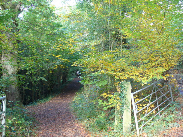
🍂
Seasonal nature
Strong match
Ancient woodland — bluebells, fungi and autumn colour; Plants — Hedge Bedstraw, Upright Brome, Hawthorn +19 more · last seen 2026
Free
🐶
Dog walks
Strong match
Dogs allowed — public woodland
Free
🦋
Insect spotting
Strong match
Insects — Southern Oak Bush-cricket, Stag Beetle, Red-legged Shieldbug +37 more · last seen 2026; Insects — Southern Oak Bush-cricket, Stag Beetle, Red-legged Shieldbug +37 more · last seen 2026
Free
🌿
Foraging
Good match
Deciduous woodland — fungi, berries and wild garlic; Plants — Hawthorn, Wild Marjoram, Wood-sorrel +1 more foraging species
Varies
Trails nearby
Within roughly 5 km
🚶
Walking
▾
41 signed routes nearby · 51 public paths nearby
Signed route nearbyPublic paths
Mole Gap TrailWalking route▾
Named routeLocal walking route
Box Hill Train To Stepping Stones Walk, Box HillWalking route4.8 km▾
Named routeLength 4.8 kmDuration 02:00Round tripLocal walking route
The Box Hill Hike, Box HillWalking route12.8 km▾
Circular walk, dog friendly, steep climbs and steps, paths may be slippery in winter, Please take care with your footing and wear suitable footwear for the conditions, Broadwood's Folly, Mickleham Gallops
Named routeLength 12.8 kmDuration 04:00;06:00Round tripLocal walking route
Thames Down LinkWalking route▾
Named routeRef TDLRegional walking route
Heathland Trail (Headley Heath NT)Walking route▾
Named routeLocal walking route
West Bankpublic footpath · 133 m▾
Public pathpublic footpathLength 133 mPath type: residential
The Strugglepublic footpath · 72 m▾
Public pathpublic footpathLength 72 mSurface asphaltPath type: footway
School Lanepublic footpath · 209 m▾
Public pathpublic footpathLength 209 mPath type: residential
🚴
Cycling
▾
51 signed routes nearby
Signed route nearby
A24 Cycle RouteCycling route▾
Named routeLocal cycle route
Im Still StandingCycling route▾
Named route
RegurgitatorCycling route▾
Named route
Holmwood Common_Circular TrailCycling route▾
Named routeLocal cycle route
Surrey CyclewayCycling route▾
Leigh Hill link
Named routeRegional cycle route
Wookies HoleCycling route▾
Named route
🚵
Mountain biking
▾
19 signed routes nearby
Signed route nearby
CrackpipeMountain bike route▾
Named routeFriends of hurtwood
Tumnus Strikes BackMountain bike route▾
Named routeFriends of hurtwood
The GardenMountain bike route▾
Named route
Surfa Rosa to Secret SquirrelMountain bike route▾
Named routeFriends of hurtwood
Au NaturalMountain bike route▾
Named routeFriends of hurtwood
Telegraph RowMountain bike route▾
Named routeFriends of hurtwood
🐴
Horse riding
▾
27 public paths nearby
Public paths
Milton Court Lane (BW 110)bridleway · 241 m▾
Public pathbridlewayLength 241 mPath type: bridleway
Lince Lane BW 109bridleway · 250 m▾
Public pathbridlewayLength 250 mPath type: bridleway
Milton Streetbridleway · 24 m▾
Public pathbridlewayLength 24 mPath type: residential
Milton Streetbridleway · 37 m▾
Public pathbridlewayLength 37 mPath type: residential
Milton Streetbridleway · 66 m▾
Public pathbridlewayLength 66 mPath type: residential