🦅 Birds🦉 Wildlife🦋 Insects
↑ Share
Free entry Dogs welcome 2 ha
Places › England › West Midlands › Telford and Wrekin Getting here
52.75252, -2.44552
Open directionsv Visiting this summer
Seasonal nature notes and what to look for now
▾ 🐦 81+ species recorded in this area — summer evenings are best for activity; watch for Woodpigeon and Lapwing 🌿 Foraging is at its best in summer here 🐕 Dogs welcome — bring water in summer; the site has enough space to find shade on hot days 🌤️ Visiting this summer
🐦 81+ species recorded in this area — summer evenings are best for activity; watch for Woodpigeon and Lapwing 🌿 Foraging is at its best in summer here 🐕 Dogs welcome — bring water in summer; the site has enough space to find shade on hot days £ Free to visit — no entry charge🐕 Dogs welcome🦅 Bird watching
Very strong match
Birds — Woodpigeon, Lapwing, Carrion Crow +78 more · last seen 2026; Birds — Woodpigeon, Lapwing, Carrion Crow +78 more · last seen 2026
Free
🦉 Wildlife
Very strong match
Multi-group wildlife — Birds, Mammals; Multi-group wildlife — Birds, Mammals
Free
🦋 Insect spotting
Strong match
Insects — 7-spot Ladybird, Nephus quadrimaculatus, 22-spot Ladybird +19 more · last seen 2025; Insects — 7-spot Ladybird, Nephus quadrimaculatus, 22-spot Ladybird +19 more · last seen 2025
Free
Deciduous woodland — fungi, berries and wild garlic
Varies
🌲 Forest walks
Moderate match
Public woodland
Free
Trails nearby Within roughly 5 km 1 signed route nearby
Signed route nearby
Telford T50 Walking route 50 km ▾
The T50 Trail links parks, woods, nature reserves, and historic sites across Telford, starting and ending at Town Park. It’s easily accessible from estates and bus routes, with key points at Ironbridge, The Wrekin, Lilleshall Hill, and Granville Park.
Named route Length 50 km Local walking route
Show on map 46 signed routes nearby
Signed route nearby
NCN 552 Cycling route ▾
Named route Ref 552 National Cycle Network
Show on map Silkin Way Cycling route ▾
Cycle route that follows disused railway lines and canal beds. The path was opened in 1977 by Prime Minister James Callaghan, and was named after Lord Silkin; who was a parliamentarian responsible for creating New Towns including Telford.
Named route Ref SW Local cycle route
Show on map Telford Strategic Cycling Network Cycling route ▾
Named route Local cycle route
Show on map Route 81 Cycling route ▾
Named route Ref 81 National Cycle Network
Show on map Route 55 Cycling route ▾
Named route Ref 55 National Cycle Network
Show on map Main Route Cycling route 802 m ▾
Named route Ref 55 Length 802 m National Cycle Network On-road Surface asphalt
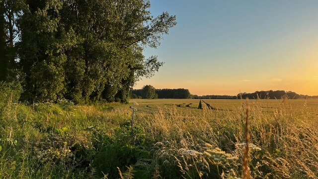
Show on map Photos Cornfield viewed from Hincks Brook
‹ ›
Weather for this location Next 14 days Nearby places Useful places within 5 km
All Historic
Own or manage this place?
Claim this listing to keep details accurate, add photos, and highlight what makes it special — free.
Claim this page→ How useful was the information on this page?
Something wrong on this page?
id: dd5924f1-3677-4b89-9310-19845279934c
UK green spaces mapped from open public data — so anyone can find the woodland, trail, or nature reserve closest to them.
© 2026 Glade · Made with care for UK green spaces
Events & activities nearby Switch provider to compare local events, tours and bookable activities.
Bookable tours GetYourGuide Promote here
Wildlife to spot
9,739 records · National Biodiversity Network
▾
Wildlife to spot 9,739 records · National Biodiversity Network 🐦 Birds 48 species
summer autumn
2026 ▾
Blue Tit · Woodpigeon · Chiffchaff · House Martin · Kestrel +43
Blue Tit Cyanistes caeruleus2025 Woodpigeon Columba palumbus2025 Chiffchaff Phylloscopus collybita2025 House Martin Delichon urbicum2025 Kestrel Falco tinnunculus Stonechat Saxicola rubicola2025 Spotted Flycatcher Muscicapa striata2025 Swallow Hirundo rustica2025 Magpie Pica pica2025 Long-tailed Tit Aegithalos caudatus2025 Robin Erithacus rubecula2025 Redstart Phoenicurus phoenicurus2025 Tufted Duck Aythya fuligula Teal Anas crecca Starling Sturnus vulgaris2025 Jay Garrulus glandarius2025 Carrion Crow Corvus corone2025 Grey Heron Ardea cinerea2025 Great Tit Parus major2025 Stock Dove Columba oenas2025 Gadwall Mareca strepera Jackdaw Coloeus monedula2025 Wren Troglodytes troglodytes2025 Blackbird Turdus merula2025 Rook Corvus frugilegus2025 Chaffinch Fringilla coelebs2025 Raven Corvus corax2025 Goldfinch Carduelis carduelis2025 Treecreeper Certhia familiaris2025 Reed Bunting Emberiza schoeniclus Lesser Redpoll Acanthis flammea cabaret2025 Fieldfare Turdus pilaris2025 Redwing Turdus iliacus2025 Mallard Anas platyrhynchos2025 Black-headed Gull Chroicocephalus ridibundus2025 Little Grebe Tachybaptus ruficollis2025 Lapwing Vanellus vanellus2025 Corn Bunting Emberiza calandra2025 Linnet Linaria cannabina2025 Skylark Alauda arvensis2025 Lesser Whitethroat Curruca curruca2025 Willow Warbler Phylloscopus trochilus2025 Whinchat Saxicola rubetra2025 Marsh Tit Poecile palustris2025 Mistle Thrush Turdus viscivorus2025 Yellow Wagtail Motacilla flava2025 Rock Dove Columba livia2025 Collared Dove Streptopelia decaocto2025 7-spot Ladybird · Nephus quadrimaculatus · 22-spot Ladybird · Rhyzobius litura · Rhyzobius lophanthae +13
7-spot Ladybird Coccinella septempunctata Nephus quadrimaculatus Nephus quadrimaculatus 22-spot Ladybird Psyllobora vigintiduopunctata Rhyzobius litura Rhyzobius litura Rhyzobius lophanthae Rhyzobius lophanthae 24-spot Ladybird Subcoccinella vigintiquattuorpunctata Species observations from the last 10 years via NBN Atlas
16-spot Ladybird
16-spot Ladybird
Tytthaspis sedecimpunctata
Tytthaspis sedecimpunctata
Pine Ladybird Exochomus quadripustulatus
Pine Ladybird Exochomus quadripustulatus
Harlequin Ladybird Harmonia axyridis
Harlequin Ladybird Harmonia axyridis
Rhyzobius chrysomeloides Rhyzobius chrysomeloides
Rhyzobius chrysomeloides Rhyzobius chrysomeloides
Adonis' Ladybird Hippodamia variegata
Adonis' Ladybird Hippodamia variegata
Stethorus pusillus Stethorus pusillus
Stethorus pusillus Stethorus pusillus
Coccidula rufa Coccidula rufa
Coccidula rufa Coccidula rufa
Orange Ladybird Halyzia sedecimguttata
Orange Ladybird Halyzia sedecimguttata
10-spot Ladybird Adalia decempunctata
10-spot Ladybird Adalia decempunctata
14-spot Ladybird Propylea quattuordecimpunctata
14-spot Ladybird Propylea quattuordecimpunctata
Common Earwig Forficula auricularia/dentata agg.
Common Earwig Forficula auricularia/dentata agg.
Scymnus interruptus Scymnus interruptus
Scymnus interruptus Scymnus interruptus