Plan your visit
Getting here
52.06383, -0.83609
Visiting this summer
Seasonal nature notes and what to look for now
Visiting this summer
Seasonal nature notes and what to look for now
- 🐦73+ species recorded in this area — summer evenings are best for activity; watch for Blue Tit and Mallard
- 🐕Early mornings are best for dog walks in summer — visit before 9am to avoid the heat and find quieter trails
- 🅿️Wolverton house 324m away
🌤️ Visiting this summer
- 🐦73+ species recorded in this area — summer evenings are best for activity; watch for Blue Tit and Mallard
- 🐕Early mornings are best for dog walks in summer — visit before 9am to avoid the heat and find quieter trails
- 🅿️Wolverton house 324m away
Good to know
- £Free to visit — no entry charge
- 🐕Dogs welcome
Best for
Bird watching
Very strong match
Birds — Blue Tit, Mallard, Woodpigeon +70 more · last seen 2026; Deciduous woodland — woodpeckers, warblers and woodland birds
Wildlife
Strong match
Birds — Blue Tit, Mallard, Woodpigeon +70 more · last seen 2026; Deciduous woodland priority habitat
Insect spotting
Strong match
Insects — Eristalis intricaria, Eristalis tenax, Eupeodes +15 more · last seen 2026; Semi-improved grassland — butterflies and wildflowers
Dog walks
Strong match
Dogs allowed with public access
Foraging
Good match
Deciduous woodland — fungi, berries and wild garlic
Hiking
Good match
Named hiking route nearby: Milton Keynes Boundary Walk; Named hiking route nearby: Milton Keynes Boundary Walk
Trails nearby
Within roughly 5 km🚶Walking
8 signed routes nearby · 50 public paths nearby
Signed route nearbyPublic paths
Walking
Grafton WayWalking route
Midshires WayWalking route370 km
Multi-use trail links the Ridgeway National Trail with the Trans Pennine Trail
Grand Union Canal WalkWalking route
Napton to Coy Carp section
North Bucks WayWalking route
Three Shires WayWalking route79 km
49 mile route liking the Swan's Way to the Grafham Water circular walk, which it now incorporates, made up largely of bridleways.
Bridge Hook Closepublic footpath · 48 m
Wodell Drivepublic footpath · 89 m
Manor Farm Lanepublic footpath · 188 m
🚴Cycling
52 signed routes nearby
Signed route nearby
Cycling
Millennium Circular RouteCycling route
Route 6Cycling route
MK Redway Super Route V6Cycling route
MK Redway Super Route V4Cycling route
MK Redway Super Route H2Cycling route
NCN 51Cycling route
🐴Horse riding
4 public paths nearby
Public paths
Horse riding
Empress Matilda Gardensbridleway · 61 m
Wildlife to spot
Photos
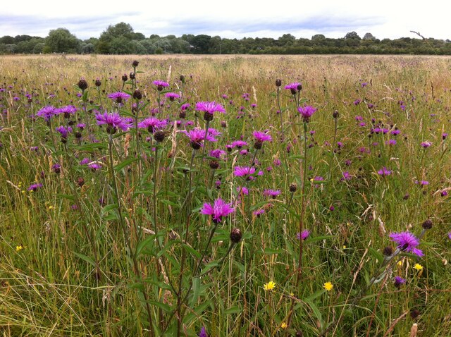
Greater Knapweed growing in the valley of the Great Ouse near Old Wolverton
Weather for this location
Loading local forecast…
Nearby places
Useful places within 5 km