Oxford Road Recreation Ground
Plan your visit
🦉 Wildlife⚽ Pitches🦅 Birds
Dogs welcome
Places › England › South East › Reading Getting here
51.46376, -1.01816
Open directionsv Visiting this summer
Seasonal nature notes and what to look for now
▾ ☀️ June — long evenings and clear skies; one of the most rewarding months for a late visit ⚽ Playing fields is at its best in summer here ☕ Waitrose Cafe — a good base for a longer summer day out 🌤️ Visiting this summer
☀️ June — long evenings and clear skies; one of the most rewarding months for a late visit ⚽ Playing fields is at its best in summer here ☕ Waitrose Cafe — a good base for a longer summer day out 🚲 Bike parking☕ Café🅿️ Parking· Free 🛝 Playground
🦉 Wildlife
Very strong match
Multi-group wildlife — Amphibians, Birds, Mammals, Reptiles; Multi-group wildlife — Amphibians, Birds, Mammals, Reptiles
Free
⚽ Playing fields
Very strong match
Playing field
Free
🦅 Bird watching
Strong match
Birds — Woodpigeon, Magpie, Swift +43 more · last seen 2025; Birds — Woodpigeon, Magpie, Swift +43 more · last seen 2025
Free
🦋 Insect spotting
Strong match
Insects — Stag Beetle, Jersey Tiger, Light Brown Apple Moth +288 more · last seen 2026; Insects — Stag Beetle, Jersey Tiger, Light Brown Apple Moth +288 more · last seen 2026
Free
Trails nearby Within roughly 5 km 7 signed routes nearby
Signed route nearby
The Chiltern Way Southern Extension Walking route ▾
Long distance path
Named route Ref CWS Regional walking route
Show on map European walking route E2 west, UK, South East England Walking route ▾
Westroute: Stranraer (UK) - Birminhgham (UK) - Calais (FR) - Zoersel (BE) / Eastroute: Stranraer (UK) - Harwich (UK) - Rotterdam (NL) - Zoersel (BE) / Both Routes: Zoersel (BE) - Maastrich (NL) - Luxembourg (LUX) - Lake Geneva (CH) - Nice (FR)
Named route Ref E2 International walking route
Show on map Kennet and Avon Canal Trail Walking route 140 km ▾
Rivers linked by a canal. The name refers to the entire navigable length. From Bristol the way is the Avon. The canal is from Bath to Newbury. From there to Reading the way is the Kennet. 53 locks to Summit Pound (150 m asl) and 54 down to Reading.
Named route Ref K&A Length 140 km Regional walking route
Show on map The Wokingham Way Walking route ▾
Named route Regional walking route
Show on map St James' Way Walking route 110 km ▾
Named route Ref SJW Length 110 km Regional walking route
Show on map 131 signed routes nearby
Signed route nearby
National Cycle Network Route 5 Cycling route ▾
Named route Ref 5 National Cycle Network
Show on map Round Berkshire Cycle Route Cycling route ▾
Named route Regional cycle route
Show on map National Cycle Route 23 Cycling route ▾
Named route Ref 23 National Cycle Network
Show on map Route R5 Cycling route ▾
Named route Ref R5 Local cycle route
Show on map Route R1 Cycling route ▾
Named route Ref R1 Local cycle route
Show on map Route R6 Cycling route ▾
Named route Ref R6 Local cycle route
Show on map 1 signed route nearby
Signed route nearby
King Alfred's Way Mountain bike route ▾
King Alfreds Way is 350km (220 miles) off road route designed to be ridden clockwise. It starts & ends in Winchester. It is suitable for gravel or cross-country bikes.
Named route Regional cycle route
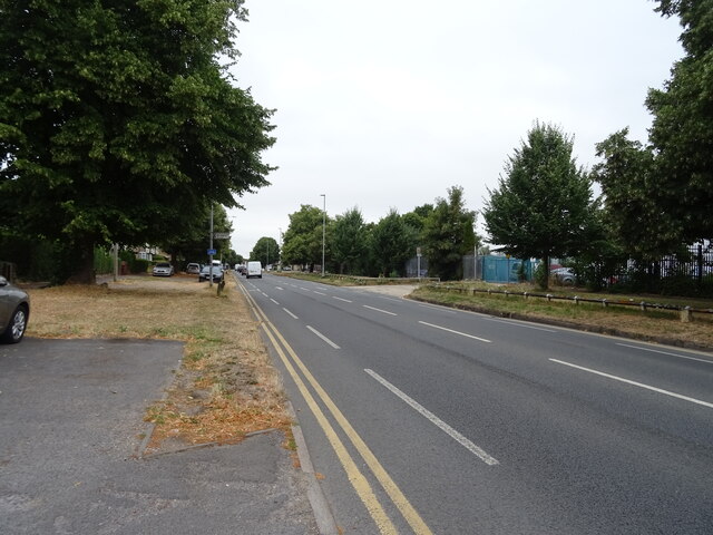
Show on map Photos Oxford Road (A329), Reading
‹ ›
Weather for this location Next 14 days Nearby places Useful places within 5 km
All Historic
Own or manage this place?
Claim this listing to keep details accurate, add photos, and highlight what makes it special — free.
Claim this page→ How useful was the information on this page?
id: dbb671f3-b10a-4f2f-ae6c-41be88c7cdec
UK green spaces mapped from open public data — so anyone can find the woodland, trail, or nature reserve closest to them.
© 2026 Glade · Made with care for UK green spaces
Events & activities nearby Switch provider to compare local events, tours and bookable activities.
Bookable tours GetYourGuide Promote here
Wildlife to spot
36,779 records · National Biodiversity Network
▾
Wildlife to spot 36,779 records · National Biodiversity Network 🐦 Birds 3 species
summer autumn
2025 ▾
Pied Wagtail · Greylag Goose · Green Woodpecker
Pied Wagtail Motacilla alba Greylag Goose Anser anser Green Woodpecker Picus viridis 🦌 Mammals 5 species
winter summer autumn
2026 ▾
Grey Squirrel · Muntjac · Brown Rat · Red Fox · Hedgehog
Grey Squirrel Sciurus carolinensis Muntjac Muntiacus reevesi Brown Rat Rattus norvegicus2025 Red Fox Vulpes vulpes2025 Hedgehog Erinaceus europaeus2025 Slow-worm
🐸 Amphibians 1 species
winter autumn
2026 ▾
Smooth Newt
Smooth Newt Lissotriton vulgaris Jersey Tiger · Large Yellow Underwing · Light Brown Apple Moth · Turnip Moth · Shuttle-shaped Dart +104
Jersey Tiger Euplagia quadripunctaria2025 Large Yellow Underwing Noctua pronuba Light Brown Apple Moth Epiphyas postvittana2025 Turnip Moth Agrotis segetum2025 Shuttle-shaped Dart Agrotis puta2025 Vine's Rustic Hoplodrina ambigua Species observations from the last 10 years via NBN Atlas
2025
2025
Box Tree Moth Cydalima perspectalis2025
Box Tree Moth Cydalima perspectalis2025
Common Grass-veneer Agriphila tristella2025
Common Grass-veneer Agriphila tristella2025
Codling Moth Cydia pomonella2025
Codling Moth Cydia pomonella2025
Locust Blowfly Stomorhina lunata2025
Locust Blowfly Stomorhina lunata2025
Mother of Pearl Patania ruralis2025
Mother of Pearl Patania ruralis2025
Eristalis tenax Eristalis tenax
Eristalis tenax Eristalis tenax
Early Grey Xylocampa areola
Early Grey Xylocampa areola
Common Quaker Orthosia cerasi
Common Quaker Orthosia cerasi
Merveille du Jour Griposia aprilina2025
Merveille du Jour Griposia aprilina2025
Cypress Pug Eupithecia phoeniceata2025
Cypress Pug Eupithecia phoeniceata2025
Barred Sallow Tiliacea aurago2025
Barred Sallow Tiliacea aurago2025
White-point Mythimna albipuncta2025
White-point Mythimna albipuncta2025
Twin-spot Centurion Sargus bipunctatus2025
Twin-spot Centurion Sargus bipunctatus2025
Brimstone Moth Opisthograptis luteolata2025
Brimstone Moth Opisthograptis luteolata2025
Hairy Shieldbug Dolycoris baccarum2025
Hairy Shieldbug Dolycoris baccarum2025
European Corn-borer Ostrinia nubilalis2025
European Corn-borer Ostrinia nubilalis2025
Square-spot Rustic Xestia xanthographa2025
Square-spot Rustic Xestia xanthographa2025
Lesser Broad-bordered Yellow Underwing Noctua janthe2025
Lesser Broad-bordered Yellow Underwing Noctua janthe2025
Setaceous Hebrew Character Xestia c-nigrum2025
Setaceous Hebrew Character Xestia c-nigrum2025
Pale Mottled Willow Caradrina clavipalpis2025
Pale Mottled Willow Caradrina clavipalpis2025
Straw Underwing Thalpophila matura2025
Straw Underwing Thalpophila matura2025
Humming-bird Hawk-moth Macroglossum stellatarum2025
Humming-bird Hawk-moth Macroglossum stellatarum2025
Heart & Dart Agrotis exclamationis2025
Heart & Dart Agrotis exclamationis2025
Straw Grass-veneer Agriphila straminella2025
Straw Grass-veneer Agriphila straminella2025
Field Grasshopper Chorthippus brunneus2025
Field Grasshopper Chorthippus brunneus2025
Gypsy Moth Lymantria dispar2025
Gypsy Moth Lymantria dispar2025
Cinnabar Tyria jacobaeae2025
Cinnabar Tyria jacobaeae2025
Gymnosoma rotundatum Gymnosoma rotundatum2025
Gymnosoma rotundatum Gymnosoma rotundatum2025
Dark-edged Bee-fly Bombylius major
Dark-edged Bee-fly Bombylius major
Oak Beauty Biston strataria
Oak Beauty Biston strataria
Twin-spotted Quaker Anorthoa munda
Twin-spotted Quaker Anorthoa munda
Small Quaker Orthosia cruda
Small Quaker Orthosia cruda
December Moth Poecilocampa populi2025
December Moth Poecilocampa populi2025
Blair's Shoulder-knot Lithophane leautieri2025
Blair's Shoulder-knot Lithophane leautieri2025
Red-Line Quaker Leptologia lota2025
Red-Line Quaker Leptologia lota2025
Orange Sallow Tiliacea citrago2025
Orange Sallow Tiliacea citrago2025
Black Rustic Aporophyla nigra2025
Black Rustic Aporophyla nigra2025
Grey Shoulder-knot Lithophane ornitopus lactipennis2025
Grey Shoulder-knot Lithophane ornitopus lactipennis2025
Rosy Rustic Hydraecia micacea2025
Rosy Rustic Hydraecia micacea2025
Grey Pine Carpet Thera obeliscata2025
Grey Pine Carpet Thera obeliscata2025
Lesser Yellow Underwing Noctua comes2025
Lesser Yellow Underwing Noctua comes2025
Red-green Carpet Chloroclysta siterata2025
Red-green Carpet Chloroclysta siterata2025
L-album Wainscot Mythimna l-album2025
L-album Wainscot Mythimna l-album2025
Dock Bug Coreus marginatus2025
Dock Bug Coreus marginatus2025
Common Darter Sympetrum striolatum2025
Common Darter Sympetrum striolatum2025
Cabbage Bug Eurydema (Eurydema) oleracea2025
Cabbage Bug Eurydema (Eurydema) oleracea2025
Golden-haired Robberfly Choerades marginatus2025
Golden-haired Robberfly Choerades marginatus2025
Rush Veneer Nomophila noctuella2025
Rush Veneer Nomophila noctuella2025
Rose Chafer Cetonia aurata2025
Rose Chafer Cetonia aurata2025
Mint Moth Pyrausta aurata2025
Mint Moth Pyrausta aurata2025
Scarce Bordered Straw Helicoverpa armigera2025
Scarce Bordered Straw Helicoverpa armigera2025
Centre-barred Sallow Atethmia centrago2025
Centre-barred Sallow Atethmia centrago2025
Double-striped Pug Gymnoscelis rufifasciata2025
Double-striped Pug Gymnoscelis rufifasciata2025
September Thorn Ennomos erosaria2025
September Thorn Ennomos erosaria2025
Dusky Thorn Ennomos fuscantaria2025
Dusky Thorn Ennomos fuscantaria2025
Long-horned Flat-body Carcina quercana2025
Long-horned Flat-body Carcina quercana2025
Clover-root Weevil Sitona hispidulus2025
Clover-root Weevil Sitona hispidulus2025
Oak Hook-tip Watsonalla binaria2025
Oak Hook-tip Watsonalla binaria2025
Flounced Rustic Luperina testacea2025
Flounced Rustic Luperina testacea2025
Rusty Dot Udea ferrugalis2025
Rusty Dot Udea ferrugalis2025
Small Blood-vein Scopula imitaria2025
Small Blood-vein Scopula imitaria2025
Marmalade Hoverfly Episyrphus balteatus2025
Marmalade Hoverfly Episyrphus balteatus2025
Phasia obesa Phasia obesa2025
Phasia obesa Phasia obesa2025
Glow-worm Lampyris noctiluca2025
Glow-worm Lampyris noctiluca2025
Orange Ladybird Halyzia sedecimguttata2025
Orange Ladybird Halyzia sedecimguttata2025
Yponomeuta Yponomeuta2025
Yponomeuta Yponomeuta2025
Barred Grass-moth Agriphila inquinatella2025
Barred Grass-moth Agriphila inquinatella2025
Migrant Hawker Aeshna mixta2025
Migrant Hawker Aeshna mixta2025
Dark Arches Apamea monoglypha2025
Dark Arches Apamea monoglypha2025
Flame Shoulder Ochropleura plecta2025
Flame Shoulder Ochropleura plecta2025
Common Plume Emmelina monodactyla2025
Common Plume Emmelina monodactyla2025
Lychnis Hadena bicruris2025
Lychnis Hadena bicruris2025
Ash-bark Knot-horn Euzophera pinguis2025
Ash-bark Knot-horn Euzophera pinguis2025
Heart & Club Agrotis clavis2025
Heart & Club Agrotis clavis2025
Common Wainscot Mythimna pallens2025
Common Wainscot Mythimna pallens2025
Pale Prominent Pterostoma palpina2025
Pale Prominent Pterostoma palpina2025
Poplar Grey Subacronicta megacephala2025
Poplar Grey Subacronicta megacephala2025
Common Rustic agg. Mesapamea secalis agg.2025
Common Rustic agg. Mesapamea secalis agg.2025
White-banded Grass-moth Crambus pascuella2025
White-banded Grass-moth Crambus pascuella2025
Riband Wave Idaea aversata2025
Riband Wave Idaea aversata2025
Beautiful Plume Amblyptilia acanthadactyla2025
Beautiful Plume Amblyptilia acanthadactyla2025
Brown Moss-moth Bryotropha terrella2025
Brown Moss-moth Bryotropha terrella2025
Shark Cucullia umbratica2025
Shark Cucullia umbratica2025
Dun-bar Cosmia trapezina2025
Dun-bar Cosmia trapezina2025
Uncertain/Rustic Hoplodrina octogenaria/blanda2025
Uncertain/Rustic Hoplodrina octogenaria/blanda2025
Tree-lichen Beauty Cryphia algae2025
Tree-lichen Beauty Cryphia algae2025
Willow Beauty Peribatodes rhomboidaria2025
Willow Beauty Peribatodes rhomboidaria2025
Phytocoris (Ktenocoris) varipes Phytocoris (Ktenocoris) varipes2025
Phytocoris (Ktenocoris) varipes Phytocoris (Ktenocoris) varipes2025
August Thorn Ennomos quercinaria2025
August Thorn Ennomos quercinaria2025
Elephant Hawk-moth Deilephila elpenor2025
Elephant Hawk-moth Deilephila elpenor2025
Least Carpet Idaea rusticata2025
Least Carpet Idaea rusticata2025
House-fly Musca domestica2025
House-fly Musca domestica2025
Banded General Stratiomys potamida2025
Banded General Stratiomys potamida2025
Emperor Dragonfly Anax imperator2025
Emperor Dragonfly Anax imperator2025
Azure Damselfly Coenagrion puella2025
Azure Damselfly Coenagrion puella2025
Chequered Grass-moth Catoptria falsella2025
Chequered Grass-moth Catoptria falsella2025
Fig-leaf Skeletoniser Choreutis nemorana2025
Fig-leaf Skeletoniser Choreutis nemorana2025
Old Lady Mormo maura2025
Old Lady Mormo maura2025
Stag Beetle Lucanus cervus2025
Stag Beetle Lucanus cervus2025
Oncotylus (Oncotylus) viridiflavus Oncotylus (Oncotylus) viridiflavus2025
Oncotylus (Oncotylus) viridiflavus Oncotylus (Oncotylus) viridiflavus2025
Downland Villa Villa cingulata2025
Downland Villa Villa cingulata2025
Double Orange-spot Pammene aurana2025
Double Orange-spot Pammene aurana2025
Conops quadrifasciatus Conops quadrifasciatus2025
Conops quadrifasciatus Conops quadrifasciatus2025