Getting here
51.81779, -1.59399
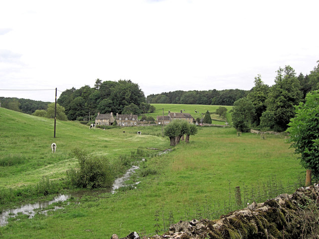
Visiting this summer
Seasonal nature notes and what to look for now
Visiting this summer
Seasonal nature notes and what to look for now
- 🌞Midsummer — early morning visits most comfortable; look for deer fawns in quieter clearings
- 🌿Foraging is at its best in summer here
- 🐕Dogs welcome — bring water in summer; the site has enough space to find shade on hot days
🌤️ Visiting this summer
- 🌞Midsummer — early morning visits most comfortable; look for deer fawns in quieter clearings
- 🌿Foraging is at its best in summer here
- 🐕Dogs welcome — bring water in summer; the site has enough space to find shade on hot days
Good to know
- £Free to visit — no entry charge
- 🐕Dogs welcome
Best for
Wildlife
Very strong match
Multi-group wildlife — Amphibians, Birds, Mammals, Reptiles; Multi-group wildlife — Amphibians, Birds, Mammals, Reptiles
Bird watching
Very strong match
Birds — Robin, Woodpigeon, Chaffinch +67 more · last seen 2026; Birds — Robin, Woodpigeon, Chaffinch +67 more · last seen 2026
Seasonal nature
Strong match
Plants — False Oat-grass, Blackthorn, Cock's-foot +184 more · last seen 2021; Plants — False Oat-grass, Blackthorn, Cock's-foot +184 more · last seen 2021
Foraging
Strong match
Plants — Blackthorn, Mouse-ear-hawkweed, Bramble +23 more foraging species
Insect spotting
Strong match
Insects — Glow-worm, Orange-tip, Small White +44 more · last seen 2024; Insects — Glow-worm, Orange-tip, Small White +44 more · last seen 2024
Heritage
Strong match
Historic site
Trails nearby
Within roughly 5 km🚶Walking
6 signed routes nearby · 4 public paths nearby
Signed route nearbyPublic paths
Walking
Oxfordshire WayWalking route110 km
a traverse of Oxfordshire from the Cotswolds to the Chilterns
Wychwood WayWalking route59.5 km
D'Arcy Dalton WayWalking route107 km
Follows roughly the western boundary of Oxfordshire in unspoilt countryside.
The Roman WayWalking route274.5 km
European walking route E2 west, UK, South East EnglandWalking route
Westroute: Stranraer (UK) - Birminhgham (UK) - Calais (FR) - Zoersel (BE) / Eastroute: Stranraer (UK) - Harwich (UK) - Rotterdam (NL) - Zoersel (BE) / Both Routes: Zoersel (BE) - Maastrich (NL) - Luxembourg (LUX) - Lake Geneva (CH) - Nice (FR)
🚴Cycling
25 signed routes nearby
Signed route nearby
Cycling
NCN National Route 57Cycling route
National Byway (Oxon and Glos)Cycling route
Alternative RouteCycling route524 m
Main RouteCycling route2.1 km
Main RouteCycling route36 m
Main RouteCycling route274 m
🐴Horse riding
2 public paths nearby
Public paths
Horse riding
No named routes yet. Public paths are shown on the map.
Wildlife to spot
Photos
Weather for this location
Loading local forecast…
Nearby places
Useful places within 5 km
Own or manage this place?
Claim this listing to keep details accurate, add photos, and highlight what makes it special — free.
Claim this pageHow was your visit?
How useful was the information on this page?
id: 0c28758d-a23e-4da6-8de5-eb78534dcf14