Getting here
51.83951, 0.52727
Visiting this summer
Seasonal nature notes and what to look for now
Visiting this summer
Seasonal nature notes and what to look for now
- 🌞Midsummer — early morning visits most comfortable; look for deer fawns in quieter clearings
- 🐕Early mornings are best for dog walks in summer — visit before 9am to avoid the heat and find quieter trails
- 📍Open access throughout summer — no booking required
🌤️ Visiting this summer
- 🌞Midsummer — early morning visits most comfortable; look for deer fawns in quieter clearings
- 🐕Early mornings are best for dog walks in summer — visit before 9am to avoid the heat and find quieter trails
- 📍Open access throughout summer — no booking required
Good to know
- £Free to visit — no entry charge
- 🐕Dogs welcome
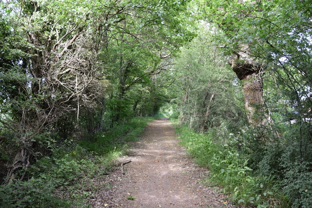
- 🌿Ancient woodland — rare wildlife habitat
Best for
Wildlife
Very strong match
Multi-group wildlife — Amphibians, Birds, Mammals; Multi-group wildlife — Amphibians, Birds, Mammals
Bird watching
Very strong match
Birds — Mallard, Moorhen, Woodpigeon +71 more · last seen 2025; Birds — Mallard, Moorhen, Woodpigeon +71 more · last seen 2025
Seasonal nature
Strong match
Ancient woodland — bluebells, fungi and autumn colour; Plants — Corky-fruited Water-dropwort, Agrimony, Grass Vetchling +17 more · last seen 2024
Dog walks
Strong match
Dogs allowed — public woodland
Insect spotting
Strong match
Insects — Speckled Wood, Small White, Large White +41 more · last seen 2025; Insects — Speckled Wood, Small White, Large White +41 more · last seen 2025
Cycling
Good match
Named cycling route nearby: Route 16
Trails nearby
Within roughly 5 km🚶Walking
2 signed routes nearby · 4 public paths nearby
Signed route nearbyPublic paths
Walking
John Ray WalkWalking route
Essex Way (Epping to Stratford St Mary)Walking route
🚴Cycling
77 signed routes nearby
Signed route nearby
Cycling
Notley Link PathCycling route
Regional Route 50Cycling route
(50)Cycling route
National Cycle Network link route between NCN 16 and Regional Route 50
Route 16Cycling route
Main RouteCycling route177 m
N/ACycling route20 m
🐴Horse riding
1 public path nearby
Public paths
Horse riding
No named routes yet. Public paths are shown on the map.
Wildlife to spot
Photos
Weather for this location
Loading local forecast…
Nearby places
Useful places within 5 km
Own or manage this place?
Claim this listing to keep details accurate, add photos, and highlight what makes it special — free.
Claim this pageHow was your visit?
How useful was the information on this page?
id: f13659d6-7cb2-4cde-afce-fb6fbf981203