Plan your visit
🦉 Wildlife🦅 Birds🦋 Insects
Free entry Dogs welcome 3 ha
Places › England › West Midlands › Lichfield Getting here
52.68294, -1.86324
Open directionsv Visiting this summer
Seasonal nature notes and what to look for now
▾ ☀️ June — canopy now fully closed, creating cool dappled shade even on warm days 🌿 Foraging is at its best in summer here 🐕 Dogs welcome — bring water in summer; the site has enough space to find shade on hot days 🌤️ Visiting this summer
☀️ June — canopy now fully closed, creating cool dappled shade even on warm days 🌿 Foraging is at its best in summer here 🐕 Dogs welcome — bring water in summer; the site has enough space to find shade on hot days £ Free to visit — no entry charge🐕 Dogs welcome🦉 Wildlife
Very strong match
Multi-group wildlife — Amphibians, Birds, Mammals, Reptiles; Multi-group wildlife — Amphibians, Birds, Mammals, Reptiles
Free
🦅 Bird watching
Very strong match
Birds — Woodpigeon, Blackbird, Robin +82 more · last seen 2026; Birds — Woodpigeon, Blackbird, Robin +82 more · last seen 2026
Free
🦋 Insect spotting
Strong match
Insects — Meadow Brown, Green-veined White, Ringlet +66 more · last seen 2025; Insects — Meadow Brown, Green-veined White, Ringlet +66 more · last seen 2025
Free
🍂 Seasonal nature
Strong match
Plants — Butterfly-bush, Hogweed, Broad-leaved Dock +30 more · last seen 2026; Plants — Butterfly-bush, Hogweed, Broad-leaved Dock +30 more · last seen 2026
Free
Deciduous woodland — fungi, berries and wild garlic; Plants — Hogweed, Common Nettle, Elder +2 more foraging species
Varies
🌲 Forest walks
Moderate match
Public woodland
Free
Trails nearby Within roughly 5 km 7 signed routes nearby · 1 public path nearby
Signed route nearby Public paths
Heart of England Way Walking route ▾
Named route Listed length 161km Regional walking route
Show on map Two Saints Way Walking route 148 km ▾
Two Saints Way - Chester Cathedral to/from Lichfield Cathedral. In the late Middle Ages a steady stream of pilgrims walked this way – both housing shrines to two game-changing Mercian saints in the 7th century - St Werburgh and St Chad
Named route Ref TSW Length 148 km Point-to-point Regional walking route
Show on map Four Commons Walk Walking route 9.5 km ▾
Circular route following the Wyrley & Essington Canal to Clayhanger Common – one of Walsall’s much-loved areas of green, open space.
Distance: 6 miles/9.5 km(approx)
Duration: 120 mins(approx)
Named route Length 9.5 km Round trip Local walking route
Show on map Clayhanger Common Walk Walking route 9.5 km ▾
Short, circular route following the Wyrley & Essington Canal to Clayhanger Common – one of Walsall’s much-loved areas of green, open space.
Distance: 6 miles/9.5 km(approx)
Duration: 120 mins(approx)
Named route Length 9.5 km Round trip Local walking route
Show on map Beacon Way Walking route 40 km ▾
Starting at Sandwell Valley via the outskirts of Birmingham and the countryside of Walsall into Staffordshire. Take in the Forest of Mercia, lakes, nature reserves, woods, and canal banks. Named after Barr Beacon, one of the highest hills in this area.
Named route Length 40 km Point-to-point Regional walking route
Show on map 53 signed routes nearby
Signed route nearby
Route 54 Cycling route ▾
Named route Ref 54 National Cycle Network
Show on map McClean Way Cycling route ▾
Named route Local cycle route
Show on map Cannock Extension Canal to Longwood Junction Cycling route 11.2 km ▾
Canalside route leading past Clayhanger Common and through Rushall, with a pub along the way.
Distance: 7 miles/11.2 km (approx)
Duration: 60 min (approx)
Named route Length 11.2 km Point-to-point Local cycle route
Show on map National Cycle Network Route 5 Cycling route ▾
Named route Ref 5 National Cycle Network
Show on map N/A Cycling route 393 m ▾
Named route Length 393 m National Cycle Network Traffic-free Surface asphalt
Show on map Main Route Cycling route 27 m ▾
Named route Ref 5 Length 27 m National Cycle Network Traffic-free Surface blocks
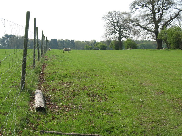
Show on map Photos View South from Abnalls Lane
‹ ›
Weather for this location Next 14 days Nearby places Useful places within 5 km
All Historic
Own or manage this place?
Claim this listing to keep details accurate, add photos, and highlight what makes it special — free.
Claim this page→ How useful was the information on this page?
id: 107b301d-8893-4899-a2c2-66d8f14b15ee
UK green spaces mapped from open public data — so anyone can find the woodland, trail, or nature reserve closest to them.
© 2026 Glade · Made with care for UK green spaces
Wildlife to spot
4,355 records · National Biodiversity Network
▾
Wildlife to spot 4,355 records · National Biodiversity Network 🐦 Birds 35 species
spring summer autumn
2026 ▾
Blackbird · Robin · Magpie · Goldfinch · Woodpigeon +30
Blackbird Turdus merula Robin Erithacus rubecula2025 Magpie Pica pica2025 Goldfinch Carduelis carduelis2025 Woodpigeon Columba palumbus2025 Jackdaw Coloeus monedula2025 Starling Sturnus vulgaris2025 Wren Troglodytes troglodytes2025 Greenfinch Chloris chloris2025 Long-tailed Tit Aegithalos caudatus2025 Great Tit Parus major2025 Blue Tit Cyanistes caeruleus2025 Kestrel Falco tinnunculus2025 Whitethroat Curruca communis2025 Chaffinch Fringilla coelebs2025 Moorhen Gallinula chloropus2025 Dunnock Prunella modularis2024 Barn Owl Tyto alba2025 Grasshopper Warbler Locustella naevia2025 Blackcap Sylvia atricapilla2025 Chiffchaff Phylloscopus collybita2025 Mallard Anas platyrhynchos2025 Carrion Crow Corvus corone2025 Black-headed Gull Chroicocephalus ridibundus2025 Little Egret Egretta garzetta2025 House Sparrow Passer domesticus2025 Stock Dove Columba oenas2025 Grey Wagtail Motacilla cinerea2025 Treecreeper Certhia familiaris2025 Jay Garrulus glandarius2025 Fieldfare Turdus pilaris2025 Water Rail Rallus aquaticus2024 Goldcrest Regulus regulus2024 Redwing Turdus iliacus2024 Coot Fulica atra2024 Mole · Wood Mouse · Common Shrew · Pygmy Shrew · Bank Vole +8
Mole Talpa europaea Wood Mouse Apodemus sylvaticus Common Shrew Sorex araneus Pygmy Shrew Sorex minutus Bank Vole Myodes glareolus Pipistrelle Pipistrellus pipistrellus Field Vole Microtus agrestis 🐸 Amphibians 1 species
winter
2026 ▾
Common Toad
7-spot Ladybird · Large Willow Aphid · Dock Bug · Common Red Soldier Beetle · Batman Hoverfly +17
7-spot Ladybird Coccinella septempunctata Large Willow Aphid Tuberolachnus (Tuberolachnus) salignus Dock Bug Coreus marginatus Common Red Soldier Beetle Rhagonycha fulva Batman Hoverfly Myathropa florea Yellow Meadow Ant Lasius flavus Oak Bush-cricket Hogweed · Butterfly-bush · Yarrow · Common Knapweed · Rosebay Willowherb +54
Hogweed Heracleum sphondylium2025 Butterfly-bush Buddleja davidii2025 Yarrow Achillea millefolium2025 Common Knapweed Centaurea nigra2025 Rosebay Willowherb Chamaenerion angustifolium2025 Common Nettle Urtica dioica Species observations from the last 10 years via NBN Atlas
Leisler's Bat Nyctalus leisleri
Leisler's Bat Nyctalus leisleri
Noctule Nyctalus noctula
Noctule Nyctalus noctula
Soprano Pipistrelle Pipistrellus pygmaeus
Soprano Pipistrelle Pipistrellus pygmaeus
Rabbit Oryctolagus cuniculus
Rabbit Oryctolagus cuniculus
Grey Squirrel Sciurus carolinensis
Grey Squirrel Sciurus carolinensis
Muntjac Muntiacus reevesi
Muntjac Muntiacus reevesi Meconema thalassinum
Meconema thalassinum
Migrant Hawker Aeshna mixta
Migrant Hawker Aeshna mixta
Field Grasshopper Chorthippus brunneus
Field Grasshopper Chorthippus brunneus
Sericomyia silentis Sericomyia silentis
Sericomyia silentis Sericomyia silentis
Eristalis Eristalis
Eristalis Eristalis
Eupeodes luniger Eupeodes luniger
Eupeodes luniger Eupeodes luniger
Broad-bodied Chaser Libellula depressa
Broad-bodied Chaser Libellula depressa
2-spot Ladybird Adalia bipunctata
2-spot Ladybird Adalia bipunctata
Red-legged Shieldbug Pentatoma rufipes
Red-legged Shieldbug Pentatoma rufipes
Welsh Chafer Hoplia philanthus
Welsh Chafer Hoplia philanthus
Denticollis linearis Denticollis linearis
Denticollis linearis Denticollis linearis
Dasysyrphus Dasysyrphus
Dasysyrphus Dasysyrphus
Common Cockchafer Melolontha melolontha
Common Cockchafer Melolontha melolontha
Green Shieldbug Palomena prasina
Green Shieldbug Palomena prasina
Dark-edged Bee-fly Bombylius major
Dark-edged Bee-fly Bombylius major
Box Bug Gonocerus acuteangulatus2024
Box Bug Gonocerus acuteangulatus2024 2025
2025
Foxglove Digitalis purpurea2025
Foxglove Digitalis purpurea2025
Gorse Ulex europaeus2025
Gorse Ulex europaeus2025
Green Snowdrop Galanthus woronowii
Green Snowdrop Galanthus woronowii
Lords-and-Ladies Arum maculatum
Lords-and-Ladies Arum maculatum
Dogwood Cornus sanguinea2025
Dogwood Cornus sanguinea2025
Elder Sambucus nigra2025
Elder Sambucus nigra2025
Hawthorn Crataegus monogyna2025
Hawthorn Crataegus monogyna2025
Sycamore Acer pseudoplatanus2025
Sycamore Acer pseudoplatanus2025
Cornflower Centaurea cyanus2025
Cornflower Centaurea cyanus2025
Black Horehound Ballota nigra2025
Black Horehound Ballota nigra2025
Bracken Pteridium aquilinum2025
Bracken Pteridium aquilinum2025
Hoary Cress Lepidium draba2025
Hoary Cress Lepidium draba2025
Spear Thistle Cirsium vulgare2025
Spear Thistle Cirsium vulgare2025
Creeping Thistle Cirsium arvense2025
Creeping Thistle Cirsium arvense2025
Red Campion Silene dioica2025
Red Campion Silene dioica2025
Field Bindweed Convolvulus arvensis2025
Field Bindweed Convolvulus arvensis2025
White Campion Silene latifolia2025
White Campion Silene latifolia2025
Germander Speedwell Veronica chamaedrys2025
Germander Speedwell Veronica chamaedrys2025
Bell Heather Erica cinerea2025
Bell Heather Erica cinerea2025
Common Poppy Papaver rhoeas2025
Common Poppy Papaver rhoeas2025
Wood Avens Geum urbanum2025
Wood Avens Geum urbanum2025
Cuckooflower Cardamine pratensis2025
Cuckooflower Cardamine pratensis2025
Brooklime Veronica beccabunga2025
Brooklime Veronica beccabunga2025
Mistletoe Viscum album2024
Mistletoe Viscum album2024
Yellow Buckeye Aesculus flava2024
Yellow Buckeye Aesculus flava2024
Walnut Juglans regia2024
Walnut Juglans regia2024
Red Oak Quercus rubra2024
Red Oak Quercus rubra2024
Black Walnut Juglans nigra2024
Black Walnut Juglans nigra2024
Lady-fern Athyrium filix-femina2024
Lady-fern Athyrium filix-femina2024
Male-fern Dryopteris filix-mas2024
Male-fern Dryopteris filix-mas2024
Lamiaceae Lamiaceae2024
Lamiaceae Lamiaceae2024
Bramble Rubus fruticosus2024
Bramble Rubus fruticosus2024
Sweet Vernal-grass Anthoxanthum odoratum2024
Sweet Vernal-grass Anthoxanthum odoratum2024
Common Mouse-ear Cerastium fontanum2024
Common Mouse-ear Cerastium fontanum2024
Mugwort Artemisia vulgaris2024
Mugwort Artemisia vulgaris2024
Cat's-ear Hypochaeris radicata2024
Cat's-ear Hypochaeris radicata2024
Great Willowherb Epilobium hirsutum2024
Great Willowherb Epilobium hirsutum2024
Oxeye Daisy Leucanthemum vulgare2024
Oxeye Daisy Leucanthemum vulgare2024
Purple-loosestrife Lythrum salicaria2024
Purple-loosestrife Lythrum salicaria2024
Field Horsetail Equisetum arvense2024
Field Horsetail Equisetum arvense2024
Selfheal Prunella vulgaris2024
Selfheal Prunella vulgaris2024
Broom Cytisus scoparius2024
Broom Cytisus scoparius2024
Common Bird's-foot-trefoil Lotus corniculatus2024
Common Bird's-foot-trefoil Lotus corniculatus2024
Creeping Buttercup Ranunculus repens2024
Creeping Buttercup Ranunculus repens2024
Red Clover Trifolium pratense2024
Red Clover Trifolium pratense2024
Imperforate St John's-wort Hypericum maculatum2024
Imperforate St John's-wort Hypericum maculatum2024
Dandelion Taraxacum2024
Dandelion Taraxacum2024
Cow Parsley Anthriscus sylvestris2024
Cow Parsley Anthriscus sylvestris2024
Festuca rubra Festuca rubra2024
Festuca rubra Festuca rubra2024
Zigzag Clover Trifolium medium2024
Zigzag Clover Trifolium medium2024
Crested Dog's-tail Cynosurus cristatus2024
Crested Dog's-tail Cynosurus cristatus2024
Curled Dock Rumex crispus2024
Curled Dock Rumex crispus2024
Meadow Buttercup Ranunculus acris2024
Meadow Buttercup Ranunculus acris2024 Events & activities nearby Switch provider to compare local events, tours and bookable activities.
Bookable tours GetYourGuide Promote here