Perranporth Golf Club
120 ha
Paid entryDogs welcome120 ha
Getting here
50.35075, -5.14437
Open directionsv
Visiting this summer
Seasonal nature notes and what to look for now
- 🌞Midsummer — early morning visits most comfortable; look for deer fawns in quieter clearings
- ⛳Golf is at its best in summer here
- 🐕Dogs welcome — bring water in summer; the site has enough space to find shade on hot days
🌤️ Visiting this summer
- 🌞Midsummer — early morning visits most comfortable; look for deer fawns in quieter clearings
- ⛳Golf is at its best in summer here
- 🐕Dogs welcome — bring water in summer; the site has enough space to find shade on hot days
Trails nearby
Within roughly 5 km6 signed routes nearby · 51 public paths nearby
Signed route nearbyPublic paths
South West Coast Path (Section 17: Newquay to Perranporth)Walking route▾
Named routeRef SWCPNational walking route
South West Coast Path (Section 18: Perranporth to Portreath)Walking route▾
Named routeRef SWCPNational walking route
King Charles III England Coast Path: Newquay to PenzanceWalking route▾
Named routeRef ECPNational walking route
Cubert Common walk, North CornwallWalking route1.6 km▾
A gentle grassy walk, with sandy paths and tracks across open grassland.
Named routeLength 1.6 kmDuration 00:30Round tripLocal walking route
Cubert wildlife walk, North CornwallWalking route9.6 km▾
This walk has some short steep slopes and steps on the coast path. Walking boots are advised due to the uneven ground.
Named routeLength 9.6 kmDuration 2:00Round tripLocal walking route
Wheal Leisurepublic footpath · 112 m▾
Public pathpublic footpathLength 112 mSurface asphaltPath type: residential
Hendrawna Lanepublic footpath · 164 m▾
Public pathpublic footpathLength 164 mPath type: residential
Hendrawna Lanepublic footpath · 296 m▾
Public pathpublic footpathLength 296 mPath type: footway
10 signed routes nearby
Signed route nearby
NCN National Route 32Cycling route▾
Named routeRef 32National Cycle Network
Saints' TrailCycling route▾
Named routeLocal cycle route
Main RouteCycling route4.1 km▾
Named routeRef 34Length 4.1 kmNational Cycle NetworkTraffic-freeSurface unsealedfirm
Main RouteCycling route1.5 km▾
Named routeRef 32Length 1.5 kmNational Cycle NetworkOn-roadSurface asphalt
Main RouteCycling route988 m▾
Named routeRef 32Length 988 mNational Cycle NetworkOn-roadSurface asphalt
Main RouteCycling route248 m▾
Named routeRef 32Length 248 mNational Cycle NetworkOn-roadSurface asphalt
6 public paths nearby
Public paths
Budnic Hillbridleway · 179 m▾
Public pathbridlewayLength 179 mPath type: track
Reen Lanebridleway · 331 m▾
Public pathbridlewayLength 331 mPath type: track
Photos
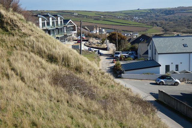
Ramoth Way, Perranporth, Perranzabuloe
Weather for this location
Next 14 daysNearby places
Useful places within 5 km
Own or manage this place?
Claim this listing to keep details accurate, add photos, and highlight what makes it special — free.
Claim this page→How useful was the information on this page?
id: f188e790-aa3e-49be-a8a6-51aa142a85ef
Wildlife to spot
22,199 records · National Biodiversity Network
Wildlife to spot
22,199 records · National Biodiversity NetworkChough · Jackdaw · Carrion Crow · Herring Gull · Stonechat +47
- ChoughPyrrhocorax pyrrhocorax2025
- JackdawColoeus monedula
- Carrion CrowCorvus corone2025
- Herring GullLarus argentatus2025
- StonechatSaxicola rubicola2025
- BlackbirdTurdus merula2025
- RookCorvus frugilegus2025
- Rock PipitAnthus petrosus2025
- MagpiePica pica2025
- DunnockPrunella modularis2025
- Meadow PipitAnthus pratensis2025
- LinnetLinaria cannabina2025
- WoodpigeonColumba palumbus2025
- RobinErithacus rubecula2025
- StarlingSturnus vulgaris2025
- SkylarkAlauda arvensis2025
- SwallowHirundo rustica2025
- Blue TitCyanistes caeruleus2025
- GannetMorus bassanus2025
- MallardAnas platyrhynchos2025
- Pied WagtailMotacilla alba yarrellii2025
- Black-headed GullChroicocephalus ridibundus2025
- BlackcapSylvia atricapilla2025
- Great TitParus major2025
- OystercatcherHaematopus ostralegus2025
- ChiffchaffPhylloscopus collybita2025
- House SparrowPasser domesticus2025
- Great Black-backed GullLarus marinus2025
- WrenTroglodytes troglodytes2025
- Long-tailed TitAegithalos caudatus2025
- MoorhenGallinula chloropus2025
- Rock DoveColumba livia2025
- KestrelFalco tinnunculus2025
- SwiftApus apus2025
- ShagGulosus aristotelis2025
- WhitethroatCurruca communis2025
- Sand MartinRiparia riparia2025
- RavenCorvus corax2025
- Grey WagtailMotacilla cinerea2025
- Song ThrushTurdus philomelos2025
- JayGarrulus glandarius2025
- RedwingTurdus iliacus2025
- GoldfinchCarduelis carduelis2025
- Canada GooseBranta canadensis2025
- GoldcrestRegulus regulus2025
- ChaffinchFringilla coelebs2025
- GadwallMareca strepera2025
- House MartinDelichon urbicum2025
- Sedge WarblerAcrocephalus schoenobaenus2025
- PeregrineFalco peregrinus2025
- FulmarFulmarus glacialis2025
- WheatearOenanthe oenanthe2025
Grey Squirrel
- Grey SquirrelSciurus carolinensis
🐸Amphibians1 species
summer
2025▾
Common Toad
Broad-bodied Chaser · Glow-worm · Large Red Damselfly · Common Darter · Red-veined Darter +21
- Broad-bodied ChaserLibellula depressa
- Glow-wormLampyris noctiluca
- Large Red DamselflyPyrrhosoma nymphula
- Common DarterSympetrum striolatum
- Red-veined DarterSympetrum fonscolombii
- Dune VillaVilla modesta
- Calocoris (Calocoris) roseomaculatus
Species observations from the last 10 years via NBN Atlas
Calocoris (Calocoris) roseomaculatus
Calocoris (Calocoris) roseomaculatus
Opsius stactogalusOpsius stactogalusOpsius stactogalusOpsius stactogalusCrataerina hirundinisCrataerina hirundinisCrataerina hirundinisCrataerina hirundinisEristalis pertinaxEristalis pertinaxEristalis pertinaxEristalis pertinaxCommon Red Soldier BeetleRhagonycha fulvaCommon Red Soldier BeetleRhagonycha fulvaSolomon's-seal SawflyPhymatocera aterrimaSolomon's-seal SawflyPhymatocera aterrimaIsomira murinaIsomira murinaIsomira murinaIsomira murinaAblattaria laevigataAblattaria laevigataAblattaria laevigataAblattaria laevigataBlack ClockPterostichus madidusBlack ClockPterostichus madidusAzure DamselflyCoenagrion puellaAzure DamselflyCoenagrion puellaHairy ShieldbugDolycoris baccarumHairy ShieldbugDolycoris baccarumMarram WeevilPhilopedon plagiatumMarram WeevilPhilopedon plagiatumWelsh ChaferHoplia philanthusWelsh ChaferHoplia philanthusBlack Marram WeevilOtiorhynchus atroapterusBlack Marram WeevilOtiorhynchus atroapterusAthous haemorrhoidalisAthous haemorrhoidalisAthous haemorrhoidalisAthous haemorrhoidalisBeautiful DemoiselleCalopteryx virgoBeautiful DemoiselleCalopteryx virgoGreater Bulb-FlyMerodon equestrisGreater Bulb-FlyMerodon equestrisPhylan gibbusPhylan gibbusPhylan gibbusPhylan gibbusOpatrum sabulosumOpatrum sabulosumOpatrum sabulosumOpatrum sabulosumHairy Sand WaspPodalonia hirsutaHairy Sand WaspPodalonia hirsutaEvents & activities nearby
Switch provider to compare local events, tours and bookable activities.