Plan your visit
🦉Wildlife🦅Birds🦋Insects
Public accessFree entryDogs welcome18 ha
Getting here
51.66735, -2.18879
Open directionsv
Visiting this summer
Seasonal nature notes and what to look for now
- 🌞Midsummer — early morning visits most comfortable; look for deer fawns in quieter clearings
- 🐕Early mornings are best for dog walks in summer — visit before 9am to avoid the heat and find quieter trails
- 📍Open access throughout summer — no booking required
🌤️ Visiting this summer
- 🌞Midsummer — early morning visits most comfortable; look for deer fawns in quieter clearings
- 🐕Early mornings are best for dog walks in summer — visit before 9am to avoid the heat and find quieter trails
- 📍Open access throughout summer — no booking required
- £Free to visit — no entry charge
- 🐕Dogs welcome
🦉Wildlife
Very strong match
Multi-group wildlife — Birds, Mammals; Multi-group wildlife — Birds, Mammals
Free
🦅Bird watching
Very strong match
Birds — Pheasant, Skylark, Robin +63 more · last seen 2026; Birds — Pheasant, Skylark, Robin +63 more · last seen 2026
Free
🦋Insect spotting
Strong match
Chalk and limestone grassland — chalkhill blue, adonis blue and rare moths; Insects — Small White, Meadow Brown, Gatekeeper +21 more · last seen 2025
Free
Dogs allowed — public woodland
Free
Deciduous woodland — fungi, berries and wild garlic
Varies
Trails nearby
Within roughly 5 km4 signed routes nearby · 11 public paths nearby
Signed route nearbyPublic paths
Monarch's WayWalking route990 km▾
approximate route of Charles II's escape
Named routeRef MWLength 990 kmRegional walking route
Macmillan WayWalking route290 km▾
Named routeRef MWALength 290 kmListed length 461Regional walking route
Woodchester Blue TrailWalking route▾
Named routeLocal walking route
Palladian WayWalking route190 km▾
The Old Goal, Buckingham to Pulteney Bridge, Bath
Named routeLength 190 kmRegional walking route
FP NBE9public footpath · 633 m▾
Public pathpublic footpathLength 633 mSurface dirtPath type: footway
FP NAV27public footpath · 463 m▾
Public pathpublic footpathLength 463 mSurface dirtPath type: footway
22 signed routes nearby
Signed route nearby
Mercian WayCycling route▾
Named routeRef 45National Cycle Network
National BywayCycling route▾
Named routeRef NBRegional cycle route
Fosse2Cycling route▾
Named routeRef 48National Cycle Network
Cotswold CyclewayCycling route▾
Named routeRef CCRegional cycle route
Main RouteCycling route145 m▾
Named routeRef 45Length 145 mNational Cycle NetworkTraffic-freeSurface asphalt
Main RouteCycling route911 m▾
Named routeRef 45Length 911 mNational Cycle NetworkOn-roadSurface asphalt
6 public paths nearby
Public paths
BW NBE1bridleway · 2.2 km▾
Public pathbridlewayLength 2.2 kmSurface groundPath type: bridleway
Photos
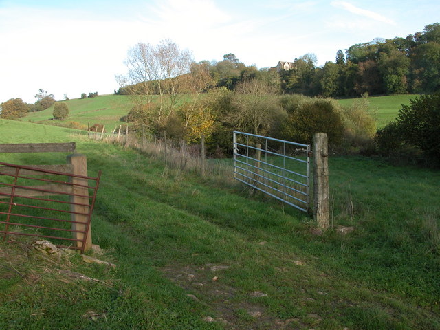
Larch Covert viewed from Ledgemore Bottom
Weather for this location
Next 14 daysNearby places
Useful places within 5 km
Own or manage this place?
Claim this listing to keep details accurate, add photos, and highlight what makes it special — free.
Claim this page→How useful was the information on this page?
id: 2a62f873-db38-433c-8081-247ac7a65faa
Events & activities nearby
Switch provider to compare local events, tours and bookable activities.
Wildlife to spot
5,971 records · National Biodiversity Network
Wildlife to spot
5,971 records · National Biodiversity Network🐦Birds45 species
springautumn
2026▾
Robin · Pheasant · Woodpigeon · Jackdaw · Blue Tit +40
- RobinErithacus rubecula2025
- PheasantPhasianus colchicus2025
- WoodpigeonColumba palumbus2025
- JackdawColoeus monedula2025
- Blue TitCyanistes caeruleus2025
- WrenTroglodytes troglodytes2025
- ChaffinchFringilla coelebs2025
- Carrion CrowCorvus corone2025
- GoldfinchCarduelis carduelis2025
- BlackbirdTurdus merula2025
- GoldcrestRegulus regulus2025
- Great Spotted WoodpeckerDendrocopos major2025
- SkylarkAlauda arvensis2025
- Great TitParus major2025
- DunnockPrunella modularis2025
- SwallowHirundo rustica2025
- KestrelFalco tinnunculus
- RavenCorvus corax2025
- MagpiePica pica2025
- Pied WagtailMotacilla alba2025
- RookCorvus frugilegus2025
- Collared DoveStreptopelia decaocto2025
- ChiffchaffPhylloscopus collybita2025
- Mistle ThrushTurdus viscivorus2025
- NuthatchSitta europaea2025
- Red-legged PartridgeAlectoris rufa2025
- Song ThrushTurdus philomelos2025
- GreenfinchChloris chloris2025
- YellowhammerEmberiza citrinella2025
- BlackcapSylvia atricapilla2025
- Stock DoveColumba oenas2025
- LinnetLinaria cannabina2025
- Coal TitPeriparus ater2025
- FieldfareTurdus pilaris2025
- JayGarrulus glandarius2025
- Meadow PipitAnthus pratensis2025
- Spotted FlycatcherMuscicapa striata2025
- WhitethroatCurruca communis2025
- StonechatSaxicola rubicola2025
- Lesser WhitethroatCurruca curruca2025
- Lesser Black-backed GullLarus fuscus2025
- House SparrowPasser domesticus2025
- Green WoodpeckerPicus viridis2025
- BullfinchPyrrhula pyrrhula2025
- Golden PloverPluvialis apricaria2024
🦌Mammals5 species
springautumn
2025▾
Grey Squirrel · Muntjac · Roe Deer · Rabbit · Red Fox
- Grey SquirrelSciurus carolinensis
- MuntjacMuntiacus reevesi
- Roe DeerCapreolus capreolus
- RabbitOryctolagus cuniculus
- Red FoxVulpes vulpes
Meadow Brown · Small White · Gatekeeper · Large White · Peacock +4
- Meadow BrownManiola jurtina2024
- Small WhitePieris rapae2024
- GatekeeperPyronia tithonus2024
- Large WhitePieris brassicae2024
- PeacockAglais io2024
- Marbled WhiteMelanargia galathea
Timothy · Canadian Fleabane · Hedgerow Crane's-bill · Rough Hawkbit · Phleum pratense +7
- TimothyPhleum pratense
- Canadian FleabaneErigeron canadensis
- Hedgerow Crane's-billGeranium pyrenaicum
- Rough HawkbitLeontodon hispidus
- Phleum pratensePhleum pratense
- Welted ThistleCarduus crispus
- Wild StrawberryFragaria vesca
Species observations from the last 10 years via NBN Atlas
2024
2024
Helophilus pendulusHelophilus pendulusHelophilus pendulusHelophilus pendulusOedemera femoralisOedemera femoralisOedemera femoralisOedemera femoralisRingletAphantopus hyperantus2024RingletAphantopus hyperantus2024Cat's-earHypochaeris radicataCat's-earHypochaeris radicataMontbretiaCrocosmia aurea x pottsii = C. x crocosmiifloraMontbretiaCrocosmia aurea x pottsii = C. x crocosmiifloraWhite CampionSilene latifoliaWhite CampionSilene latifoliaDruce's Crane's-billGeranium endressii x versicolor = G. x oxonianumDruce's Crane's-billGeranium endressii x versicolor = G. x oxonianumCommon Bird's-foot-trefoilLotus corniculatusCommon Bird's-foot-trefoilLotus corniculatus