Getting here
50.42022, -5.00125
Visiting this summer
Seasonal nature notes and what to look for now
Visiting this summer
Seasonal nature notes and what to look for now
- 🌞Midsummer — dragonfly and damselfly activity peaks along water edges
- 🐕Early mornings are best for dog walks in summer — visit before 9am to avoid the heat and find quieter trails
- 🅿️Parking 53m away — 2 car parks within reach
🌤️ Visiting this summer
- 🌞Midsummer — dragonfly and damselfly activity peaks along water edges
- 🐕Early mornings are best for dog walks in summer — visit before 9am to avoid the heat and find quieter trails
- 🅿️Parking 53m away — 2 car parks within reach
Good to know
- £Free to visit — no entry charge
- 🐕Dogs welcome
Best for
Wildlife
Very strong match
Multi-group wildlife — Birds, Mammals, Reptiles; Multi-group wildlife — Birds, Mammals, Reptiles
Bird watching
Very strong match
Birds — Great Crested Grebe, Coot, Mallard +83 more · last seen 2025; Birds — Great Crested Grebe, Coot, Mallard +83 more · last seen 2025
Dog walks
Good match
Dogs allowed with public access
Insect spotting
Good match
Insects — Blue-tailed Damselfly, Beautiful Demoiselle, Black-tailed Skimmer +3 more · last seen 2025; Insects — Blue-tailed Damselfly, Beautiful Demoiselle, Black-tailed Skimmer +3 more · last seen 2025
Foraging
Good match
Deciduous woodland — fungi, berries and wild garlic
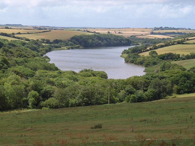
Waterside walks
Good match
Reservoir — waterside public access
Trails nearby
Within roughly 5 km🚶Walking
3 signed routes nearby · 8 public paths nearby
Signed route nearbyPublic paths
Walking
South West Coast Path (Section 16: Porthcothan to Newquay)Walking route
King Charles III England Coast Path: Marsland Mouth to NewquayWalking route
Carnewas bus route walking trail, North CornwallWalking route6.4 km
A majority of the trail follows the South West Coast Path, following coast and farmland footpaths. There is moderate terrain along natural, uneven surfaces and it can be muddy during wet weather. The route includes slopes, steps and and unfenced clifftop.
🚴Cycling
61 signed routes nearby
Signed route nearby
Cycling
NCN National Route 32Cycling route
Route 305Cycling route
Main RouteCycling route54 m
Main RouteCycling route285 m
Main RouteCycling route604 m
Main RouteCycling route178 m
Wildlife to spot
Photos
Weather for this location
Loading local forecast…
Nearby places
Useful places within 5 km
Own or manage this place?
Claim this listing to keep details accurate, add photos, and highlight what makes it special — free.
Claim this pageHow was your visit?
How useful was the information on this page?
id: b3efd949-0a72-473c-ac19-abf88eb3ef66