Prehistoric to post-medieval settlement, and religious and funerary remains on the middle and lower slopes west and south of Roughtor 71 ha
Plan your visit
🦉 Wildlife🦅 Birds🍄 Fungi
Free entry Dogs welcome 71 ha
Places › England › South West › Cornwall Getting here
50.59889, -4.62604
Open directionsv ✦ Scheduled Ancient Monument — Nationally protected archaeological site on the National Heritage List for England (NHLE). Scheduled monuments represent the best surviving examples of England's irreplaceable archaeological heritage.
Archaeological site scheduled monument
Visiting this summer
Seasonal nature notes and what to look for now
▾ 🌞 Midsummer — early morning visits most comfortable; look for deer fawns in quieter clearings 🍄 Mushroom foraging is at its best in summer here 🐕 Dogs welcome — bring water in summer; the site has enough space to find shade on hot days 🌤️ Visiting this summer
🌞 Midsummer — early morning visits most comfortable; look for deer fawns in quieter clearings 🍄 Mushroom foraging is at its best in summer here 🐕 Dogs welcome — bring water in summer; the site has enough space to find shade on hot days £ Free to visit — no entry charge🐕 Dogs welcome🦉 Wildlife
Very strong match
Multi-group wildlife — Amphibians, Birds, Mammals, Reptiles; Multi-group wildlife — Amphibians, Birds, Mammals, Reptiles
Free
🦅 Bird watching
Very strong match
Birds — Meadow Pipit, Robin, Carrion Crow +80 more · last seen 2025; Birds — Meadow Pipit, Robin, Carrion Crow +80 more · last seen 2025
Free
🍄 Mushroom foraging
Strong match
Fungi — Deceiver, Tagell Binc Sbôr Serog, Bicoloured Deceiver +35 more · last seen 2020; Fungi — Deceiver, Tagell Binc Sbôr Serog, Bicoloured Deceiver +35 more · last seen 2020
Varies
🦋 Insect spotting
Strong match
Insects — Meadow Brown, Small Red Damselfly, Keeled Skimmer +39 more · last seen 2025; Insects — Meadow Brown, Small Red Damselfly, Keeled Skimmer +39 more · last seen 2025
Free
🍂 Seasonal nature
Good match
Plants — Broom Fork-moss, Glittering Wood-moss, Hart's-tongue Thyme-moss +4 more · last seen 2025; Plants — Broom Fork-moss, Glittering Wood-moss, Hart's-tongue Thyme-moss +4 more · last seen 2025
Free
Trails nearby Within roughly 5 km 12 signed routes nearby
Signed route nearby
Route 3 Cycling route 527.7 km ▾
Named route Ref 3 Length 527.7 km National Cycle Network
Show on map Main Route Cycling route 2.9 km ▾
Named route Ref 3 Length 2.9 km National Cycle Network On-road Surface asphalt
Show on map Main Route Cycling route 3.1 km ▾
Named route Ref 3 Length 3.1 km National Cycle Network On-road Surface asphalt
Show on map Main Route Cycling route 870 m ▾
Named route Ref 3 Length 870 m National Cycle Network On-road Surface asphalt
Show on map Main Route Cycling route 737 m ▾
Named route Ref 3 Length 737 m National Cycle Network On-road Surface asphalt
Show on map Main Route Cycling route 1.3 km ▾
Named route Ref 3 Length 1.3 km National Cycle Network On-road Surface asphalt
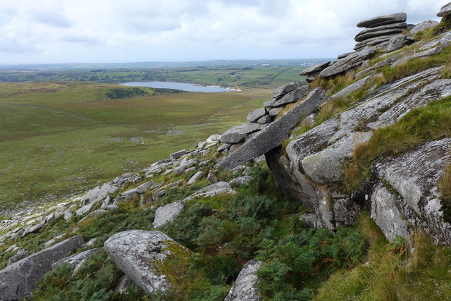
Show on map Photos The South western Slopes of Rough Tor
‹ ›
Weather for this location Next 14 days Nearby places Useful places within 5 km
All Historic
Own or manage this place?
Claim this listing to keep details accurate, add photos, and highlight what makes it special — free.
Claim this page→ How useful was the information on this page?
id: d2968e5c-3302-4fcf-98e9-870df14733c2
UK green spaces mapped from open public data — so anyone can find the woodland, trail, or nature reserve closest to them.
© 2026 Glade · Made with care for UK green spaces
Events & activities nearby Switch provider to compare local events, tours and bookable activities.
Bookable tours GetYourGuide Promote here
Wildlife to spot
4,725 records · National Biodiversity Network
▾
Wildlife to spot 4,725 records · National Biodiversity Network Meadow Pipit · Carrion Crow · Wheatear · Cuckoo · Wren +40
Meadow Pipit Anthus pratensis Carrion Crow Corvus corone2024 Wheatear Oenanthe oenanthe Cuckoo Cuculus canorus Wren Troglodytes troglodytes2024 Raven Corvus corax Starling Sturnus vulgaris Skylark Alauda arvensis Robin Erithacus rubecula2024 Herring Gull Larus argentatus2024 Blackbird Turdus merula2024 Magpie Pica pica2024 Goldfinch Carduelis carduelis Swallow Hirundo rustica Mistle Thrush Turdus viscivorus Chaffinch Fringilla coelebs Pied Wagtail Motacilla alba yarrellii2024 Woodpigeon Columba palumbus2024 Chiffchaff Phylloscopus collybita2024 Stonechat Saxicola rubicola Linnet Linaria cannabina2024 Kestrel Falco tinnunculus2024 Golden Plover Pluvialis apricaria2024 Rook Corvus frugilegus2024 Willow Warbler Phylloscopus trochilus2024 Song Thrush Turdus philomelos2024 Dunnock Prunella modularis2024 Jackdaw Coloeus monedula2024 Lesser Redpoll Acanthis flammea cabaret2024 Lesser Black-backed Gull Larus fuscus2024 Canada Goose Branta canadensis2024 Goldcrest Regulus regulus2024 Pheasant Phasianus colchicus2024 Fieldfare Turdus pilaris2023 Lapwing Vanellus vanellus2023 Grasshopper Warbler Locustella naevia2024 Siskin Spinus spinus2024 Coal Tit Periparus ater2024 Jay Garrulus glandarius2024 Blue Tit Cyanistes caeruleus2024 Collared Dove Streptopelia decaocto2024 House Sparrow Passer domesticus2024 Rock Dove Columba livia2024 Great Black-backed Gull Larus marinus2023 Snipe Gallinago gallinago2023 🦎 Reptiles 2 species
spring summer
2024 ▾
Common Lizard · Adder
Common Lizard Zootoca vivipara Adder Vipera berus 🐸 Amphibians 1 species
spring
2024 ▾
Common Frog
Common Frog Rana temporaria Keeled Skimmer · Small Red Damselfly · Large Red Damselfly · Green Tiger Beetle · Golden-ringed Dragonfly +8
Keeled Skimmer Orthetrum coerulescens2024 Small Red Damselfly Ceriagrion tenellum2024 Large Red Damselfly Pyrrhosoma nymphula2024 Green Tiger Beetle Cicindela campestris2024 Golden-ringed Dragonfly Cordulegaster boltonii2024 Emperor Dragonfly Broom Fork-moss · Glittering Wood-moss
Broom Fork-moss Dicranum scoparium Glittering Wood-moss Hylocomium splendens Species observations from the last 10 years via NBN Atlas
Anax imperator2024
Anax imperator2024
Common Blue Damselfly Enallagma cyathigerum2024
Common Blue Damselfly Enallagma cyathigerum2024
Scathophaga stercoraria Scathophaga stercoraria
Scathophaga stercoraria Scathophaga stercoraria
Four-spotted Chaser Libellula quadrimaculata2024
Four-spotted Chaser Libellula quadrimaculata2024
Emerald Damselfly Lestes sponsa2024
Emerald Damselfly Lestes sponsa2024
Welsh Chafer Hoplia philanthus2024
Welsh Chafer Hoplia philanthus2024
Livia juncorum Livia juncorum2024
Livia juncorum Livia juncorum2024
Black Darter Sympetrum danae2024
Black Darter Sympetrum danae2024