Plan your visit
Getting here
50.69650, -3.77445
About Prestonbury Castle (hillfort)
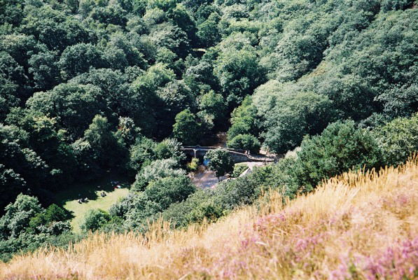
Prestonbury Castle is an Iron Age Hill fort on the north east edge of Dartmoor in Devon, England. Situated on a massive hilltop some 240 metres (790 ft) above sea level overlooking the Teign Valley, it is located near two other hill forts both of which lie about 2 km (1 mi) away.
Read more on Wikipedia →Visiting this summer
Seasonal nature notes and what to look for now
Visiting this summer
Seasonal nature notes and what to look for now
- 🐦69+ species recorded in this area — summer evenings are best for activity; watch for Swift and Robin
- 🍄Mushroom foraging is at its best in summer here
- 🐕Dogs welcome — bring water in summer; the site has enough space to find shade on hot days
🌤️ Visiting this summer
- 🐦69+ species recorded in this area — summer evenings are best for activity; watch for Swift and Robin
- 🍄Mushroom foraging is at its best in summer here
- 🐕Dogs welcome — bring water in summer; the site has enough space to find shade on hot days
Good to know
- £Free to visit — no entry charge
- 🐕Dogs welcome
Best for
Bird watching
Very strong match
Birds — Swift, Robin, Dipper +66 more · last seen 2025; Lowland heathland — Dartford warblers, nightjars and stonechats
Wildlife
Strong match
Birds — Swift, Robin, Dipper +66 more · last seen 2025; Lowland heathland priority habitat
Insect spotting
Strong match
Lowland heathland — silver-studded blue and heath fritillary butterflies; Insects — Violet Oil-beetle, Oil Beetle, Beautiful Demoiselle +39 more · last seen 2025
Mushroom foraging
Strong match
Fungi — Smoky Bracket, Stump Puffball, Hairy Curtain Crust +136 more · last seen 2024
Heritage
Strong match
Historic site
Seasonal nature
Moderate match
Plants — Holly, Royal Fern · last seen 2023
Trails nearby
Within roughly 5 km🚶Walking
10 signed routes nearby · 5 public paths nearby
Signed route nearbyPublic paths
Walking
Two Moors WayWalking route
Dartmoor WayWalking route
Taw Teign LinkWalking route
Dunsford to Moretonhampstead TrailWalking route
Mary Michael Pilgrims WayWalking route
Fisherman's Pathpublic footpath · 23 m
Fisherman's Pathpublic footpath · 246 m
Fisherman's Pathpublic footpath · 98 m
🚴Cycling
7 signed routes nearby
Signed route nearby
Cycling
Exeter to Okehampton LinkCycling route
Route 28Cycling route
Dartmoor Way (Cycle)Cycling route
Wray Valley TrailCycling route
Main RouteCycling route6.1 km
Main RouteCycling route17.1 km
🐴Horse riding
7 public paths nearby
Public paths
Horse riding
Hunter's Pathbridleway · 777 m
Wildlife to spot
Photos
Weather for this location
Loading local forecast…
Nearby places
Useful places within 5 km