Getting here
51.31655, -0.51944
Visiting this summer
Seasonal nature notes and what to look for now
Visiting this summer
Seasonal nature notes and what to look for now
- 🐦79+ species recorded in this area — summer evenings are best for activity; watch for Carrion Crow and Woodpigeon
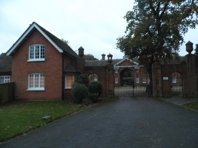
- ✦Historic character is a year-round quality here — summer brings its own atmosphere to the setting
- 🐕Dogs welcome — bring water in summer; the site has enough space to find shade on hot days
🌤️ Visiting this summer
- 🐦79+ species recorded in this area — summer evenings are best for activity; watch for Carrion Crow and Woodpigeon
- ✦Historic character is a year-round quality here — summer brings its own atmosphere to the setting
- 🐕Dogs welcome — bring water in summer; the site has enough space to find shade on hot days
Good to know
- 🐕Dogs welcome
Best for
Bird watching
Very strong match
Birds — Carrion Crow, Woodpigeon, Mallard +76 more · last seen 2026; Birds — Carrion Crow, Woodpigeon, Mallard +76 more · last seen 2026
Wildlife
Very strong match
Multi-group wildlife — Birds, Mammals; Multi-group wildlife — Birds, Mammals
Heritage
Strong match
Historic site with public access
Dog walks
Good match
Dogs allowed with public access
Insect spotting
Good match
Insects — Banded Demoiselle, Apion frumentarium, 7-spot Ladybird +16 more · last seen 2026; Insects — Banded Demoiselle, Apion frumentarium, 7-spot Ladybird +16 more · last seen 2026
Foraging
Good match
Deciduous woodland — fungi, berries and wild garlic
Trails nearby
Within roughly 5 km🚶Walking
9 signed routes nearby · 20 public paths nearby
Signed route nearbyPublic paths
Walking
Locks and Levels (SCC)Walking route
The Fox WayWalking route
Canons and CornmillsWalking route
Papercourt Lock to Triggs Lock Walk, River Wey NavigationsWalking route9.6 km
Starting from Papercourt, this walk is based in Send, where the River Wey Navigations has its navigation workshops. On this flat route you'll find locks from the 1760s and ponds and meadows that are important for the local wildlife. Flat & easy walking.
European walking route E2 west, UK, South East EnglandWalking route
Westroute: Stranraer (UK) - Birminhgham (UK) - Calais (FR) - Zoersel (BE) / Eastroute: Stranraer (UK) - Harwich (UK) - Rotterdam (NL) - Zoersel (BE) / Both Routes: Zoersel (BE) - Maastrich (NL) - Luxembourg (LUX) - Lake Geneva (CH) - Nice (FR)
Shey Copsepublic footpath · 190 m
The Roughpublic footpath · 13 m
🚴Cycling
99 signed routes nearby
Signed route nearby
Cycling
Neptune TrailCycling route
Mars TrailCycling route
Phobos TrailCycling route
Mimas TrailCycling route
A3 Cycle Route (alternative)Cycling route
Route 223Cycling route
🚵Mountain biking
1 signed route nearby
Signed route nearby
Mountain biking
Basingstoke Canal TowpathMountain bike route
🐴Horse riding
10 public paths nearby
Public paths
Horse riding
The Sheep Walkbridleway · 24 m
Sandy Lanebridleway · 234 m
Sandy Lanebridleway · 11 m
Sandy Lanebridleway · 304 m
The Sheep Walkbridleway · 152 m
Wildlife to spot
Photos
Weather for this location
Loading local forecast…
Nearby places
Useful places within 5 km
Own or manage this place?
Claim this listing to keep details accurate, add photos, and highlight what makes it special — free.
Claim this pageHow was your visit?
How useful was the information on this page?
id: 9dc0ddcd-8e48-42e9-bf7f-605bfb80325a