Queens Lea Allotments
Getting here
52.59865, -2.04367
Visiting this summer
Seasonal nature notes and what to look for now
Visiting this summer
Seasonal nature notes and what to look for now
- 🌞Midsummer — early morning visits most comfortable; look for deer fawns in quieter clearings
- 🌿Foraging is at its best in summer here
- 🐕Dogs welcome — bring water in summer; the site has enough space to find shade on hot days
🌤️ Visiting this summer
- 🌞Midsummer — early morning visits most comfortable; look for deer fawns in quieter clearings
- 🌿Foraging is at its best in summer here
- 🐕Dogs welcome — bring water in summer; the site has enough space to find shade on hot days
Good to know
- 🐕Dogs welcome
Best for
Wildlife
Very strong match
Multi-group wildlife — Amphibians, Birds, Mammals; Multi-group wildlife — Amphibians, Birds, Mammals
Bird watching
Very strong match
Birds — Blackbird, Woodpigeon, Magpie +67 more · last seen 2026; Birds — Blackbird, Woodpigeon, Magpie +67 more · last seen 2026
Insect spotting
Strong match
Insects — Syrphus, Eristalis pertinax, Green Shieldbug +100 more · last seen 2026; Insects — Syrphus, Eristalis pertinax, Green Shieldbug +100 more · last seen 2026
Seasonal nature
Strong match
Plants — Ramsons, Germander Speedwell, Lords-and-Ladies +53 more · last seen 2026; Plants — Ramsons, Germander Speedwell, Lords-and-Ladies +53 more · last seen 2026
Foraging
Strong match
Plants — Ramsons, Hawthorn, Garlic Mustard +7 more foraging species
Trails nearby
Within roughly 5 km🚶Walking
17 signed routes nearby
Signed route nearby
Walking
Monarch's WayWalking route990 km
approximate route of Charles II's escape
Bilston to Loxdale Health WalkWalking route2.8 km
Self-guided health walk through Black Country Millenium Urban Forest sites. Route passes 15th century Greyhound & Punchbowl pub and Bradley Arm which is topped up by pumping water out of disused mines. Difficulty: Medium due to slopes Duration: 45-60 mins
Four Commons WalkWalking route9.5 km
Circular route following the Wyrley & Essington Canal to Clayhanger Common – one of Walsall’s much-loved areas of green, open space. Distance: 6 miles/9.5 km(approx) Duration: 120 mins(approx)
ABCD War Heritage TrailWalking route
A short guide to some of the First and Second World War heritage of the All Saints and the Blakenhall area. This trail explores historic Wolverhampton sites associated with the periods 1914-1918 and 1939-1945.
All Saints' TrailWalking route
Heritage trail around the large former Parish of All Saints along a route traditionally church members would walk to beat set points with canes (known as 'Beating the Bounds) This formed a mental map of the area when maps were rare.
🚴Cycling
63 signed routes nearby
Signed route nearby
Cycling
McClean WayCycling route
[PROPOSED]Starley Regional Cycle NetworkCycling route804 km
Starley (TfWM) Regional Cycle Network (Proposed route)
Sneyd Junction to Cannock Extension CanalCycling route8.8 km
A semi-rural route following the curves of the canal, until it opens out into parkland at the Cannock Extension. Distance: 5.5 miles/8.8 km (approx) Duration: 45 min (approx)
Cannock Extension Canal to Longwood JunctionCycling route11.2 km
Canalside route leading past Clayhanger Common and through Rushall, with a pub along the way. Distance: 7 miles/11.2 km (approx) Duration: 60 min (approx)
SCWIP Cycle Route 8Cycling route
Sneyd Junction to Pudding Green JunctionCycling route16 km
Canalside route passing through the heartlands of the industrial Black Country. Decends using the Walsall locks then rises at Ryders Green Locks. Distance: 10 miles/16 km (approx) Duration: 90 min (approx)
Wildlife to spot
Photos
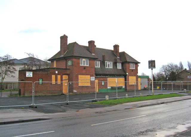
The former Brown Jug (1), 52 Sandbeds Road, Shortheath, Willenhall
Weather for this location
Loading local forecast…
Nearby places
Useful places within 5 km
Own or manage this place?
Claim this listing to keep details accurate, add photos, and highlight what makes it special — free.
Claim this pageHow was your visit?
How useful was the information on this page?
id: 4cce3cb7-a6b5-46a8-a63f-309bfbcbdfcc