🦅 Birds🦉 Wildlife⚽ Pitches
↑ Share
Public access Dogs welcome
Places › England › South East › South Oxfordshire Getting here
51.49830, -0.96726
Open directionsv Visiting this summer
Seasonal nature notes and what to look for now
▾ 🐦 83+ species recorded in this area — summer evenings are best for activity; watch for Woodpigeon and Robin ⚽ Playing fields is at its best in summer here 🐕 Dogs welcome — bring water in summer; the site has enough space to find shade on hot days 🌤️ Visiting this summer
🐦 83+ species recorded in this area — summer evenings are best for activity; watch for Woodpigeon and Robin ⚽ Playing fields is at its best in summer here 🐕 Dogs welcome — bring water in summer; the site has enough space to find shade on hot days 🦅 Bird watching
Very strong match
Birds — Woodpigeon, Robin, Magpie +80 more · last seen 2026; Birds — Woodpigeon, Robin, Magpie +80 more · last seen 2026
Free
🦉 Wildlife
Very strong match
Multi-group wildlife — Birds, Mammals; Multi-group wildlife — Birds, Mammals
Free
⚽ Playing fields
Very strong match
Playing field
Free
🦋 Insect spotting
Strong match
Insects — Stag Beetle, Box Tree Moth, Glow-worm +38 more · last seen 2025; Insects — Stag Beetle, Box Tree Moth, Glow-worm +38 more · last seen 2025
Free
Dogs allowed with public access
Free
🍂 Seasonal nature
Good match
Plants — Giant Hogweed, Early-purple Orchid · last seen 2024; Plants — Giant Hogweed, Early-purple Orchid · last seen 2024
Free
Trails nearby Within roughly 5 km 12 signed routes nearby · 6 public paths nearby
Signed route nearby Public paths
Oxfordshire Way Walking route 110 km ▾
a traverse of Oxfordshire from the Cotswolds to the Chilterns
Named route Ref OW Length 110 km Regional walking route
Show on map The Chiltern Way Southern Extension Walking route ▾
Long distance path
Named route Ref CWS Regional walking route
Show on map The Chiltern Way Berkshire Loop Walking route 28 km ▾
Long distance path
Named route Ref CWB Length 28 km Regional walking route
Show on map European walking route E2 west, UK, South East England Walking route ▾
Westroute: Stranraer (UK) - Birminhgham (UK) - Calais (FR) - Zoersel (BE) / Eastroute: Stranraer (UK) - Harwich (UK) - Rotterdam (NL) - Zoersel (BE) / Both Routes: Zoersel (BE) - Maastrich (NL) - Luxembourg (LUX) - Lake Geneva (CH) - Nice (FR)
Named route Ref E2 International walking route
Show on map Kennet and Avon Canal Trail Walking route 140 km ▾
Rivers linked by a canal. The name refers to the entire navigable length. From Bristol the way is the Avon. The canal is from Bath to Newbury. From there to Reading the way is the Kennet. 53 locks to Summit Pound (150 m asl) and 54 down to Reading.
Named route Ref K&A Length 140 km Regional walking route
Show on map 94 signed routes nearby
Signed route nearby
National Cycle Network Route 5 Cycling route ▾
Named route Ref 5 National Cycle Network
Show on map Link to NCN 4 Cycling route ▾
Named route Ref NCN4 Link Local cycle route
Show on map Woodley, Earley Cycling route ▾
Named route Local cycle route
Show on map Round Berkshire Cycle Route Cycling route ▾
Named route Regional cycle route
Show on map Route R5 Cycling route ▾
Named route Ref R5 Local cycle route
Show on map Reading R50 Cycling route ▾
Named route Ref R50 Local cycle route
Show on map 2 signed routes nearby
Signed route nearby
Judges' Ride Mountain bike route ▾
King Alfred's Way Mountain bike route ▾
King Alfreds Way is 350km (220 miles) off road route designed to be ridden clockwise. It starts & ends in Winchester. It is suitable for gravel or cross-country bikes.
Named route Regional cycle route
Show on map 2 public paths nearby
Public paths
Chalkhouse Green Lane restricted byway · 254 m ▾
Public path restricted byway Length 254 m Surface asphalt Path type: unclassified
Show on map Chalkhouse Green Lane restricted byway · 1.1 km ▾
Public path restricted byway Length 1.1 km Surface ground Path type: bridleway
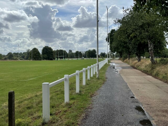
Show on map Photos Driveway to Reading Abbey Rugby Club
‹ ›
Weather for this location Next 14 days Nearby places Useful places within 5 km
Own or manage this place?
Claim this listing to keep details accurate, add photos, and highlight what makes it special — free.
Claim this page→ How useful was the information on this page?
Something wrong on this page?
id: edb1d56b-7910-44e0-ab2e-47de394bc70b
UK green spaces mapped from open public data — so anyone can find the woodland, trail, or nature reserve closest to them.
© 2026 Glade · Made with care for UK green spaces
Wildlife to spot
16,080 records · National Biodiversity Network
▾
Wildlife to spot 16,080 records · National Biodiversity Network 🐦 Birds 43 species
winter spring autumn
2026 ▾
Robin · Woodpigeon · Blue Tit · Great Spotted Woodpecker · Carrion Crow +38
Robin Erithacus rubecula Woodpigeon Columba palumbus2025 Blue Tit Cyanistes caeruleus2025 Great Spotted Woodpecker Dendrocopos major2025 Carrion Crow Corvus corone2025 Magpie Pica pica2025 Dunnock Prunella modularis2025 Great Tit Parus major2025 Wren Troglodytes troglodytes2025 Starling Sturnus vulgaris2025 Jackdaw Coloeus monedula2025 Blackbird Turdus merula2025 Nuthatch Sitta europaea2025 Jay Garrulus glandarius2025 Green Woodpecker Picus viridis2025 Greenfinch Chloris chloris2025 Redwing Turdus iliacus2025 Long-tailed Tit Aegithalos caudatus2025 Song Thrush Turdus philomelos2025 Chiffchaff Phylloscopus collybita2025 Goldfinch Carduelis carduelis2025 Treecreeper Certhia familiaris2025 Black-headed Gull Chroicocephalus ridibundus2025 Blackcap Sylvia atricapilla2025 Chaffinch Fringilla coelebs2025 Mallard Anas platyrhynchos2025 Pheasant Phasianus colchicus2025 Kestrel Falco tinnunculus2025 Herring Gull Larus argentatus2025 Raven Corvus corax2025 Goldcrest Regulus regulus2025 Stock Dove Columba oenas2025 Collared Dove Streptopelia decaocto2025 Fieldfare Turdus pilaris2025 Rook Corvus frugilegus2025 Crossbill Loxia curvirostra2025 Garden Warbler Sylvia borin2025 Mandarin Duck Aix galericulata2025 Pied Wagtail Motacilla alba yarrellii2025 Rock Dove Columba livia2025 Firecrest Regulus ignicapilla2025 Tawny Owl Strix aluco2024 Bullfinch Pyrrhula pyrrhula2024 Noctule · Common Pipistrelle · Soprano Pipistrelle · Eurasian Serotine · Hazel Dormouse
Noctule Nyctalus noctula2024 Common Pipistrelle Pipistrellus pipistrellus2024 Soprano Pipistrelle Pipistrellus pygmaeus2024 Eurasian Serotine Cnephaeus serotinus Hazel Dormouse Muscardinus avellanarius2024 Beautiful Demoiselle · Marmalade Hoverfly · Brown Hawker · Emperor Dragonfly · Red-legged Shieldbug +9
Beautiful Demoiselle Calopteryx virgo Marmalade Hoverfly Episyrphus balteatus Brown Hawker Aeshna grandis Emperor Dragonfly Anax imperator Red-legged Shieldbug Pentatoma rufipes Stag Beetle Lucanus cervus Small Scissor Bee Giant Hogweed
Giant Hogweed Heracleum mantegazzianum Species observations from the last 10 years via NBN Atlas
Chelostoma campanularum
Chelostoma campanularum
Common Red Soldier Beetle Rhagonycha fulva2024
Common Red Soldier Beetle Rhagonycha fulva2024
Oedemera lurida Oedemera lurida2024
Oedemera lurida Oedemera lurida2024
Eristalis tenax Eristalis tenax2024
Eristalis tenax Eristalis tenax2024
Green Shieldbug Palomena prasina2024
Green Shieldbug Palomena prasina2024
Eristalis pertinax Eristalis pertinax2024
Eristalis pertinax Eristalis pertinax2024
Speckled Bush-cricket Leptophyes punctatissima2024
Speckled Bush-cricket Leptophyes punctatissima2024
Broad-bodied Chaser Libellula depressa2024
Broad-bodied Chaser Libellula depressa2024 Events & activities nearby Switch provider to compare local events, tours and bookable activities.
Bookable tours GetYourGuide Promote here