Birds — Woodpigeon, Blue Tit, Robin +57 more · last seen 2026; Birds — Woodpigeon, Blue Tit, Robin +57 more · last seen 2026
Free
🍂
Seasonal nature
Strong match
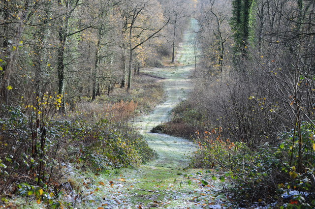
Ancient woodland — bluebells, fungi and autumn colour
Free
🌿
Foraging
Strong match
Traditional orchard — seasonal fruit, fungi and wild plants
Varies
🐶
Dog walks
Strong match
Dogs allowed — public woodland
Free
🦋
Insect spotting
Strong match
Insects — Green-veined White, Common Darter, Ringlet +44 more · last seen 2025; Insects — Green-veined White, Common Darter, Ringlet +44 more · last seen 2025
Free
Trails nearby
Within roughly 5 km
🚶
Walking
▾
9 signed routes nearby · 10 public paths nearby
Signed route nearbyPublic paths
Gloucestershire WayWalking route161 km▾
Named routeLength 161 kmRegional walking route
Severn Way (3) Worcester to BristolWalking route153 km▾
Named routeRef SW (3)Length 153 kmRegional walking route
Wysis WayWalking route88.5 km▾
Long distance footpath forming a link between the Thames and the Wye
Named routeRef WYSLength 88.5 kmRegional walking route
Geopark WayWalking route175 km▾
Named routeRef geoLength 175 kmRegional walking route
Glevum WayWalking route42 km▾
A circular path around Gloucester passing through a varied landscape of river plain and limestone hillsides
Named routeLength 42 kmRegional walking route
🚴
Cycling
▾
52 signed routes nearby
Signed route nearby
Mercian WayCycling route▾
Named routeRef 45National Cycle Network
Route 41Cycling route▾
Named routeRef 41National Cycle Network
Newent Cycling LoopCycling route▾
Named routeRef NCLRegional cycle route
National Cycle Network Route 42Cycling route▾
Named routeRef 42National Cycle Network
Main RouteCycling route47 m▾
Named routeRef 42Length 47 mNational Cycle NetworkTraffic-freeSurface asphalt
Main RouteCycling route32 m▾
Named routeRef 42Length 32 mNational Cycle NetworkTraffic-freeSurface asphalt
🐴
Horse riding
▾
7 public paths nearby
Public paths
HIGHNAM BRIDLEWAY 1bridleway · 399 m▾
Public pathbridlewayLength 399 mPath type: bridleway
Whitehall Lanebridleway · 1.9 km▾
Public pathbridlewayLength 1.9 kmPath type: unclassified
Kites Nest Lanerestricted byway · 722 m▾
Public pathrestricted bywayLength 722 mPath type: unclassified
HIGHNAM BRIDLEWAY 1bridleway · 951 m▾
Public pathbridlewayLength 951 mPath type: bridleway