Plan your visit
🦉 Wildlife🦅 Birds🦋 Insects
Dogs welcome 15 ha
Places › England › East Midlands › South Kesteven Getting here
52.98853, -0.54238
Open directionsv Visiting this summer
Seasonal nature notes and what to look for now
▾ 🌞 Midsummer — early morning visits most comfortable; look for deer fawns in quieter clearings ✦ Historic character is a year-round quality here — summer brings its own atmosphere to the setting 🐕 Dogs welcome — bring water in summer; the site has enough space to find shade on hot days 🌤️ Visiting this summer
🌞 Midsummer — early morning visits most comfortable; look for deer fawns in quieter clearings ✦ Historic character is a year-round quality here — summer brings its own atmosphere to the setting 🐕 Dogs welcome — bring water in summer; the site has enough space to find shade on hot days 🦉 Wildlife
Very strong match
Multi-group wildlife — Amphibians, Birds, Mammals, Reptiles; Multi-group wildlife — Amphibians, Birds, Mammals, Reptiles
Free
🦅 Bird watching
Very strong match
Birds — Blackbird, Blue Tit, Woodpigeon +67 more · last seen 2025; Birds — Blackbird, Blue Tit, Woodpigeon +67 more · last seen 2025
Free
🦋 Insect spotting
Strong match
Insects — Small White, Small Tortoiseshell, Brimstone +91 more · last seen 2025; Insects — Small White, Small Tortoiseshell, Brimstone +91 more · last seen 2025
Free
🍂 Seasonal nature
Strong match
Plants — Creeping Feather-moss, Wood Bristle-moss, Streblotrichum convolutum var. commutatum +19 more · last seen 2026; Plants — Creeping Feather-moss, Wood Bristle-moss, Streblotrichum convolutum var. commutatum +19 more · last seen 2026
Free
Deciduous woodland — fungi, berries and wild garlic
Varies
Trails nearby Within roughly 5 km 1 signed route nearby · 10 public paths nearby
Signed route nearby Public paths
Viking Way (Barnetby to Whitwell) Walking route ▾
Named route Regional walking route
Show on map Angel Court public footpath · 63 m ▾
Public path public footpath Length 63 m Path type: residential
Show on map Angel Court public footpath · 50 m ▾
Public path public footpath Length 50 m Path type: residential
Show on map 2 signed routes nearby
Signed route nearby
National Byway (Lincolnshire) Cycling route ▾
The National Byway in Lincolnshire
Named route Ref NB Regional cycle route
Show on map Route 15 Cycling route ▾
Named route Ref 15 National Cycle Network
Show on map 3 public paths nearby
Public paths
Pottergate Road restricted byway · 350 m ▾
Public path restricted byway Length 350 m Path type: unclassified
Show on map Pottergate Road restricted byway · 1 km ▾
Public path restricted byway Length 1 km Surface gravel Path type: track
Show on map Pottergate Road restricted byway · 470 m ▾
Public path restricted byway Length 470 m Path type: unclassified
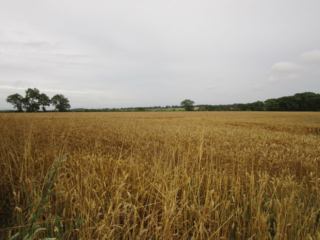
Show on map Photos Wheat field near Ancaster
‹ ›
Weather for this location Next 14 days Nearby places Useful places within 5 km
All Historic
Own or manage this place?
Claim this listing to keep details accurate, add photos, and highlight what makes it special — free.
Claim this page→ How useful was the information on this page?
id: b9b4a796-e6e5-4ebb-a3bf-8a0ae59436b9
UK green spaces mapped from open public data — so anyone can find the woodland, trail, or nature reserve closest to them.
© 2026 Glade · Made with care for UK green spaces
Events & activities nearby Switch provider to compare local events, tours and bookable activities.
Bookable tours GetYourGuide Promote here
Wildlife to spot
7,024 records · National Biodiversity Network
▾
Wildlife to spot 7,024 records · National Biodiversity Network 🐦 Birds 47 species
spring summer
2025 ▾
Woodpigeon · Carrion Crow · Greylag Goose · Robin · Blackbird +42
Woodpigeon Columba palumbus2024 Carrion Crow Corvus corone2024 Greylag Goose Anser anser2024 Robin Erithacus rubecula2024 Blackbird Turdus merula2024 Long-tailed Tit Aegithalos caudatus Skylark Alauda arvensis2024 Swallow Hirundo rustica Kestrel Falco tinnunculus Blue Tit Cyanistes caeruleus2024 Rook Corvus frugilegus2024 Red-legged Partridge Alectoris rufa2024 Magpie Pica pica2024 Chaffinch Fringilla coelebs2024 Jackdaw Coloeus monedula2024 Blackcap Sylvia atricapilla Pheasant Phasianus colchicus2024 Wren Troglodytes troglodytes2024 Chiffchaff Phylloscopus collybita2024 Fieldfare Turdus pilaris Swift Apus apus Lesser Black-backed Gull Larus fuscus2024 Linnet Linaria cannabina2024 Goldfinch Carduelis carduelis2024 Mallard Anas platyrhynchos2024 Great Tit Parus major2024 Herring Gull Larus argentatus2024 Dunnock Prunella modularis2024 Meadow Pipit Anthus pratensis2024 Green Woodpecker Picus viridis2024 Cormorant Phalacrocorax carbo2024 Yellow Wagtail Motacilla flava2024 Black-headed Gull Chroicocephalus ridibundus2024 Golden Plover Pluvialis apricaria2024 Rock Dove Columba livia2024 House Sparrow Passer domesticus2024 Corn Bunting Emberiza calandra2024 Starling Sturnus vulgaris2024 Canada Goose Branta canadensis2024 House Martin Delichon urbicum2023 Yellowhammer Emberiza citrinella2023 Apus apus apus Apus apus apus2023 Stock Dove Columba oenas2023 Song Thrush Turdus philomelos2023 Lapwing Vanellus vanellus2023 Oystercatcher Haematopus ostralegus2023 Anas platyrhynchos x Anas platyrhynchos x2023 Grey Squirrel
Grey Squirrel Sciurus carolinensis Common Lizard
Common Lizard Zootoca vivipara 🐸 Amphibians 1 species
autumn
2025 ▾
Common Toad
7-spot Ladybird · Meadow Grasshopper · Pouting Woodlouse-fly · Field Grasshopper · Dock Bug +8
7-spot Ladybird Coccinella septempunctata Meadow Grasshopper Pseudochorthippus parallelus Pouting Woodlouse-fly Rhinophora lepida2024 Field Grasshopper Chorthippus brunneus Dock Bug Coreus marginatus 24-spot Ladybird Subcoccinella vigintiquattuorpunctata Small Nettle · Red Dead-nettle · Daisy · Groundsel · Creeping Feather-moss +29
Small Nettle Urtica urens2024 Red Dead-nettle Lamium purpureum2024 Daisy Bellis perennis2024 Groundsel Senecio vulgaris2024 Creeping Feather-moss Amblystegium serpens Dilated Scalewort Frullania dilatata Species observations from the last 10 years via NBN Atlas
Roesel's Bush-cricket
Roesel's Bush-cricket
Roeseliana roeselii
Roeseliana roeselii
Harlequin Ladybird Harmonia axyridis
Harlequin Ladybird Harmonia axyridis
Ivy Bee Colletes hederae2024
Ivy Bee Colletes hederae2024
Chrysolina hyperici Chrysolina hyperici2024
Chrysolina hyperici Chrysolina hyperici2024
Xanthogramma pedissequum Xanthogramma pedissequum2024
Xanthogramma pedissequum Xanthogramma pedissequum2024
10-spot Ladybird Adalia decempunctata2024
10-spot Ladybird Adalia decempunctata2024
Harmonia axyridis form succinea Harmonia axyridis form succinea2023
Harmonia axyridis form succinea Harmonia axyridis form succinea2023
Capillary Thread-moss Bryum capillare
Capillary Thread-moss Bryum capillare
Rock Pocket-moss Fissidens dubius
Rock Pocket-moss Fissidens dubius
Common Pincushion Dicranoweisia cirrata
Common Pincushion Dicranoweisia cirrata
Wood Bristle-moss Lewinskya affinis
Wood Bristle-moss Lewinskya affinis
Streblotrichum convolutum var. commutatum Streblotrichum convolutum var. commutatum
Streblotrichum convolutum var. commutatum Streblotrichum convolutum var. commutatum
Lateral Cryphaea Cryphaea heteromalla
Lateral Cryphaea Cryphaea heteromalla
Clustered Feather-moss Rhynchostegium confertum
Clustered Feather-moss Rhynchostegium confertum
Hypnum cupressiforme var. cupressiforme Hypnum cupressiforme var. cupressiforme
Hypnum cupressiforme var. cupressiforme Hypnum cupressiforme var. cupressiforme
Rough-stalked Feather-moss Brachythecium rutabulum
Rough-stalked Feather-moss Brachythecium rutabulum
White-tipped Bristle-moss Orthotrichum diaphanum
White-tipped Bristle-moss Orthotrichum diaphanum
Common Pocket-moss Fissidens taxifolius
Common Pocket-moss Fissidens taxifolius
Green Yoke-moss Zygodon viridissimus
Green Yoke-moss Zygodon viridissimus
Shady Beard-moss Didymodon umbrosus
Shady Beard-moss Didymodon umbrosus
Crimson-tuber Thread-moss Bryum rubens
Crimson-tuber Thread-moss Bryum rubens
Common Feather-moss Kindbergia praelonga
Common Feather-moss Kindbergia praelonga
Neat Feather-moss Pseudoscleropodium purum
Neat Feather-moss Pseudoscleropodium purum
Hart's-tongue Thyme-moss Plagiomnium undulatum
Hart's-tongue Thyme-moss Plagiomnium undulatum
Wall Screw-moss Tortula muralis
Wall Screw-moss Tortula muralis
Yarrow Achillea millefolium2024
Yarrow Achillea millefolium2024
Borage Borago officinalis2024
Borage Borago officinalis2024
Dove's-foot Crane's-bill Geranium molle2024
Dove's-foot Crane's-bill Geranium molle2024
Stellaria media Stellaria media2024
Stellaria media Stellaria media2024
Hogweed Heracleum sphondylium2024
Hogweed Heracleum sphondylium2024
White Dead-nettle Lamium album2024
White Dead-nettle Lamium album2024
Field Pansy Viola arvensis2024
Field Pansy Viola arvensis2024
Gorse Ulex europaeus2023
Gorse Ulex europaeus2023
Common Fiddleneck Amsinckia micrantha2023
Common Fiddleneck Amsinckia micrantha2023
Spear Thistle Cirsium vulgare2023
Spear Thistle Cirsium vulgare2023