Sandylay Wood ✦ Ancient woodland 8 ha
Plan your visit
🦉 Wildlife🦅 Birds🍂 Seasonal
Public access Free entry Dogs welcome 8 ha
Places › England › Eastern › Chelmsford Getting here
51.82964, 0.51401
Open directionsv Visiting this summer
Seasonal nature notes and what to look for now
▾ 🌞 Midsummer — early morning visits most comfortable; look for deer fawns in quieter clearings 🐕 Early mornings are best for dog walks in summer — visit before 9am to avoid the heat and find quieter trails 🅿️ Parking 453m away — 6 car parks within reach 🌤️ Visiting this summer
🌞 Midsummer — early morning visits most comfortable; look for deer fawns in quieter clearings 🐕 Early mornings are best for dog walks in summer — visit before 9am to avoid the heat and find quieter trails 🅿️ Parking 453m away — 6 car parks within reach £ Free to visit — no entry charge🐕 Dogs welcome🌿 Ancient woodland — rare wildlife habitat🦉 Wildlife
Very strong match
Multi-group wildlife — Amphibians, Birds, Mammals; Multi-group wildlife — Amphibians, Birds, Mammals
Free
🦅 Bird watching
Very strong match
Birds — Blue Tit, Mallard, Moorhen +67 more · last seen 2026; Birds — Blue Tit, Mallard, Moorhen +67 more · last seen 2026
Free
🍂 Seasonal nature
Strong match
Ancient woodland — bluebells, fungi and autumn colour; Plants — Corky-fruited Water-dropwort, Grass Vetchling, Creeping Cinquefoil +17 more · last seen 2024
Free
🦋 Insect spotting
Strong match
Insects — Small White, Speckled Wood, Large White +55 more · last seen 2025; Insects — Small White, Speckled Wood, Large White +55 more · last seen 2025
Free
Dogs allowed — public woodland
Free
Deciduous woodland — fungi, berries and wild garlic
Varies
Trails nearby Within roughly 5 km 2 signed routes nearby · 19 public paths nearby
Signed route nearby Public paths
John Ray Walk Walking route ▾
Named route Local walking route
Show on map Essex Way (Epping to Stratford St Mary) Walking route ▾
Named route Regional walking route
Show on map Chase Side Bridge public footpath · 59 m ▾
Public path public footpath Length 59 m Path type: footway
Show on map 75 signed routes nearby
Signed route nearby
Notley Link Path Cycling route ▾
Named route Ref (16) National Cycle Network
Show on map Regional Route 50 Cycling route ▾
Named route Ref 50 Regional cycle route
Show on map Great Waltham to City Centre Cycle Route Cycling route ▾
Named route Local cycle route
Show on map (50) Cycling route ▾
National Cycle Network link route between NCN 16 and Regional Route 50
Named route Local cycle route
Show on map Route 16 Cycling route ▾
Named route Ref 16 National Cycle Network
Show on map Main Route Cycling route 1.5 km ▾
Named route Ref 16 Length 1.5 km National Cycle Network Traffic-free Surface unsealedfirm
Show on map 7 public paths nearby
Public paths
Dog and Partridge Underpass bridleway · 27 m ▾
Public path bridleway Length 27 m Surface dirt Path type: track
Show on map ✦ Ancient woodland — continuously wooded since at least 1600 AD. A rare and irreplaceable habitat, rich in biodiversity and historical character.
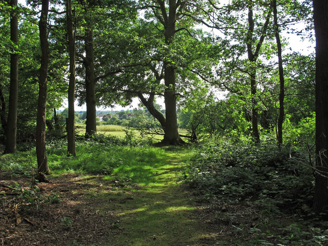
Photos The edge of Sandylay Wood
‹ ›
Weather for this location Next 14 days Nearby places Useful places within 5 km
All Historic
Own or manage this place?
Claim this listing to keep details accurate, add photos, and highlight what makes it special — free.
Claim this page→ How useful was the information on this page?
id: aa8ed73d-4eea-4ab4-a60f-e0d5e4e96188
UK green spaces mapped from open public data — so anyone can find the woodland, trail, or nature reserve closest to them.
© 2026 Glade · Made with care for UK green spaces
Events & activities nearby Switch provider to compare local events, tours and bookable activities.
Bookable tours GetYourGuide Promote here
Wildlife to spot
15,162 records · National Biodiversity Network
▾
Wildlife to spot 15,162 records · National Biodiversity Network 🐦 Birds 48 species
summer autumn
2026 ▾
Blue Tit · Mallard · Great Tit · Moorhen · Woodpigeon +43
Blue Tit Cyanistes caeruleus Mallard Anas platyrhynchos2025 Great Tit Parus major Moorhen Gallinula chloropus Woodpigeon Columba palumbus Robin Erithacus rubecula Long-tailed Tit Aegithalos caudatus Little Grebe Tachybaptus ruficollis Grey Heron Ardea cinerea2025 Treecreeper Certhia familiaris Green Woodpecker Picus viridis2025 Blackcap Sylvia atricapilla2025 Nuthatch Sitta europaea2025 Jay Garrulus glandarius2025 Kingfisher Alcedo atthis2025 Carrion Crow Corvus corone2025 Linnet Linaria cannabina2025 Blackbird Turdus merula2025 Sand Martin Riparia riparia2025 Wren Troglodytes troglodytes2025 Black-headed Gull Chroicocephalus ridibundus Coot Fulica atra2025 Green Sandpiper Tringa ochropus2025 Jackdaw Coloeus monedula2025 Magpie Pica pica2025 Goldcrest Regulus regulus2025 Cormorant Phalacrocorax carbo2025 Common Gull Larus canus2025 Great Spotted Woodpecker Dendrocopos major2025 Lesser Black-backed Gull Larus fuscus2025 Chiffchaff Phylloscopus collybita2025 Kestrel Falco tinnunculus2025 Coal Tit Periparus ater2025 Chaffinch Fringilla coelebs2025 Stonechat Saxicola rubicola2025 Grey Wagtail Motacilla cinerea2025 Herring Gull Larus argentatus2025 Raven Corvus corax2025 Red-legged Partridge Alectoris rufa2025 Goldfinch Carduelis carduelis2025 Swallow Hirundo rustica2025 House Martin Delichon urbicum2025 Pheasant Phasianus colchicus2025 Whitethroat Curruca communis2025 Garden Warbler Sylvia borin2025 Reed Warbler Acrocephalus scirpaceus2025 Canada Goose Branta canadensis2025 Song Thrush Turdus philomelos2025 🦌 Mammals 4 species
spring autumn
2026 ▾
Fallow Deer · Polecat-Ferret · Brown Rat · Rabbit
Fallow Deer Dama dama Polecat-Ferret Mustela furo x putorius2025 Brown Rat Rattus norvegicus Rabbit Oryctolagus cuniculus2025 🐝 Insects 20 species
spring summer
2025 ▾
Azure Damselfly · Large Red Damselfly · Scarce Chaser · Cantharis rustica · Emperor Dragonfly +15
Azure Damselfly Coenagrion puella Large Red Damselfly Pyrrhosoma nymphula Scarce Chaser Libellula fulva Cantharis rustica Cantharis rustica Emperor Dragonfly Anax imperator Four-spotted Chaser Libellula quadrimaculata Species observations from the last 10 years via NBN Atlas
Blue-tailed Damselfly
Blue-tailed Damselfly
Ischnura elegans
Ischnura elegans
Common Blue Damselfly Enallagma cyathigerum
Common Blue Damselfly Enallagma cyathigerum
Red-headed Cardinal Beetle Pyrochroa serraticornis
Red-headed Cardinal Beetle Pyrochroa serraticornis
Large White Pieris brassicae
Large White Pieris brassicae
Banded Demoiselle Calopteryx splendens
Banded Demoiselle Calopteryx splendens
Batman Hoverfly Myathropa florea
Batman Hoverfly Myathropa florea
Chrysolina oricalcia Chrysolina oricalcia
Chrysolina oricalcia Chrysolina oricalcia
Cantharis rufa Cantharis rufa
Cantharis rufa Cantharis rufa
Helophilus pendulus Helophilus pendulus
Helophilus pendulus Helophilus pendulus
Denticollis linearis Denticollis linearis
Denticollis linearis Denticollis linearis
14-spot Ladybird Propylea quattuordecimpunctata
14-spot Ladybird Propylea quattuordecimpunctata
Rhingia rostrata Rhingia rostrata
Rhingia rostrata Rhingia rostrata
Green Nettle Weevil Phyllobius pomaceus
Green Nettle Weevil Phyllobius pomaceus
Cercopis vulnerata Cercopis vulnerata
Cercopis vulnerata Cercopis vulnerata