Getting here
50.99247, -1.17991
Visiting this summer
Seasonal nature notes and what to look for now
Visiting this summer
Seasonal nature notes and what to look for now
- 🐦55+ species recorded in this area — summer evenings are best for activity; watch for Chaffinch and Blackbird
- 🍄Mushroom foraging is at its best in summer here
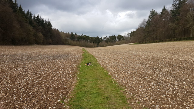
- 🐕Dogs welcome — bring water in summer; the site has enough space to find shade on hot days
🌤️ Visiting this summer
- 🐦55+ species recorded in this area — summer evenings are best for activity; watch for Chaffinch and Blackbird
- 🍄Mushroom foraging is at its best in summer here
- 🐕Dogs welcome — bring water in summer; the site has enough space to find shade on hot days
Good to know
- £Free to visit — no entry charge
- 🐕Dogs welcome
- 🌿Ancient woodland — rare wildlife habitat
Best for
Bird watching
Very strong match
Birds — Chaffinch, Blackbird, Robin +52 more · last seen 2025; Birds — Chaffinch, Blackbird, Robin +52 more · last seen 2025
Wildlife
Very strong match
Multi-group wildlife — Birds, Mammals; Multi-group wildlife — Birds, Mammals
Mushroom foraging
Strong match
Fungi — Dog's Mercury Rust, Daisy Rust, Spermosporina aricola +11 more · last seen 2020; Fungi — Dog's Mercury Rust, Daisy Rust, Spermosporina aricola +11 more · last seen 2020
Seasonal nature
Strong match
Ancient woodland — bluebells, fungi and autumn colour; Plants — Greater Knapweed, Cyrtomium fortunei · last seen 2022
Dog walks
Strong match
Dogs allowed — public woodland
Insect spotting
Strong match
Insects — Meadow Brown, Small White, Large White +28 more · last seen 2024; Insects — Meadow Brown, Small White, Large White +28 more · last seen 2024
Trails nearby
Within roughly 5 km🚶Walking
8 signed routes nearby · 2 public paths nearby
Signed route nearbyPublic paths
Walking
Wayfarers WalkWalking route
Walbury Hill, Berkshire to Emsworth, Hampshire
Allan King WayWalking route
Monarch's WayWalking route990 km
approximate route of Charles II's escape
Soberton and Newtown Millennium WalkWalking route
Pilgrims' TrailWalking route
🚴Cycling
2 signed routes nearby
Signed route nearby
Cycling
National Byway (Winchester loop)Cycling route
Route 224Cycling route
🚵Mountain biking
5 signed routes nearby
Signed route nearby
Mountain biking
South Downs WayMountain bike route
South Downs Way alternative route through WarnfordMountain bike route
King Alfred's WayMountain bike route
King Alfreds Way is 350km (220 miles) off road route designed to be ridden clockwise. It starts & ends in Winchester. It is suitable for gravel or cross-country bikes.
Meon Valley TrailMountain bike route
Cheesefoot Head Off Road Cycle TrailMountain bike route
🐴Horse riding
2 public paths nearby
Public paths
Horse riding
No named routes yet. Public paths are shown on the map.
Wildlife to spot
Photos
Weather for this location
Loading local forecast…
Nearby places
Useful places within 5 km
Own or manage this place?
Claim this listing to keep details accurate, add photos, and highlight what makes it special — free.
Claim this pageHow was your visit?
How useful was the information on this page?
id: d22c19ce-8514-48bb-b0f7-40af1d64856d