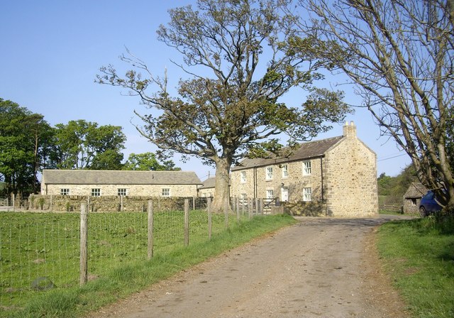
Scargill fortified house, medieval settlement and associated field system
4 ha
Plan your visit
🦅Birds✦Heritage🦉Wildlife
Public accessFree entryDogs welcome4 ha
Getting here
54.49112, -1.92118
Open directionsv
Visiting this summer
Seasonal nature notes and what to look for now
- 🐦81+ species recorded in this area — summer evenings are best for activity; watch for Wren and Robin
- ✦Historic character is a year-round quality here — summer brings its own atmosphere to the setting
- 🐕Dogs welcome — bring water in summer; the site has enough space to find shade on hot days
🌤️ Visiting this summer
- 🐦81+ species recorded in this area — summer evenings are best for activity; watch for Wren and Robin
- ✦Historic character is a year-round quality here — summer brings its own atmosphere to the setting
- 🐕Dogs welcome — bring water in summer; the site has enough space to find shade on hot days
- £Free to visit — no entry charge
- 🐕Dogs welcome
🦅Bird watching
Very strong match
Birds — Wren, Robin, Blackbird +78 more · last seen 2025; Deciduous woodland — woodpeckers, warblers and woodland birds
Free
Historic site with public access; Grade II* listed building: SCARGILL CASTLE
Free
Birds — Wren, Robin, Blackbird +78 more · last seen 2025; Deciduous woodland priority habitat
Free
🍄Mushroom foraging
Strong match
Fungi — Dead Moll's Fingers, Candlesnuff Fungus, Torth Felen +216 more · last seen 2023
Varies
Dogs allowed with public access
Free
Deciduous woodland — fungi, berries and wild garlic
Varies
Trails nearby
Within roughly 5 km2 signed routes nearby · 4 public paths nearby
Signed route nearbyPublic paths
Teesdale Way (Middleton in Teesdale to Middlesbrough)Walking route▾
UK long distance footpath from Dufton to Warrenby.
Named routeRegional walking route
Alternatives in Teesdale Way (Middleton in Teesdale to Middlesbrough)Walking route▾
Named routeRegional walking route
6 signed routes nearby
Signed route nearby
National Byway (Yorkshire)Cycling route▾
Named routeRef NBRegional cycle route
National Cycle Route 165Cycling route▾
Named routeRef 165National Cycle Network
A66 Cycle RouteCycling route▾
Named routeRef A66Regional cycle route
Main RouteCycling route1.5 km▾
Named routeRef 165Length 1.5 kmNational Cycle NetworkOn-roadSurface asphalt
Main RouteCycling route2.3 km▾
Named routeRef 165Length 2.3 kmNational Cycle NetworkOn-roadSurface asphalt
Main RouteCycling route788 m▾
Named routeRef 165Length 788 mNational Cycle NetworkOn-roadSurface asphalt
4 public paths nearby
Public paths
Broadmires Lanebridleway · 363 m▾
Public pathbridlewayLength 363 mPath type: track
Weather for this location
Next 14 daysNearby places
Useful places within 5 km
Events & activities nearby
Switch provider to compare local events, tours and bookable activities.
Wildlife to spot
6,706 records · National Biodiversity Network
Wildlife to spot
6,706 records · National Biodiversity NetworkShoveler · Wigeon · Nuthatch · Chaffinch · Curlew +31
- ShovelerSpatula clypeata
- WigeonMareca penelope
- NuthatchSitta europaea
- ChaffinchFringilla coelebs
- CurlewNumenius arquata
- Mediterranean GullIchthyaetus melanocephalus
- PheasantPhasianus colchicus
- Great TitParus major
- ChiffchaffPhylloscopus collybita
- Long-tailed TitAegithalos caudatus
- WrenTroglodytes troglodytes
- WoodpigeonColumba palumbus
- Marsh TitPoecile palustris
- RobinErithacus rubecula
- BlackbirdTurdus merula
- OystercatcherHaematopus ostralegus
- GoldcrestRegulus regulus
- Blue TitCyanistes caeruleus
- LapwingVanellus vanellus
- MallardAnas platyrhynchos
- RuffCalidris pugnax
- Red Grouse (scotica)Lagopus scotica
- Great Spotted WoodpeckerDendrocopos major
- TreecreeperCerthia familiaris
- MoorhenGallinula chloropus
- Grey WagtailMotacilla cinerea
- Coal TitPeriparus ater
- Pied WagtailMotacilla alba yarrellii
- BlackcapSylvia atricapilla
- Mistle ThrushTurdus viscivorus
- Willow WarblerPhylloscopus trochilus
- BullfinchPyrrhula pyrrhula
- Common GullLarus canus
- SkylarkAlauda arvensis
- RedwingTurdus iliacus
- YellowhammerEmberiza citrinella
Gilletteella cooleyi · Adelges laricis
- Gilletteella cooleyiGilletteella cooleyi
- Adelges laricisAdelges laricis
Jelly Ear · Scarlet Elfcup · Holly Speckle · Bacidia arceutina · Common Jelly Spot +107
- Jelly EarAuricularia auricula-judae
- Scarlet ElfcupSarcoscypha austriaca
- Holly SpeckleTrochila ilicina
- Bacidia arceutinaBacidia arceutina
- Common Jelly SpotDacrymyces stillatus
- Chaetosphaerella phaeostromaChaetosphaerella phaeostroma
- Puccinia obscura
Species observations from the last 10 years via NBN Atlas
Puccinia obscura
Puccinia obscura
Candelariella vitellinaCandelariella vitellinaCandelariella vitellinaCandelariella vitellinaMelanelixia glabratulaMelanelixia glabratulaMelanelixia glabratulaMelanelixia glabratulaOpegrapha vulgataOpegrapha vulgataOpegrapha vulgataOpegrapha vulgataLophium mytilinumLophium mytilinumLophium mytilinumLophium mytilinumGlistening InkcapCoprinellus micaceusGlistening InkcapCoprinellus micaceusHysterographium fraxiniHysterographium fraxiniHysterographium fraxiniHysterographium fraxiniMilesina kriegerianaMilesina kriegerianaMilesina kriegerianaMilesina kriegerianaMycosphaerella punctiformisMycosphaerella punctiformisMycosphaerella punctiformisMycosphaerella punctiformisViolet Bramble RustPhragmidium violaceumViolet Bramble RustPhragmidium violaceumPhacidium lauriPhacidium lauriPhacidium lauriPhacidium lauriUrocystis eranthidisUrocystis eranthidisUrocystis eranthidisUrocystis eranthidisHeterosphaeria patellaHeterosphaeria patellaHeterosphaeria patellaHeterosphaeria patellaSnowy DiscoLachnum virgineumSnowy DiscoLachnum virgineumCoenogonium pinetiCoenogonium pinetiCoenogonium pinetiCoenogonium pinetiArtist's BracketGanoderma applanatumArtist's BracketGanoderma applanatumResinicium furfuraceumResinicium furfuraceumResinicium furfuraceumResinicium furfuraceumOak MazegillDaedalea quercinaOak MazegillDaedalea quercinaTear DropperCylindrobasidium laeveTear DropperCylindrobasidium laevePorpidia tuberculosaPorpidia tuberculosaPorpidia tuberculosaPorpidia tuberculosaSycamore TarspotRhytisma acerinumSycamore TarspotRhytisma acerinumEutypa mauraEutypa mauraEutypa mauraEutypa mauraHypospilina pustulaHypospilina pustulaHypospilina pustulaHypospilina pustulaCommon MazegillDatronia mollisCommon MazegillDatronia mollisIvy SpeckleTrochila crateriumIvy SpeckleTrochila crateriumSplit PorecrustSchizopora paradoxaSplit PorecrustSchizopora paradoxaFlavoplaca citrina s. lat.Flavoplaca citrina s. lat.Flavoplaca citrina s. lat.Flavoplaca citrina s. lat.Cliostomum griffithiiCliostomum griffithiiCliostomum griffithiiCliostomum griffithiiTurkeytailTrametes versicolorTurkeytailTrametes versicolorBeechmast CandlesnuffXylaria carpophilaBeechmast CandlesnuffXylaria carpophilaVerrucaria elaeinaVerrucaria elaeinaVerrucaria elaeinaVerrucaria elaeinaLepraria vouauxiiLepraria vouauxiiLepraria vouauxiiLepraria vouauxiiAlyxoria culmigenaAlyxoria culmigenaAlyxoria culmigenaAlyxoria culmigenaPodosphaera filipendulaePodosphaera filipendulaePodosphaera filipendulaePodosphaera filipendulaeSarea resinaeSarea resinaeSarea resinaeSarea resinaeChaenotheca ferrugineaChaenotheca ferrugineaChaenotheca ferrugineaChaenotheca ferrugineaSmooth-spored Fern RustMilesina vogesiacaSmooth-spored Fern RustMilesina vogesiacaCucumber CapMacrocystidia cucumisCucumber CapMacrocystidia cucumisBrittle CinderKretzschmaria deustaBrittle CinderKretzschmaria deustaRamularia septataRamularia septataRamularia septataRamularia septataLepraria incana s. lat.Lepraria incana s. lat.Lepraria incana s. lat.Lepraria incana s. lat.Hairy Curtain CrustStereum hirsutumHairy Curtain CrustStereum hirsutumBlackfoot PolyporePolyporus leptocephalusBlackfoot PolyporePolyporus leptocephalusNetted Shield LichenParmelia sulcataNetted Shield LichenParmelia sulcataArthonia radiataArthonia radiataArthonia radiataArthonia radiataAscodichaena rugosaAscodichaena rugosaAscodichaena rugosaAscodichaena rugosaPestle PuffballLycoperdon excipuliformePestle PuffballLycoperdon excipuliformePorina aeneaPorina aeneaPorina aeneaPorina aeneaPericonia cookeiPericonia cookeiPericonia cookeiPericonia cookeiTutsan RustMelampsora hypericorumTutsan RustMelampsora hypericorumBeech BarkspotDiatrype disciformisBeech BarkspotDiatrype disciformisLichenoconium xanthoriaeLichenoconium xanthoriaeLichenoconium xanthoriaeLichenoconium xanthoriaeParmelia saxatilis s. lat.Parmelia saxatilis s. lat.Parmelia saxatilis s. lat.Parmelia saxatilis s. lat.Common Orange LichenXanthoria parietinaCommon Orange LichenXanthoria parietinaPhyscia adscendensPhyscia adscendensPhyscia adscendensPhyscia adscendensDark CrottleHypogymnia physodesDark CrottleHypogymnia physodesAcarospora fuscataAcarospora fuscataAcarospora fuscataAcarospora fuscataOchre CushionTrichoderma pulvinatumOchre CushionTrichoderma pulvinatumNeosetophoma samarorumNeosetophoma samarorumNeosetophoma samarorumNeosetophoma samarorumLepra amaraLepra amaraLepra amaraLepra amaraCelandine Clustercup RustUromyces dactylidisCelandine Clustercup RustUromyces dactylidisNetted CrustByssomerulius coriumNetted CrustByssomerulius coriumHart's Tongue Fern RustMilesina scolopendriiHart's Tongue Fern RustMilesina scolopendriiEntyloma ficariaeEntyloma ficariaeEntyloma ficariaeEntyloma ficariaeScript LichenGraphis scripta s. lat.Script LichenGraphis scripta s. lat.Beech WoodwartHypoxylon fragiformeBeech WoodwartHypoxylon fragiformePhlyctis argenaPhlyctis argenaPhlyctis argenaPhlyctis argenaRazor Strop FungusFomitopsis betulinaRazor Strop FungusFomitopsis betulinaPertusaria hymeneaPertusaria hymeneaPertusaria hymeneaPertusaria hymeneaPeniophora cinereaPeniophora cinereaPeniophora cinereaPeniophora cinereaPodosphaera aphanisPodosphaera aphanisPodosphaera aphanisPodosphaera aphanisElder WhitewashXylodon sambuciElder WhitewashXylodon sambuciFuscidea lightfootiiFuscidea lightfootiiFuscidea lightfootiiFuscidea lightfootiiMicrothyrium ciliatumMicrothyrium ciliatumMicrothyrium ciliatumMicrothyrium ciliatumGlaucomaria carpineaGlaucomaria carpineaGlaucomaria carpineaGlaucomaria carpineaDidymocyrtis slaptoniensisDidymocyrtis slaptoniensisDidymocyrtis slaptoniensisDidymocyrtis slaptoniensisCoral SpotNectria cinnabarinaCoral SpotNectria cinnabarinaAshen CrustPeniophora lyciiAshen CrustPeniophora lyciiNettle RashLeptosphaeria acutaNettle RashLeptosphaeria acutaUromyces muscariUromyces muscariUromyces muscariUromyces muscariBitter Chocolate RustUromyces ficariaeBitter Chocolate RustUromyces ficariaeCandlesnuff FungusXylaria hypoxylonCandlesnuff FungusXylaria hypoxylonPhyscia tenellaPhyscia tenellaPhyscia tenellaPhyscia tenellaRamalina farinaceaRamalina farinaceaRamalina farinaceaRamalina farinaceaLecidea planaLecidea planaLecidea planaLecidea planaDryad's SaddlePolyporus squamosusDryad's SaddlePolyporus squamosusTorula herbarumTorula herbarumTorula herbarumTorula herbarumDiarthonis spadiceaDiarthonis spadiceaDiarthonis spadiceaDiarthonis spadiceaDiaporthe crustosaDiaporthe crustosaDiaporthe crustosaDiaporthe crustosaHard Fern RustMilesina blechniHard Fern RustMilesina blechniPorpidia crustulataPorpidia crustulataPorpidia crustulataPorpidia crustulataDiaporthe samaricolaDiaporthe samaricolaDiaporthe samaricolaDiaporthe samaricolaCladonia coniocraeaCladonia coniocraeaCladonia coniocraeaCladonia coniocraeaKing Alfred's CakesDaldinia concentricaKing Alfred's CakesDaldinia concentricaSpermosporina aricolaSpermosporina aricolaSpermosporina aricolaSpermosporina aricolaHypogymnia tubulosaHypogymnia tubulosaHypogymnia tubulosaHypogymnia tubulosaLecanora chlarotera s. lat.Lecanora chlarotera s. lat.Lecanora chlarotera s. lat.Lecanora chlarotera s. lat.Anemone SmutUrocystis anemonesAnemone SmutUrocystis anemonesOak CrustPeniophora quercinaOak CrustPeniophora quercinaNaevia punctiformisNaevia punctiformisNaevia punctiformisNaevia punctiformisNettle PoxCalloria tremelloidesNettle PoxCalloria tremelloidesPertusaria pertusaPertusaria pertusaPertusaria pertusaPertusaria pertusaOak BlackheadDiatrypella quercinaOak BlackheadDiatrypella quercinaCoccomyces dentatusCoccomyces dentatusCoccomyces dentatusCoccomyces dentatusOak MossEvernia prunastriOak MossEvernia prunastriCommon Grey DiscoMollisia cinereaCommon Grey DiscoMollisia cinerea