🐦48+ species recorded in this area — summer evenings are best for activity; watch for Raven and Jackdaw
✦Historic character is a year-round quality here — summer brings its own atmosphere to the setting
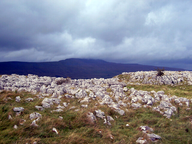
🐕Dogs welcome — bring water in summer; the site has enough space to find shade on hot days
🌤️ Visiting this summer
🐦48+ species recorded in this area — summer evenings are best for activity; watch for Raven and Jackdaw
✦Historic character is a year-round quality here — summer brings its own atmosphere to the setting
🐕Dogs welcome — bring water in summer; the site has enough space to find shade on hot days
Good to know
£Free to visit — no entry charge
🐕Dogs welcome
Best for
8 activities
🦅
Bird watching
Very strong match
Birds — Raven, Jackdaw, Wheatear +45 more · last seen 2025
Free
🦉
Wildlife
Strong match
Birds — Raven, Jackdaw, Wheatear +45 more · last seen 2025; Lowland calcareous grassland priority habitat
Free
🦋
Insect spotting
Strong match
Chalk and limestone grassland — chalkhill blue, adonis blue and rare moths; Insects — Meadow Brown, Small Pearl-bordered Fritillary, Dark Green Fritillary +36 more · last seen 2025
Free
🍂
Seasonal nature
Strong match
Plants — Springy Turf-moss, Common Bent, Sweet Vernal-grass +172 more · last seen 2025
Free
✦
Heritage
Strong match
Historic site
Free
🍄
Mushroom foraging
Good match
Fungi — Meadowsweet Rust · last seen 2023
Varies
Trails nearby
Within roughly 5 km
🚶
Walking
▾
8 signed routes nearby · 1 public path nearby
Signed route nearbyPublic paths
Three Peaks WalkWalking route▾
Named routeRegional walking route
Ribblehead Quarry WalkWalking route▾
Named routeRound tripLocal walking route
Limestone WalkWalking route▾
Named routeRound tripLocal walking route
Dales WayWalking route129 km▾
Named routeLength 129 kmRegional walking route
Ribble WayWalking route114 km▾
The Ribble Way follows the valley of the River Ribble from the mouth to the source near to the Pennine Way National Trail on Gayle Moor.
Named routeLength 114 kmRegional walking route
🚴
Cycling
▾
13 signed routes nearby
Signed route nearby
Pennine CyclewayCycling route▾
Named routeRef 68National Cycle Network
Yorkshire Dales CyclewayCycling route▾
Named routeRef YDCRegional cycle route
Main RouteCycling route30 m▾
Named routeRef 68Length 30 mNational Cycle NetworkOn-roadSurface asphalt
Main RouteCycling route215 m▾
Named routeRef 68Length 215 mNational Cycle NetworkOn-roadSurface asphalt
Main RouteCycling route234 m▾
Named routeRef 68Length 234 mNational Cycle NetworkOn-roadSurface asphalt
Main RouteCycling route234 m▾
Named routeRef 68Length 234 mNational Cycle NetworkOn-roadSurface asphalt
🚵
Mountain biking
▾
1 signed route nearby
Signed route nearby
Great North Trail (Yorkshire Dales)Mountain bike route172.2 km▾
Named routeLength 172.2 km
🐴
Horse riding
▾
2 public paths nearby
Public paths
No named routes yet. Public paths are shown on the map.