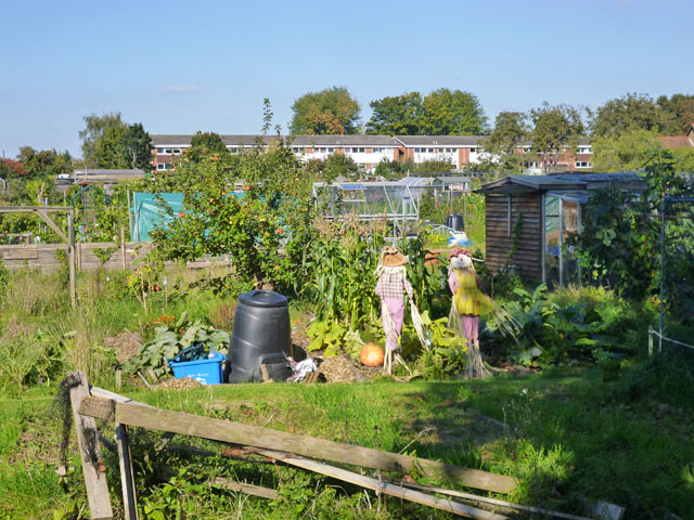
Shepperton Allotments
Getting here
51.39258, -0.44386
Visiting this summer
Seasonal nature notes and what to look for now
Visiting this summer
Seasonal nature notes and what to look for now
- 🌞Midsummer — early morning visits most comfortable; look for deer fawns in quieter clearings
- ☀️Summer family visits work well here — arrive early and plan for a longer stay
- 🛝Playground 156m away — built-in entertainment for younger visitors alongside the wider site
🌤️ Visiting this summer
- 🌞Midsummer — early morning visits most comfortable; look for deer fawns in quieter clearings
- ☀️Summer family visits work well here — arrive early and plan for a longer stay
- 🛝Playground 156m away — built-in entertainment for younger visitors alongside the wider site
Good to know
- 🐕Dogs welcome
Best for
Wildlife
Very strong match
Multi-group wildlife — Amphibians, Birds, Mammals, Reptiles; Multi-group wildlife — Amphibians, Birds, Mammals, Reptiles
Bird watching
Very strong match
Birds — Carrion Crow, Woodpigeon, Magpie +65 more · last seen 2025; Birds — Carrion Crow, Woodpigeon, Magpie +65 more · last seen 2025
Playgrounds
Strong match
playground, parking
Family friendly
Strong match
playground; Allotments
Dog walks
Good match
Dogs allowed with public access
Insect spotting
Good match
Insects — Stag Beetle, Southern Green Shieldbug, Banded Demoiselle +5 more · last seen 2025; Insects — Stag Beetle, Southern Green Shieldbug, Banded Demoiselle +5 more · last seen 2025
Trails nearby
Within roughly 5 km🚶Walking
10 signed routes nearby · 8 public paths nearby
Signed route nearbyPublic paths
Walking
Locks and Levels (SCC)Walking route
Thames Path - alternateWalking route
avoids sole ferry crossing just before Shepperton
European walking route E2 west, UK, South East EnglandWalking route
Westroute: Stranraer (UK) - Birminhgham (UK) - Calais (FR) - Zoersel (BE) / Eastroute: Stranraer (UK) - Harwich (UK) - Rotterdam (NL) - Zoersel (BE) / Both Routes: Zoersel (BE) - Maastrich (NL) - Luxembourg (LUX) - Lake Geneva (CH) - Nice (FR)
Basingstoke CanalWalking route
London LOOP (Section 9)Walking route
School Lanepublic footpath · 174 m
🚴Cycling
91 signed routes nearby
Signed route nearby
Cycling
Brooklands Business Park Accessibility Project (proposed)Cycling route
LCN 34Cycling route
Route 223Cycling route
Hersham station/Walton routeCycling route
LCN 34Cycling route
EuroVelo 2 - Capitals Route - part United Kingdom 5Cycling route
🚵Mountain biking
1 signed route nearby
Signed route nearby
Mountain biking
Basingstoke Canal TowpathMountain bike route
Wildlife to spot
Photos
Weather for this location
Loading local forecast…
Nearby places
Useful places within 5 km
Own or manage this place?
Claim this listing to keep details accurate, add photos, and highlight what makes it special — free.
Claim this pageHow was your visit?
How useful was the information on this page?
id: cbdfbeb7-1829-4a2a-8ae3-dcb9cbbdffb4