Plan your visit
🧺 Picnic🦅 Birds🦉 Wildlife
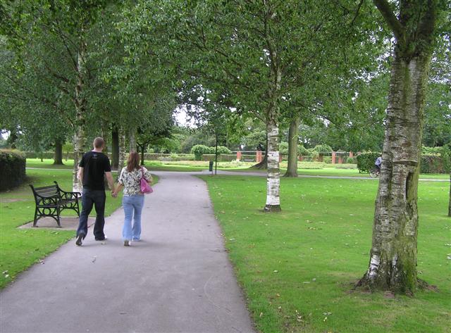
Public access Free entry Dogs welcome 30 ha
Getting here
52.41026, -1.83080
Open directionsv Visiting this summer
Seasonal nature notes and what to look for now
▾ 🐦 69+ species recorded in this area — summer evenings are best for activity; watch for Robin and Swift 🧺 Good picnic destination in summer — open space and facilities for a relaxed day out 🛝 Playground 145m away — built-in entertainment for younger visitors alongside the wider site 🌤️ Visiting this summer
🐦 69+ species recorded in this area — summer evenings are best for activity; watch for Robin and Swift 🧺 Good picnic destination in summer — open space and facilities for a relaxed day out 🛝 Playground 145m away — built-in entertainment for younger visitors alongside the wider site £ Free to visit — no entry charge🐕 Dogs welcome🅿️ Parking· Paid 🧺 Picnic spot🛝 Playground
🧺 Picnic day out
Very strong match
picnic area, car park; Urban park — open green space
Free
🦅 Bird watching
Very strong match
Birds — Robin, Swift, Woodpigeon +66 more · last seen 2026; Deciduous woodland — woodpeckers, warblers and woodland birds
Free
Mammals — Red Fox, Soprano Pipistrelle, Squirrel +11 more · last seen 2025; Deciduous woodland priority habitat
Free
🛝 Family friendly
Strong match
playground, picnic area; Urban park — family destination
Free
🦋 Insect spotting
Strong match
Insects — Beautiful Demoiselle, Batman Hoverfly, Closterotomus trivialis +124 more · last seen 2026
Free
Trails nearby Within roughly 5 km 15 signed routes nearby
Signed route nearby
Grand Union Canal Walk Walking route 234 km ▾
Birmingham to Napton section
Named route Length 234 km Regional walking route
Show on map Balsall Heath Tree Trail East Walking route ▾
Named route Local walking route
Show on map Rail Trail: Widney Manor > Dorridge Walking route 4.4 km ▾
A 2.75-mile easy walk through Solihull’s suburbia and countryside between two stations, crossing the M42 and the river Blythe.
Duration: 1.5 hours
Distance: 2.75 miles
Named route Ref rtWM Length 4.4 km Point-to-point Local walking route
Show on map Rail Trail: Olton > Shirley Walking route 12.5 km ▾
An 8-mile longer meander along the banks of the Grand Union Canal and the River Cole, through the heart of Tolkein Country!
Duration: 3.5 hours
Distance: 8 miles
Named route Ref rtOlt Length 12.5 km Point-to-point Local walking route
Show on map Rail Trail: The Lakes > Earlswood Walking route 6.3 km ▾
A 3-mile trail tranquil and easy route, circumnavigating Earlswood Lakes before heading into the leafy shade of Clowes Wood en-route to Earlswood.
Duration: 2 hours
Distance: 4 miles
Named route Ref rtTLa Length 6.3 km Point-to-point Local walking route
Show on map 9 signed routes nearby
Signed route nearby
Solihull-Knowle Cycling route ▾
Named route Local cycle route
Show on map National Cycle Network Route 5 Cycling route ▾
Named route Ref 5 National Cycle Network
Show on map Cole Valley Route Cycling route ▾
Named route Local cycle route
Show on map Billesley & Shire Country Park Circular Cycling route ▾
Named route Ref 4 Local cycle route
Show on map Rea Valley Route Cycling route ▾
NCN 5 section of Rea Valley Route
Named route Ref Rea Valley
Show on map [PROPOSED]Starley Regional Cycle Network Cycling route 804 km ▾
Starley (TfWM) Regional Cycle Network (Proposed route)
Named route Ref Starley Network Length 804 km Regional cycle route
Show on map
Weather for this location Next 14 days Nearby places Useful places within 5 km
UK green spaces mapped from open public data — so anyone can find the woodland, trail, or nature reserve closest to them.
© 2026 Glade · Made with care for UK green spaces
Events & activities nearby Switch provider to compare local events, tours and bookable activities.
Bookable tours GetYourGuide Tripadvisor
Wildlife to spot
35,544 records · National Biodiversity Network
▾
Wildlife to spot 35,544 records · National Biodiversity Network Starling · Great Crested Grebe · Mallard · Tawny Owl · Grey Heron +29
Starling Sturnus vulgaris2025 Great Crested Grebe Podiceps cristatus Mallard Anas platyrhynchos Tawny Owl Strix aluco2025 Grey Heron Ardea cinerea2025 Moorhen Gallinula chloropus2025 Swift Apus apus2025 Magpie Pica pica2025 Coot Fulica atra Song Thrush Turdus philomelos2025 Raven Corvus corax2025 Canada Goose Branta canadensis2025 Woodpigeon Columba palumbus2025 Blackcap Sylvia atricapilla2025 Stock Dove Columba oenas2025 Chiffchaff Phylloscopus collybita2025 Wren Troglodytes troglodytes2025 Greylag Goose Anser anser2025 Mute Swan Cygnus olor2025 Tufted Duck Aythya fuligula2025 Blue Tit Cyanistes caeruleus2025 Grey Wagtail Motacilla cinerea2025 Little Egret Egretta garzetta2025 Siskin Spinus spinus2025 Goldfinch Carduelis carduelis2025 Nuthatch Sitta europaea2025 House Sparrow Passer domesticus2025 Blackbird Turdus merula2025 Carrion Crow Corvus corone2025 Robin Erithacus rubecula2025 Great Spotted Woodpecker Dendrocopos major2025 Jackdaw Coloeus monedula2025 Whitethroat Curruca communis2025 Black-headed Gull Chroicocephalus ridibundus2025 🦌 Mammals 2 species
summer winter
2025 ▾
Red Fox · Water Shrew
Red Fox Vulpes vulpes Water Shrew Neomys fodiens Yellow-bellied Slider
Yellow-bellied Slider Trachemys scripta subsp. scripta 🐝 Insects 57 species
spring summer
2026 ▾
7-spot Ladybird · Platycheirus albimanus · Syritta pipiens · Hornet Hoverfly · Barberry Fusehorn +52
7-spot Ladybird Coccinella septempunctata Platycheirus albimanus Platycheirus albimanus2025 Syritta pipiens Syritta pipiens2025 Hornet Hoverfly Volucella zonaria2025 Barberry Fusehorn Arge berberidis2025 Bluebell · Enchanter's-nightshade · Bracken · Broad Buckler-fern · Raspberry +29
Bluebell Hyacinthoides non-scripta Enchanter's-nightshade Circaea lutetiana Bracken Pteridium aquilinum Broad Buckler-fern Dryopteris dilatata Raspberry Rubus idaeus Remote Sedge Carex remota Wood Avens Geum urbanum Species observations from the last 10 years via NBN Atlas
Rosemary Beetle
Rosemary Beetle
Chrysolina americana2025
Chrysolina americana2025
Closterotomus trivialis Closterotomus trivialis2025
Closterotomus trivialis Closterotomus trivialis2025
Epistrophe eligans Epistrophe eligans2025
Epistrophe eligans Epistrophe eligans2025
Cheilosia albitarsis Cheilosia albitarsis2025
Cheilosia albitarsis Cheilosia albitarsis2025
Balclutha punctata Balclutha punctata2025
Balclutha punctata Balclutha punctata2025
Eristalis tenax Eristalis tenax2025
Eristalis tenax Eristalis tenax2025
Rhopalus (Rhopalus) subrufus Rhopalus (Rhopalus) subrufus2025
Rhopalus (Rhopalus) subrufus Rhopalus (Rhopalus) subrufus2025
Ferdinandea cuprea Ferdinandea cuprea2025
Ferdinandea cuprea Ferdinandea cuprea2025
Corizus hyoscyami Corizus hyoscyami2025
Corizus hyoscyami Corizus hyoscyami2025
Loensia Loensia2025
Loensia Loensia2025
Metoecus paradoxus Metoecus paradoxus2025
Metoecus paradoxus Metoecus paradoxus2025
Field Grasshopper Chorthippus brunneus2025
Field Grasshopper Chorthippus brunneus2025
Volucella inanis Volucella inanis2025
Volucella inanis Volucella inanis2025
Scaeva pyrastri Scaeva pyrastri2025
Scaeva pyrastri Scaeva pyrastri2025
Eupeodes luniger Eupeodes luniger2025
Eupeodes luniger Eupeodes luniger2025
Common Darter Sympetrum striolatum2025
Common Darter Sympetrum striolatum2025
Syrphus Syrphus2025
Syrphus Syrphus2025
10-spot Ladybird Adalia decempunctata2025
10-spot Ladybird Adalia decempunctata2025
Syrphus torvus Syrphus torvus2025
Syrphus torvus Syrphus torvus2025
Cheilosia bergenstammi Cheilosia bergenstammi2025
Cheilosia bergenstammi Cheilosia bergenstammi2025
Oncotylus (Oncotylus) viridiflavus Oncotylus (Oncotylus) viridiflavus2025
Oncotylus (Oncotylus) viridiflavus Oncotylus (Oncotylus) viridiflavus2025
Common Blue Damselfly Enallagma cyathigerum2025
Common Blue Damselfly Enallagma cyathigerum2025
Eupteryx melissae Eupteryx melissae2025
Eupteryx melissae Eupteryx melissae2025
Blue-tailed Damselfly Ischnura elegans2025
Blue-tailed Damselfly Ischnura elegans2025
Welsh Chafer Hoplia philanthus2025
Welsh Chafer Hoplia philanthus2025
Eupteryx decemnotata Eupteryx decemnotata2025
Eupteryx decemnotata Eupteryx decemnotata2025
Eupteryx aurata Eupteryx aurata2025
Eupteryx aurata Eupteryx aurata2025
Macrosteles Macrosteles2025
Macrosteles Macrosteles2025
Psammotettix Psammotettix2025
Psammotettix Psammotettix2025
2-spot Ladybird Adalia bipunctata2025
2-spot Ladybird Adalia bipunctata2025
Pipizella Pipizella2025
Pipizella Pipizella2025
Broad Centurion Chloromyia formosa2025
Broad Centurion Chloromyia formosa2025
Andromeda Lacebug Stephanitis takeyai2025
Andromeda Lacebug Stephanitis takeyai2025
Rivellia syngenesiae Rivellia syngenesiae2025
Rivellia syngenesiae Rivellia syngenesiae2025
Meliscaeva auricollis Meliscaeva auricollis2025
Meliscaeva auricollis Meliscaeva auricollis2025
Chrysogaster solstitialis Chrysogaster solstitialis2025
Chrysogaster solstitialis Chrysogaster solstitialis2025
Melanostoma scalare Melanostoma scalare2025
Melanostoma scalare Melanostoma scalare2025
Melanostoma Melanostoma2025
Melanostoma Melanostoma2025
Cheilosia illustrata Cheilosia illustrata2025
Cheilosia illustrata Cheilosia illustrata2025
Marmalade Hoverfly Episyrphus balteatus2025
Marmalade Hoverfly Episyrphus balteatus2025
Beautiful Demoiselle Calopteryx virgo2025
Beautiful Demoiselle Calopteryx virgo2025
14-spot Ladybird Propylea quattuordecimpunctata2025
14-spot Ladybird Propylea quattuordecimpunctata2025
Greater Bulb-Fly Merodon equestris2025
Greater Bulb-Fly Merodon equestris2025
Varied Carpet Beetle Anthrenus verbasci2025
Varied Carpet Beetle Anthrenus verbasci2025
Green Shieldbug Palomena prasina2025
Green Shieldbug Palomena prasina2025
Batman Hoverfly Myathropa florea2025
Batman Hoverfly Myathropa florea2025
Helophilus pendulus Helophilus pendulus2025
Helophilus pendulus Helophilus pendulus2025
Hairy Shieldbug Dolycoris baccarum2025
Hairy Shieldbug Dolycoris baccarum2025
Cheilosia pagana Cheilosia pagana2025
Cheilosia pagana Cheilosia pagana2025
Southern Hawker Aeshna cyanea2025
Southern Hawker Aeshna cyanea2025
Creeping Thistle Lacebug Tingis (Tingis) ampliata2025
Creeping Thistle Lacebug Tingis (Tingis) ampliata2025
Eristalis pertinax Eristalis pertinax2025
Eristalis pertinax Eristalis pertinax2025
Foxglove Digitalis purpurea
Foxglove Digitalis purpurea
Compact Rush Juncus conglomeratus
Compact Rush Juncus conglomeratus
Common Nettle Urtica dioica
Common Nettle Urtica dioica
Soft-rush Juncus effusus
Soft-rush Juncus effusus
Pendulous Sedge Carex pendula
Pendulous Sedge Carex pendula
Wood Melick Melica uniflora
Wood Melick Melica uniflora
Marsh-marigold Caltha palustris
Marsh-marigold Caltha palustris
Bilberry Vaccinium myrtillus
Bilberry Vaccinium myrtillus
Herb-Robert Geranium robertianum
Herb-Robert Geranium robertianum
Creeping Buttercup Ranunculus repens
Creeping Buttercup Ranunculus repens
Few-flowered Garlic Allium paradoxum
Few-flowered Garlic Allium paradoxum
Norway Maple Acer platanoides
Norway Maple Acer platanoides
Honeysuckle Lonicera periclymenum
Honeysuckle Lonicera periclymenum
Hemlock Water-dropwort Oenanthe crocata
Hemlock Water-dropwort Oenanthe crocata
Rosebay Willowherb Chamaenerion angustifolium
Rosebay Willowherb Chamaenerion angustifolium
Wood Dock Rumex sanguineus
Wood Dock Rumex sanguineus
Holly Ilex aquifolium
Holly Ilex aquifolium
Male-fern Dryopteris filix-mas
Male-fern Dryopteris filix-mas
Ramsons Allium ursinum
Ramsons Allium ursinum
Bulrush Typha latifolia
Bulrush Typha latifolia
False-brome Brachypodium sylvaticum
False-brome Brachypodium sylvaticum
Hazel Corylus avellana
Hazel Corylus avellana
Pedunculate Oak Quercus robur
Pedunculate Oak Quercus robur
Forsythia Forsythia
Forsythia Forsythia
Cleavers Galium aparine
Cleavers Galium aparine
Downy Birch Betula pubescens
Downy Birch Betula pubescens
Cherry Laurel Prunus laurocerasus
Cherry Laurel Prunus laurocerasus