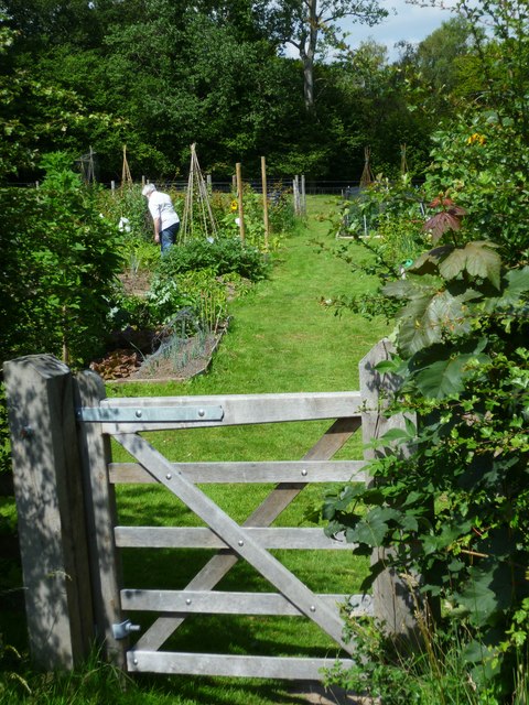
Shottermill Ponds Allotments
Getting here
51.08403, -0.74200
Visiting this summer
Seasonal nature notes and what to look for now
Visiting this summer
Seasonal nature notes and what to look for now
- 🐦51+ species recorded in this area — summer evenings are best for activity; watch for Robin and Blue Tit
- 🌿Foraging is at its best in summer here
- 🛝Playground 291m away — built-in entertainment for younger visitors alongside the wider site
🌤️ Visiting this summer
- 🐦51+ species recorded in this area — summer evenings are best for activity; watch for Robin and Blue Tit
- 🌿Foraging is at its best in summer here
- 🛝Playground 291m away — built-in entertainment for younger visitors alongside the wider site
Good to know
- 🐕Dogs welcome
Best for
Bird watching
Very strong match
Birds — Robin, Blue Tit, Woodpigeon +48 more · last seen 2026; Birds — Robin, Blue Tit, Woodpigeon +48 more · last seen 2026
Foraging
Strong match
Plants — Ramsons, Wood-sorrel, Hawthorn +21 more foraging species; Lowland meadows — wild flowers, berries and seasonal plants
Seasonal nature
Strong match
Plants — American Skunk-cabbage, Honeysuckle, Ramsons +165 more · last seen 2026; Plants — American Skunk-cabbage, Honeysuckle, Ramsons +165 more · last seen 2026
Insect spotting
Strong match
Lowland meadows — marbled white, meadow brown and pollinating insects; Insects — 7-spot Ladybird, Southern Oak Bush-cricket, Western Conifer Seed Bug +29 more · last seen 2026
Playgrounds
Strong match
playground, parking
Family friendly
Strong match
playground; Allotments
Trails nearby
Within roughly 5 km🚶Walking
18 signed routes nearby · 10 public paths nearby
Signed route nearbyPublic paths
Walking
The Shipwrights WayWalking route
A long distance route which links villages and towns in east Hampshire. The name reflects the use of oak grown at Alice Holt Forest for Tudor shipbuilding.
New Lipchis WayWalking route
Greensand WayWalking route
Sussex Border PathWalking route220 km
Stargazing Circular Walk at Black DownWalking route2.4 km
At the highest point in Surrey, away from light pollution, Black Down is ideal for stargazing. On a clear night, there are ~4,000 stars visible, including the Milky Way. This leisurely walk offers viewpoints & a chance to encounter night-time wildlife.
Oak Tree Lanepublic footpath · 264 m
🚴Cycling
3 signed routes nearby
Signed route nearby
Cycling
A3 Cycle RouteCycling route
Surrey CyclewayCycling route
Haslemere link
NCN 22 - Liphook LinkCycling route
National Cycle Network link route
🚵Mountain biking
3 signed routes nearby
Signed route nearby
Mountain biking
King Alfred's WayMountain bike route
King Alfreds Way is 350km (220 miles) off road route designed to be ridden clockwise. It starts & ends in Winchester. It is suitable for gravel or cross-country bikes.
Devils PunchBowl LoopMountain bike route
Shipwrights Way (Liphook Spur)Mountain bike route
Wildlife to spot
Photos
Weather for this location
Loading local forecast…
Nearby places
Useful places within 5 km
Own or manage this place?
Claim this listing to keep details accurate, add photos, and highlight what makes it special — free.
Claim this pageHow was your visit?
How useful was the information on this page?
id: ed072011-a798-4e3f-9915-1b579425b489