SIR HAROLD HILLIER GARDENS AND ARBORETUM 66 ha
Plan your visit
🦅 Birds🛝 Family🎠 Play
Public access Dogs welcome 66 ha
Getting here
51.01223, -1.46456
Open directionsv
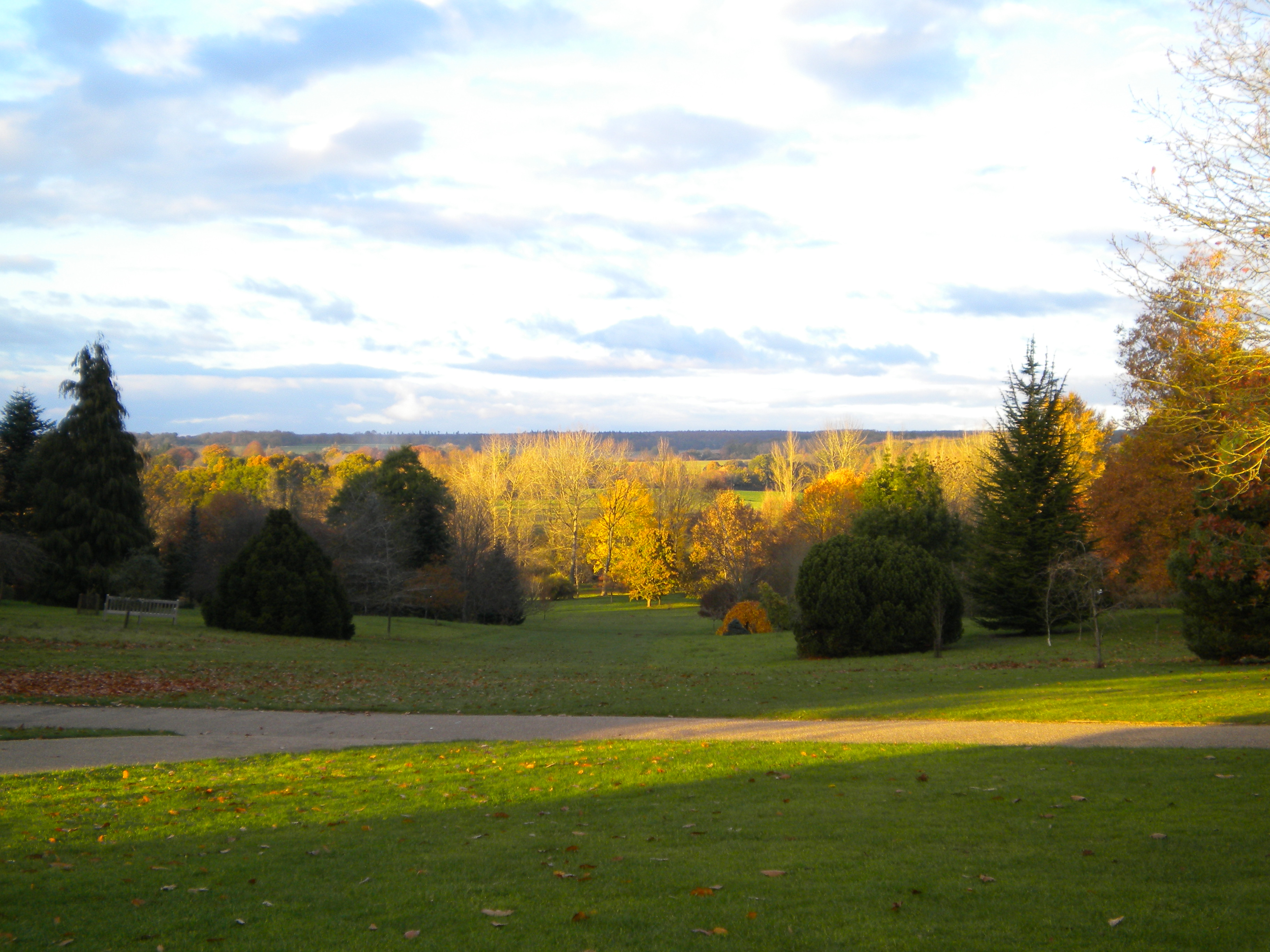
About SIR HAROLD HILLIER GARDENS AND ARBORETUM The Sir Harold Hillier Gardens is an arboretum comprising 72 hectares accommodating over 42,000 trees and shrubs in about 12,000 taxa, notably a collection of oaks, camellia, magnolia and rhododendron.
Read more on Wikipedia → Botanical garden Grade II listed park and garden
Visiting this summer
Seasonal nature notes and what to look for now
▾ 🐦 84+ species recorded in this area — summer evenings are best for activity; watch for Woodpigeon and Robin ☀️ Summer family visits work well here — arrive early and plan for a longer stay ☕ Café on site — makes this an easy full-day family visit without needing to pack food 🌤️ Visiting this summer
🐦 84+ species recorded in this area — summer evenings are best for activity; watch for Woodpigeon and Robin ☀️ Summer family visits work well here — arrive early and plan for a longer stay ☕ Café on site — makes this an easy full-day family visit without needing to pack food ☕ Café🅿️ Parking🛝 Playground🚻 Toilets
🦅 Bird watching
Very strong match
Birds — Woodpigeon, Robin, Blackbird +81 more · last seen 2026; Deciduous woodland — woodpeckers, warblers and woodland birds
Free
🛝 Family friendly
Very strong match
playground, café, toilets
Free
🎠 Playgrounds
Very strong match
playground, toilets, café, parking
Free
🧺 Picnic day out
Very strong match
café, toilets, car park
Free
Birds — Woodpigeon, Robin, Blackbird +81 more · last seen 2026; Deciduous woodland priority habitat
Free
Historic site with public access
Free
Trails nearby Within roughly 5 km 4 signed routes nearby · 16 public paths nearby
Signed route nearby Public paths
Test Way Walking route ▾
Named route Listed length 79 Regional walking route
Show on map Monarch's Way Walking route 990 km ▾
approximate route of Charles II's escape
Named route Ref MW Length 990 km Regional walking route
Show on map Mottisfont Estate Walk, Mottisfont Walking route 9.1 km ▾
A varied walk through ancient woodlands & historic farmland & part of the Test Way. The route is designed to be walked anti-clockwise, but is waymarked in both directions. Some uneven terrain & country roads with potential livestock in places.
Named route Length 9.1 km Duration 02:40-04:00 Round trip Local walking route
Show on map Keble Way Walking route ▾
56 signed routes nearby
Signed route nearby
Route 24 Cycling route ▾
Named route Ref 24 National Cycle Network
Show on map National Byway Cycling route ▾
Named route Ref NB Regional cycle route
Show on map Route 246 Cycling route ▾
Named route Ref 246 National Cycle Network
Show on map Route 246 Cycling route ▾
Named route Ref 246 National Cycle Network
Show on map Test Way Cycle route Cycling route ▾
https://www.hants.gov.uk/thingstodo/countryside/cycling/testway
Named route
Show on map Main Route Cycling route 567 m ▾
Named route Ref 24 Length 567 m National Cycle Network Traffic-free Surface asphalt
Show on map 1 signed route nearby
Signed route nearby
Farley Mount Off Road Cycle Trail Mountain bike route ▾
Named route Hampshire off Road cycle trails
Show on map 1 public path nearby
Public paths
No named routes yet. Public paths are shown on the map.
Photos Sir Harold Hillier Gardens
‹ ›
Weather for this location Next 14 days Nearby places Useful places within 5 km
All Historic
UK green spaces mapped from open public data — so anyone can find the woodland, trail, or nature reserve closest to them.
© 2026 Glade · Made with care for UK green spaces
Wildlife to spot
39,660 records · National Biodiversity Network
▾
Wildlife to spot 39,660 records · National Biodiversity Network 🐦 Birds 48 species
autumn winter
2026 ▾
Robin · Chaffinch · Blue Tit · Woodpigeon · Long-tailed Tit +43
Robin Erithacus rubecula Chaffinch Fringilla coelebs Blue Tit Cyanistes caeruleus Woodpigeon Columba palumbus Long-tailed Tit Aegithalos caudatus Blackbird Turdus merula Dunnock Prunella modularis Jay Garrulus glandarius Wren Troglodytes troglodytes Magpie Pica pica Great Spotted Woodpecker Dendrocopos major Great Tit Parus major Carrion Crow Corvus corone2025 Goldfinch Carduelis carduelis Nuthatch Sitta europaea Goldcrest Regulus regulus2025 Stock Dove Columba oenas2025 Chiffchaff Phylloscopus collybita2025 Bullfinch Pyrrhula pyrrhula Redwing Turdus iliacus Coal Tit Periparus ater2025 Siskin Spinus spinus2025 Greenfinch Chloris chloris2025 Mistle Thrush Turdus viscivorus2025 Jackdaw Coloeus monedula2025 Raven Corvus corax2025 Pheasant Phasianus colchicus2025 Moorhen Gallinula chloropus Tawny Owl Strix aluco2025 Treecreeper Certhia familiaris2025 Water Rail Rallus aquaticus2025 Black-headed Gull Chroicocephalus ridibundus2025 Cetti's Warbler Cettia cetti2025 Mallard Anas platyrhynchos2025 Mute Swan Cygnus olor2025 Cormorant Phalacrocorax carbo2025 Grey Heron Ardea cinerea2025 Kingfisher Alcedo atthis2025 Swallow Hirundo rustica2025 Fieldfare Turdus pilaris2025 Song Thrush Turdus philomelos2025 Greylag Goose Anser anser2025 House Martin Delichon urbicum2025 Canada Goose Branta canadensis2025 Herring Gull Larus argentatus2025 Skylark Alauda arvensis2025 Green Woodpecker Picus viridis2025 Pied Wagtail Motacilla alba yarrellii2025 Hazel Dormouse · Grey Squirrel · Brown Hare · Roe Deer
Hazel Dormouse Muscardinus avellanarius Grey Squirrel Sciurus carolinensis Brown Hare Lepus europaeus Roe Deer Capreolus capreolus 🦎 Reptiles 3 species
winter spring autumn
2026 ▾
Slow-worm · Common Lizard · Grass Snake
Slow-worm Anguis fragilis Common Lizard Zootoca vivipara2025 Grass Snake Natrix helvetica2025 🐸 Amphibians 1 species
winter autumn
2026 ▾
Common Frog
Common Frog Rana temporaria Common Darter · Migrant Hawker · Southern Hawker · Dock Bug · Dark-edged Bee-fly +5
Common Darter Sympetrum striolatum2025 Migrant Hawker Aeshna mixta2025 Southern Hawker Aeshna cyanea2025 Dock Bug Coreus marginatus2025 Dark-edged Bee-fly Bombylius major Dotted Bee-fly Bombylius discolor Species observations from the last 10 years via NBN Atlas
Cramp-Ball Fungus Weevil Platyrhinus resinosus
Cramp-Ball Fungus Weevil Platyrhinus resinosus
Black Oil-beetle Meloe proscarabaeus
Black Oil-beetle Meloe proscarabaeus
Hawthorn Shieldbug Acanthosoma haemorrhoidale2025
Hawthorn Shieldbug Acanthosoma haemorrhoidale2025
Glyphotaelius pellucidus Glyphotaelius pellucidus2025
Glyphotaelius pellucidus Glyphotaelius pellucidus2025 Events & activities nearby Switch provider to compare local events, tours and bookable activities.
Bookable tours GetYourGuide Tripadvisor