Getting here
53.28907, -0.02758
Visiting this summer
Seasonal nature notes and what to look for now
Visiting this summer
Seasonal nature notes and what to look for now
- 🐦74+ species recorded in this area — summer evenings are best for activity; watch for Kestrel and Carrion Crow
- 🐕Early mornings are best for dog walks in summer — visit before 9am to avoid the heat and find quieter trails
- 📍Open access throughout summer — no booking required
🌤️ Visiting this summer
- 🐦74+ species recorded in this area — summer evenings are best for activity; watch for Kestrel and Carrion Crow
- 🐕Early mornings are best for dog walks in summer — visit before 9am to avoid the heat and find quieter trails
- 📍Open access throughout summer — no booking required
Good to know
- £Free to visit — no entry charge
- 🐕Dogs welcome
Best for
Bird watching
Very strong match
Birds — Kestrel, Carrion Crow, Woodpigeon +71 more · last seen 2025; Birds — Kestrel, Carrion Crow, Woodpigeon +71 more · last seen 2025
Wildlife
Very strong match
Multi-group wildlife — Birds, Mammals; Multi-group wildlife — Birds, Mammals
Dog walks
Strong match
Dogs allowed — public woodland
Seasonal nature
Good match
Plants — Wild Carrot, Groundsel, Common Ragwort +11 more · last seen 2024; Plants — Wild Carrot, Groundsel, Common Ragwort +11 more · last seen 2024
Insect spotting
Good match
Insects — Red Admiral, Small Tortoiseshell, Peacock +13 more · last seen 2020; Insects — Red Admiral, Small Tortoiseshell, Peacock +13 more · last seen 2020
Foraging
Good match
Deciduous woodland — fungi, berries and wild garlic
Trails nearby
Within roughly 5 km🚶Walking
3 signed routes nearby · 2 public paths nearby
Signed route nearbyPublic paths
Walking
Lincolnshire Wolds WayWalking route
Greenwich Meridian TrailWalking route440 km
A long-distance walk that follows the line of the Prime Meridian. Inaugurated in 2009, to coincide with the 125th anniversary of the Greenwich Meridian.
Viking Way (Barnetby to Whitwell)Walking route
🚴Cycling
2 signed routes nearby
Signed route nearby
Cycling
Living Landscapes (Short Route)Cycling route
Lindsey TrailCycling route
🐴Horse riding
7 public paths nearby
Public paths
Horse riding
Farforth Lanebridleway · 591 m
Farforth Lanebridleway · 62 m
Wildlife to spot
Photos
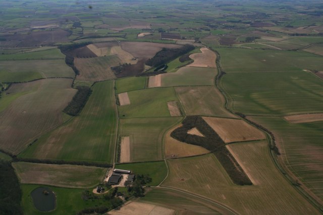
Across Farforth and Snareshill Plantation to Scotland Plantation: aerial 2018
Weather for this location
Loading local forecast…
Nearby places
Useful places within 5 km
Own or manage this place?
Claim this listing to keep details accurate, add photos, and highlight what makes it special — free.
Claim this pageHow was your visit?
How useful was the information on this page?
id: 9220f0e8-5f63-4c71-b450-c410d03a94bd