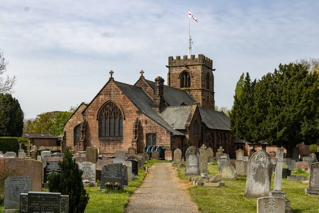
St Alban's Church
Getting here
53.12243, -2.76871
Visiting this summer
Seasonal nature notes and what to look for now
Visiting this summer
Seasonal nature notes and what to look for now
- 🌞Midsummer — early morning visits most comfortable; look for deer fawns in quieter clearings
- 🧺Good picnic destination in summer — open space and facilities for a relaxed day out
- 🛝Playground on site — built-in entertainment for younger visitors alongside the wider site
🌤️ Visiting this summer
- 🌞Midsummer — early morning visits most comfortable; look for deer fawns in quieter clearings
- 🧺Good picnic destination in summer — open space and facilities for a relaxed day out
- 🛝Playground on site — built-in entertainment for younger visitors alongside the wider site
Good to know
- £Free to visit — no entry charge
- 🐕Dogs welcome
Best for
Wildlife
Very strong match
Multi-group wildlife — Amphibians, Birds, Mammals, Reptiles; Multi-group wildlife — Amphibians, Birds, Mammals, Reptiles
Bird watching
Very strong match
Birds — Blackbird, Woodpigeon, Jackdaw +74 more · last seen 2026; Birds — Blackbird, Woodpigeon, Jackdaw +74 more · last seen 2026
Picnic day out
Strong match
picnic area, car park
Insect spotting
Strong match
Insects — Buff-tailed Bumblebee, Hairy-footed Flower Bee, Common Carder Bee +85 more · last seen 2025; Insects — Buff-tailed Bumblebee, Hairy-footed Flower Bee, Common Carder Bee +85 more · last seen 2025
Seasonal nature
Strong match
Plants — Lesser Celandine, Blueish Veilwort, Marchantia polymorpha subsp. ruderalis +36 more · last seen 2024; Plants — Lesser Celandine, Blueish Veilwort, Marchantia polymorpha subsp. ruderalis +36 more · last seen 2024
Family friendly
Strong match
playground, picnic area
Trails nearby
Within roughly 5 km🚶Walking
7 signed routes nearby · 19 public paths nearby
Signed route nearbyPublic paths
Walking
Two Saints WayWalking route148 km
Two Saints Way - Chester Cathedral to/from Lichfield Cathedral. In the late Middle Ages a steady stream of pilgrims walked this way – both housing shrines to two game-changing Mercian saints in the 7th century - St Werburgh and St Chad
Cheshire CircuitWalking route
Milennium MileWalking route
Sandstone TrailWalking route
Eddisbury WayWalking route27 km
Rosemary Rowpublic footpath · 72 m
Covert Risepublic footpath · 34 m
Field Lanepublic footpath · 98 m
🚴Cycling
14 signed routes nearby
Signed route nearby
Cycling
Mercian WayCycling route
Cheshire CyclewayCycling route
River to RidgeCycling route
Main RouteCycling route141 m
Main RouteCycling route565 m
Main RouteCycling route1.1 km
Wildlife to spot
Photos
Weather for this location
Loading local forecast…
Nearby places
Useful places within 5 km
Own or manage this place?
Claim this listing to keep details accurate, add photos, and highlight what makes it special — free.
Claim this pageHow was your visit?
How useful was the information on this page?
id: f4c71f91-4231-4900-995e-b8ed621d04f3