St Andrew's Church (remains of) 0 ha
Plan your visit
🦉 Wildlife🦅 Birds✦ Heritage
Public access Free entry Dogs welcome 0 ha
Places › England › Eastern › East Suffolk Getting here
52.49939, 1.70708
Open directionsv ✦ Scheduled Ancient Monument — Nationally protected archaeological site on the National Heritage List for England (NHLE). Scheduled monuments represent the best surviving examples of England's irreplaceable archaeological heritage.
Church ruin Grade II listed building
Visiting this summer
Seasonal nature notes and what to look for now
▾ ☀️ June — long evenings and clear skies; one of the most rewarding months for a late visit ✦ Historic character is a year-round quality here — summer brings its own atmosphere to the setting 🐕 Dogs welcome — bring water in summer; the site has enough space to find shade on hot days 🌤️ Visiting this summer
☀️ June — long evenings and clear skies; one of the most rewarding months for a late visit ✦ Historic character is a year-round quality here — summer brings its own atmosphere to the setting 🐕 Dogs welcome — bring water in summer; the site has enough space to find shade on hot days £ Free to visit — no entry charge🐕 Dogs welcome🦉 Wildlife
Very strong match
Multi-group wildlife — Amphibians, Birds, Mammals; Multi-group wildlife — Amphibians, Birds, Mammals
Free
🦅 Bird watching
Very strong match
Birds — Woodpigeon, Carrion Crow, Blackbird +64 more · last seen 2026; Birds — Woodpigeon, Carrion Crow, Blackbird +64 more · last seen 2026
Free
Historic site with public access
Free
🍂 Seasonal nature
Strong match
Plants — Ground-ivy, Green Alkanet, Yarrow +77 more · last seen 2026; Plants — Ground-ivy, Green Alkanet, Yarrow +77 more · last seen 2026
Free
🦋 Insect spotting
Strong match
Insects — Meadow Brown, Ruddy Darter, Large White +42 more · last seen 2026; Insects — Meadow Brown, Ruddy Darter, Large White +42 more · last seen 2026
Free
Plants — Alexanders, Common Nettle, Bristly Oxtongue +6 more foraging species
Varies
Trails nearby Within roughly 5 km 10 signed routes nearby · 10 public paths nearby
Signed route nearby Public paths
Norfolk Coast Path Walking route 191.7 km ▾
Named route Ref NCP Length 191.7 km National walking route
Show on map Angles Way Walking route 150 km ▾
Named route Length 150 km Regional walking route
Show on map Suffolk Coast Path Walking route 80 km ▾
Named route Length 80 km Regional walking route
Show on map Circular route Walking route ▾
King Charles III England Coast Path: Lowestoft to Sea Palling Walking route ▾
Named route Ref ECP National walking route
Show on map 104 signed routes nearby
Signed route nearby
Two Rivers Cycle Route Cycling route ▾
Named route Ref 30 Regional cycle route
Show on map Route 517 Cycling route ▾
Named route Ref 517 National Cycle Network
Show on map Wolf Way Cycling route 400 km ▾
Named route Ref Wolf Way Length 400 km Round trip Local cycle route
Show on map Regional Cycle Route 30 Cycling route 373 km ▾
Named route Ref 30 Length 373 km Round trip Regional cycle route
Show on map N/A Cycling route 67 m ▾
Named route Length 67 m National Cycle Network On-road Surface asphalt
Show on map N/A Cycling route 26 m ▾
Named route Length 26 m National Cycle Network On-road Surface asphalt
Show on map 1 public path nearby
Public paths
Wood Lane byway open to all traffic · 333 m ▾
Public path byway open to all traffic Length 333 m Surface dirt Path type: track
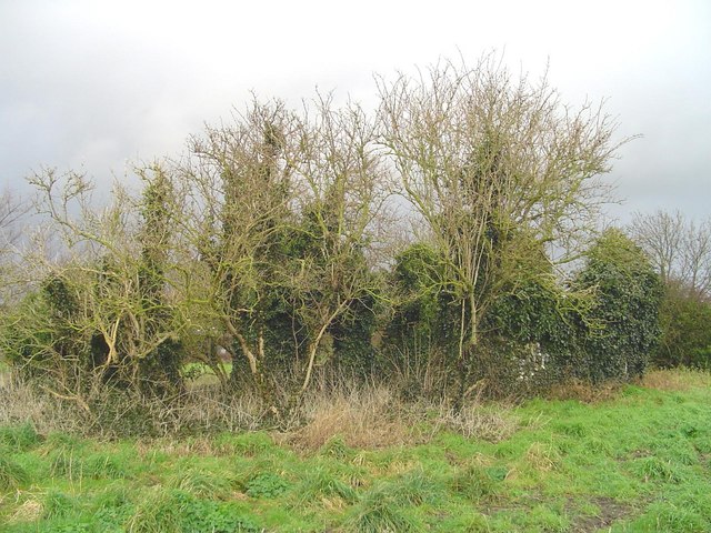
Show on map Photos Ruins of Flixton St Andrew's church
‹ ›
Weather for this location Next 14 days Nearby places Useful places within 5 km
All Historic
Own or manage this place?
Claim this listing to keep details accurate, add photos, and highlight what makes it special — free.
Claim this page→ How useful was the information on this page?
id: 2155b8f4-73d0-4dc6-940c-473d2040b998
UK green spaces mapped from open public data — so anyone can find the woodland, trail, or nature reserve closest to them.
© 2026 Glade · Made with care for UK green spaces
Wildlife to spot
14,846 records · National Biodiversity Network
▾
Wildlife to spot 14,846 records · National Biodiversity Network 🐦 Birds 38 species
autumn winter
2026 ▾
Woodpigeon · Jackdaw · Blackbird · Magpie · Rook +33
Woodpigeon Columba palumbus2025 Jackdaw Coloeus monedula2025 Blackbird Turdus merula2025 Magpie Pica pica2025 Rook Corvus frugilegus2025 Carrion Crow Corvus corone2025 Stock Dove Columba oenas2025 Robin Erithacus rubecula2025 Wren Troglodytes troglodytes2025 Blue Tit Cyanistes caeruleus2025 Pheasant Phasianus colchicus2025 Common Gull Larus canus2025 Goldcrest Regulus regulus2025 Long-tailed Tit Aegithalos caudatus2025 Chaffinch Fringilla coelebs2025 Herring Gull Larus argentatus2025 Black-headed Gull Chroicocephalus ridibundus2025 Jay Garrulus glandarius2025 Great Tit Parus major2025 Starling Sturnus vulgaris2025 Chiffchaff Phylloscopus collybita2025 Cormorant Phalacrocorax carbo2025 Redwing Turdus iliacus2025 Red-legged Partridge Alectoris rufa2025 Kestrel Falco tinnunculus2025 Lesser Black-backed Gull Larus fuscus2025 Dunnock Prunella modularis Little Egret Egretta garzetta2025 Mute Swan Cygnus olor2025 Stonechat Saxicola rubicola2025 Linnet Linaria cannabina2025 Raven Corvus corax2025 Grey Heron Ardea cinerea2025 Green Woodpecker Picus viridis2025 Pied Wagtail Motacilla alba2025 Swallow Hirundo rustica2025 Goldfinch Carduelis carduelis2025 Whitethroat Curruca communis2025 🦌 Mammals 5 species
autumn winter
2025 ▾
Grey Squirrel · Chinese Water Deer · Muntjac · Mole · Rabbit
Grey Squirrel Sciurus carolinensis Chinese Water Deer Hydropotes inermis Muntjac Muntiacus reevesi Mole Talpa europaea Rabbit Oryctolagus cuniculus 🐸 Amphibians 2 species
winter summer
2026 ▾
Smooth Newt · Common Frog
Smooth Newt Lissotriton vulgaris Common Frog Rana temporaria2025 Ruddy Darter · 7-spot Ladybird · Migrant Hawker · Hornet Hoverfly · Common Red Soldier Beetle +12
Ruddy Darter Sympetrum sanguineum2025 7-spot Ladybird Coccinella septempunctata Migrant Hawker Aeshna mixta2025 Hornet Hoverfly Volucella zonaria2025 Common Red Soldier Beetle Rhagonycha fulva2025 Common Darter Sympetrum striolatum Ground-ivy · Green Alkanet · Winter Heliotrope · Common Field-speedwell · Alexanders +21
Ground-ivy Glechoma hederacea Green Alkanet Pentaglottis sempervirens Winter Heliotrope Petasites pyrenaicus2025 Common Field-speedwell Veronica persica Alexanders Smyrnium olusatrum Lesser Celandine Ficaria verna Cherry Plum Species observations from the last 10 years via NBN Atlas
2025
2025
Willow Emerald Damselfly Chalcolestes viridis2025
Willow Emerald Damselfly Chalcolestes viridis2025
Common Blue Damselfly Enallagma cyathigerum2025
Common Blue Damselfly Enallagma cyathigerum2025
Eristalis pertinax Eristalis pertinax
Eristalis pertinax Eristalis pertinax
Common Cockchafer Melolontha melolontha
Common Cockchafer Melolontha melolontha
Harlequin Ladybird Harmonia axyridis2025
Harlequin Ladybird Harmonia axyridis2025
Oak Bush-cricket Meconema thalassinum2025
Oak Bush-cricket Meconema thalassinum2025
Birch Shieldbug Elasmostethus interstinctus2025
Birch Shieldbug Elasmostethus interstinctus2025
Marmalade Hoverfly Episyrphus balteatus2025
Marmalade Hoverfly Episyrphus balteatus2025
Field Grasshopper Chorthippus brunneus2025
Field Grasshopper Chorthippus brunneus2025
Lesser Stag Beetle Dorcus parallelipipedus2025
Lesser Stag Beetle Dorcus parallelipipedus2025
Common Rose Fusehorn Arge pagana2025
Common Rose Fusehorn Arge pagana2025 Prunus cerasifera
Prunus cerasifera
Snowberry Symphoricarpos albus2025
Snowberry Symphoricarpos albus2025
Common Ragwort Jacobaea vulgaris2025
Common Ragwort Jacobaea vulgaris2025
Tutsan Hypericum androsaemum2025
Tutsan Hypericum androsaemum2025
Common Nettle Urtica dioica2025
Common Nettle Urtica dioica2025
Pedunculate Oak Quercus robur2025
Pedunculate Oak Quercus robur2025
Common Knapweed Centaurea nigra2025
Common Knapweed Centaurea nigra2025
White Poplar Populus alba2025
White Poplar Populus alba2025
Chicory Cichorium intybus2025
Chicory Cichorium intybus2025
Tree Spinach Chenopodium giganteum2025
Tree Spinach Chenopodium giganteum2025
Sneezewort Achillea ptarmica2025
Sneezewort Achillea ptarmica2025
Greater Burdock Arctium lappa2025
Greater Burdock Arctium lappa2025
Herb-Robert Geranium robertianum2025
Herb-Robert Geranium robertianum2025
Rosebay Willowherb Chamaenerion angustifolium2025
Rosebay Willowherb Chamaenerion angustifolium2025
White Campion Silene latifolia2025
White Campion Silene latifolia2025
Field Bindweed Convolvulus arvensis2025
Field Bindweed Convolvulus arvensis2025
Creeping Thistle Cirsium arvense2025
Creeping Thistle Cirsium arvense2025
Bristly Oxtongue Helminthotheca echioides2025
Bristly Oxtongue Helminthotheca echioides2025
Great Willowherb Epilobium hirsutum2025
Great Willowherb Epilobium hirsutum2025
Medick Medicago sativa2025
Medick Medicago sativa2025 Events & activities nearby Switch provider to compare local events, tours and bookable activities.
Bookable tours GetYourGuide Promote here