🦉 Wildlife🦅 Birds🦋 Insects
↑ Share
Public access Free entry Dogs welcome
Places › England › West Midlands › Staffordshire Moorlands Getting here
53.08325, -2.14287
Open directionsv Visiting this summer
Seasonal nature notes and what to look for now
▾ 🌞 Midsummer — early morning visits most comfortable; look for deer fawns in quieter clearings 🌿 Foraging is at its best in summer here 🐕 Dogs welcome — bring water in summer; the site has enough space to find shade on hot days 🌤️ Visiting this summer
🌞 Midsummer — early morning visits most comfortable; look for deer fawns in quieter clearings 🌿 Foraging is at its best in summer here 🐕 Dogs welcome — bring water in summer; the site has enough space to find shade on hot days £ Free to visit — no entry charge🐕 Dogs welcome🦉 Wildlife
Very strong match
Multi-group wildlife — Birds, Mammals; Multi-group wildlife — Birds, Mammals
Free
🦅 Bird watching
Very strong match
Birds — Mallard, Woodpigeon, Canada Goose +71 more · last seen 2026; Birds — Mallard, Woodpigeon, Canada Goose +71 more · last seen 2026
Free
🦋 Insect spotting
Strong match
Insects — 7-spot Ladybird, Emperor Dragonfly, Red-legged Shieldbug +17 more · last seen 2025; Insects — 7-spot Ladybird, Emperor Dragonfly, Red-legged Shieldbug +17 more · last seen 2025
Free
Deciduous woodland — fungi, berries and wild garlic; Plants — Raspberry, Garlic Mustard, Blackthorn +1 more foraging species
Varies
Dogs allowed with public access
Free
🍂 Seasonal nature
Good match
Plants — Opposite-leaved Golden-saxifrage, Purple Toadflax, Cow Parsley +11 more · last seen 2025; Plants — Opposite-leaved Golden-saxifrage, Purple Toadflax, Cow Parsley +11 more · last seen 2025
Free
Trails nearby Within roughly 5 km 10 signed routes nearby · 5 public paths nearby
Signed route nearby Public paths
Two Saints Way Walking route 148 km ▾
Two Saints Way - Chester Cathedral to/from Lichfield Cathedral. In the late Middle Ages a steady stream of pilgrims walked this way – both housing shrines to two game-changing Mercian saints in the 7th century - St Werburgh and St Chad
Named route Ref TSW Length 148 km Point-to-point Regional walking route
Show on map Trent Valley Way Walking route 304 km ▾
Named route Length 304 km Point-to-point Regional walking route
Show on map Newcastle Way Walking route 40 km ▾
Market Drayton to Mow Cop
Named route Length 40 km Regional walking route
Show on map Gritstone Trail (Rushton Spencer - Kidsgrove) Walking route ▾
Named route Regional walking route
Show on map Staffordshire Way (Mow Cop-Rushton Spencer) Walking route ▾
Staffordshire Way, part north - Rushton Spencer
Named route Regional walking route
Show on map 71 signed routes nearby
Signed route nearby
National Route 555 Cycling route ▾
Named route Ref 555 National Cycle Network
Show on map National Cycle Network Route 5 Cycling route ▾
Named route Ref 5 National Cycle Network
Show on map National Route 550 Cycling route ▾
Named route Ref 550 National Cycle Network
Show on map Route 55 Cycling route ▾
Named route Ref 55 National Cycle Network
Show on map Main Route Cycling route 1.8 km ▾
Named route Ref 550 Length 1.8 km National Cycle Network Traffic-free Surface asphalt
Show on map Alternative Route Cycling route 2.4 km ▾
Named route Ref 555 Length 2.4 km National Cycle Network Traffic-free Surface asphalt
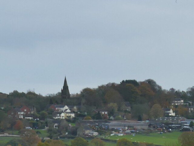
Show on map Photos St Anne's church, Brown Edge
‹ ›
Weather for this location Next 14 days Nearby places Useful places within 5 km
Own or manage this place?
Claim this listing to keep details accurate, add photos, and highlight what makes it special — free.
Claim this page→ How useful was the information on this page?
Something wrong on this page?
id: ceb0a86e-d74a-437f-b757-84f7fe3112bb
UK green spaces mapped from open public data — so anyone can find the woodland, trail, or nature reserve closest to them.
© 2026 Glade · Made with care for UK green spaces
Events & activities nearby Switch provider to compare local events, tours and bookable activities.
Bookable tours GetYourGuide Promote here
Wildlife to spot
18,140 records · National Biodiversity Network
▾
Wildlife to spot 18,140 records · National Biodiversity Network 🐦 Birds 49 species
spring summer autumn winter
2026 ▾
Robin · Blackbird · Mallard · Dunnock · Canada Goose +44
Robin Erithacus rubecula Blackbird Turdus merula Mallard Anas platyrhynchos Dunnock Prunella modularis Canada Goose Branta canadensis Blue Tit Cyanistes caeruleus Woodpigeon Columba palumbus Wren Troglodytes troglodytes Magpie Pica pica2025 Moorhen Gallinula chloropus Carrion Crow Corvus corone2025 Song Thrush Turdus philomelos2025 Great Tit Parus major2025 Goldfinch Carduelis carduelis2025 Blackcap Sylvia atricapilla2025 Nuthatch Sitta europaea House Sparrow Passer domesticus2025 Jackdaw Coloeus monedula2025 Grey Heron Ardea cinerea2025 Chiffchaff Phylloscopus collybita2025 Willow Warbler Phylloscopus trochilus2025 Black-headed Gull Chroicocephalus ridibundus Coal Tit Periparus ater Great Crested Grebe Podiceps cristatus2025 Long-tailed Tit Aegithalos caudatus2025 Chaffinch Fringilla coelebs2025 Cormorant Phalacrocorax carbo2025 Sedge Warbler Acrocephalus schoenobaenus2025 Whitethroat Curruca communis2025 Kestrel Falco tinnunculus2025 Coot Fulica atra Tufted Duck Aythya fuligula Treecreeper Certhia familiaris Redwing Turdus iliacus2025 Willow Tit Poecile montanus2025 Goldcrest Regulus regulus2025 Jay Garrulus glandarius2025 Starling Sturnus vulgaris2025 Stock Dove Columba oenas2025 Pied Wagtail Motacilla alba yarrellii2025 Goosander Mergus merganser2025 Lesser Black-backed Gull Larus fuscus2025 Rock Dove Columba livia2025 Muscovy Duck Cairina moschata2025 House Martin Delichon urbicum2025 Bullfinch Pyrrhula pyrrhula2025 Grasshopper Warbler Locustella naevia2025 Lesser Whitethroat Curruca curruca2025 Linnet Linaria cannabina2025 🦌 Mammals 6 species
summer winter
2026 ▾
Grey Squirrel · Mole · Otter · Bank Vole · Roe Deer +1
Grey Squirrel Sciurus carolinensis2025 Mole Talpa europaea2025 Otter Lutra lutra2025 Bank Vole Myodes glareolus Roe Deer Capreolus capreolus2025 Pipistrelle 🐝 Insects 4 species
spring summer winter
2025 ▾
7-spot Ladybird · Red-legged Shieldbug · Dark-edged Bee-fly · Western Honey Bee
7-spot Ladybird Coccinella septempunctata Red-legged Shieldbug Pentatoma rufipes Dark-edged Bee-fly Bombylius major Western Honey Bee Apis mellifera Purple Toadflax · Perfoliate Alexanders · Cow Parsley · Raspberry · Garlic Mustard +3
Purple Toadflax Linaria purpurea Perfoliate Alexanders Smyrnium perfoliatum Cow Parsley Anthriscus sylvestris Raspberry Rubus idaeus Garlic Mustard Alliaria petiolata Bracken Pteridium aquilinum Field Maple Acer campestre Species observations from the last 10 years via NBN Atlas
Pipistrellus pipistrellus2025
Pipistrellus pipistrellus2025
Daisy Bellis perennis
Daisy Bellis perennis