🐦35+ species recorded in this area — summer evenings are best for activity; watch for Blackcap and Chiffchaff
🧺Good picnic destination in summer — open space and facilities for a relaxed day out
🛝Playground on site — built-in entertainment for younger visitors alongside the wider site
🌤️ Visiting this summer
🐦35+ species recorded in this area — summer evenings are best for activity; watch for Blackcap and Chiffchaff
🧺Good picnic destination in summer — open space and facilities for a relaxed day out
🛝Playground on site — built-in entertainment for younger visitors alongside the wider site
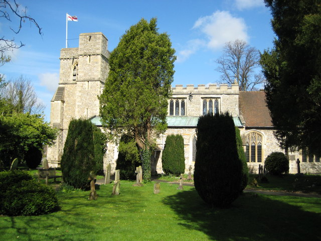
Good to know
£Free to visit — no entry charge
🐕Dogs welcome
🅿️Parking🧺Picnic spot🛝Playground
Best for
11 activities
🦅
Bird watching
Very strong match
Birds — Blackcap, Chiffchaff, Whitethroat +32 more · last seen 2026
Free
🧺
Picnic day out
Strong match
picnic area, car park; Urban park — open green space
Free
🦉
Wildlife
Strong match
Birds — Blackcap, Chiffchaff, Whitethroat +32 more · last seen 2026
Free
🛝
Family friendly
Strong match
playground, picnic area; Urban park — family destination
Free
🎠
Playgrounds
Strong match
playground, parking
Free
🦋
Insect spotting
Strong match
Insects — 7-spot Ladybird, Glow-worm, Dark-edged Bee-fly +55 more · last seen 2026
Free
Trails nearby
Within roughly 5 km
🚶
Walking
▾
26 signed routes nearby · 14 public paths nearby
Signed route nearbyPublic paths
The RidgewayWalking route140 km▾
Named routeRef RWLength 140 kmNational walking route
The Chiltern WayWalking route275 km▾
A waymarked long-distance footpath in southern England
Named routeRef CWLength 275 kmRegional walking route
Midshires WayWalking route370 km▾
Multi-use trail links the Ridgeway National Trail with the Trans Pennine Trail
Named routeLength 370 kmRegional walking route
Bradenham: Chiltern Hills, Valleys and Woodlands Walk, BradenhamWalking route12.8 km▾
Chalk meadows, beech woods & farmland with views across the Chilterns, Bradenham, Smalldean, Loosley Row & Lacey Green. Descend gently to North Dean & return to Bradenham via Naphill Common. Rough tracks, moderate climbs, stiles, gates & uneven terrain.
Named routeLength 12.8 kmDuration 03:30-04:00Round tripLocal walking route
Pulpit Hill Fort and Nature Reserves Circular Walk, Central ChilternsWalking route2.6 km▾
A short walk with panoramic views across the Chiltern Escarpment & Aylesbury Vale, and the chance to explore a hidden Iron Age hillfort, beautiful beech woods & the Grangelands & Rifle Butts Nature Reserve. Includes a steep climb, steps & kissing gates.
Named routeLength 2.6 kmDuration 01:00Round tripLocal walking route
🚴
Cycling
▾
21 signed routes nearby
Signed route nearby
Amber WayCycling route▾
Named routeRef AmberLocal cycle route
NCN National Route 57Cycling route▾
Named routeRef 57National Cycle Network
Chilterns CyclewayCycling route▾
Named routeRound tripRegional cycle route
Main RouteCycling route1.1 km▾
Named routeRef 57Length 1.1 kmNational Cycle NetworkOn-roadSurface asphalt
Main RouteCycling route6.6 km▾
Named routeRef 57Length 6.6 kmNational Cycle NetworkOn-roadSurface asphalt
Main RouteCycling route81 m▾
Named routeRef 57Length 81 mNational Cycle NetworkOn-roadSurface asphalt
🚵
Mountain biking
▾
2 signed routes nearby
Signed route nearby
Icknield Way Cycle TrailMountain bike route226 km▾
This is the off-road or mountain cycling route of the Icknield Way Trail.
Named routeLength 226 kmRegional cycle route
Bledlow Circular RideMountain bike route14 km▾
A 10 mile circular ride through Chiltern countryside with fine open views. Mainly on bridleways, byways and quiet lanes. Waymarked. Pub on route.