Plan your visit
🧺Picnic🛝Family🦉Wildlife
Public accessFree entryDogs welcome
Getting here
53.14144, -1.80739
Open directionsv
Visiting this summer
Seasonal nature notes and what to look for now
- 🐦43+ species recorded in this area — summer evenings are best for activity; watch for Carrion Crow and Magpie
- 🧺Good picnic destination in summer — open space and facilities for a relaxed day out
- ☕Beresford Tea Rooms — makes this an easy full-day family visit without needing to pack food
🌤️ Visiting this summer
- 🐦43+ species recorded in this area — summer evenings are best for activity; watch for Carrion Crow and Magpie
- 🧺Good picnic destination in summer — open space and facilities for a relaxed day out
- ☕Beresford Tea Rooms — makes this an easy full-day family visit without needing to pack food
- £Free to visit — no entry charge
- 🐕Dogs welcome
☕Café🅿️Parking· Paid🧺Picnic spot🚻Toilets
🧺Picnic day out
Very strong match
picnic area, café, toilets, car park
Free
🛝Family friendly
Strong match
café, toilets, picnic area
Free
Birds — Carrion Crow, Magpie, Robin +40 more · last seen 2026
Free
🦅Bird watching
Strong match
Birds — Carrion Crow, Magpie, Robin +40 more · last seen 2026
Free
Dogs allowed with public access
Free
🍂Seasonal nature
Good match
Plants — Winter Aconite, Orpine, Blackthorn +14 more · last seen 2026
Free
Trails nearby
Within roughly 5 km5 signed routes nearby · 21 public paths nearby
Signed route nearbyPublic paths
Midshires WayWalking route370 km▾
Multi-use trail links the Ridgeway National Trail with the Trans Pennine Trail
Named routeLength 370 kmRegional walking route
Limestone WayWalking route74 km▾
Castleton to Rocester
Named routeLength 74 kmPoint-to-pointRegional walking route
High Peak TrailWalking route27 km▾
Named routeLength 27 kmRegional walking route
Manifold TrailWalking route▾
Named routeLocal walking route
Peak PilgrimageWalking route▾
Named routeRegional walking route
Woodyardpublic footpath · 60 m▾
Public pathpublic footpathLength 60 mPath type: service
56 signed routes nearby
Signed route nearby
Route 54Cycling route▾
Named routeRef 54National Cycle Network
Route 548Cycling route▾
Named routeRef 548National Cycle Network
Pennine CyclewayCycling route▾
Named routeRef 68National Cycle Network
Route 549Cycling route▾
Named routeRef 549National Cycle Network
Main RouteCycling route312 m▾
Named routeRef 549Length 312 mNational Cycle NetworkTraffic-freeSurface bareearth
Main RouteCycling route210 m▾
Named routeRef 548Length 210 mNational Cycle NetworkOn-roadSurface asphalt
3 signed routes nearby
Signed route nearby
Tissington TrailMountain bike route▾
Named routeRef Tissington TrailPoint-to-pointLocal cycle route
High Peak TrailMountain bike route27 km▾
Named routeRef High Peak TrailLength 27 kmPoint-to-pointLocal cycle route
Great North Trail (Peak District and South Pennines)Mountain bike route130.4 km▾
Named routeLength 130.4 kmNational Cycle Network
2 public paths nearby
Public paths
Highfield Lanerestricted byway · 670 m▾
Public pathrestricted bywayLength 670 mSurface compactedPath type: track
Photos
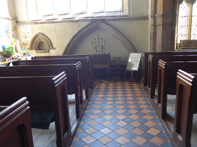
Inside St Giles, Hartington (XI)
Weather for this location
Next 14 daysNearby places
Useful places within 5 km
Wildlife to spot
7,130 records · National Biodiversity Network
Wildlife to spot
7,130 records · National Biodiversity Network🐦Birds43 species
summerautumn
2026▾
Carrion Crow · Magpie · Robin · Wren · Goldfinch +38
- Carrion CrowCorvus corone2025
- MagpiePica pica2025
- RobinErithacus rubecula2025
- WrenTroglodytes troglodytes2025
- GoldfinchCarduelis carduelis2025
- WoodpigeonColumba palumbus2025
- BlackbirdTurdus merula2025
- JackdawColoeus monedula2025
- Blue TitCyanistes caeruleus2025
- MallardAnas platyrhynchos2025
- RookCorvus frugilegus2025
- SwallowHirundo rustica2025
- ChiffchaffPhylloscopus collybita2025
- RavenCorvus corax2025
- Pied WagtailMotacilla alba2025
- Great TitParus major2025
- Lesser Black-backed GullLarus fuscus2025
- NuthatchSitta europaea2025
- Meadow PipitAnthus pratensis2025
- KestrelFalco tinnunculus2025
- Little OwlAthene noctua2025
- FieldfareTurdus pilaris
- Song ThrushTurdus philomelos2025
- ChaffinchFringilla coelebs2025
- Willow WarblerPhylloscopus trochilus2025
- WheatearOenanthe oenanthe2025
- MoorhenGallinula chloropus2025
- TreecreeperCerthia familiaris2025
- StarlingSturnus vulgaris2025
- Helmeted GuineafowlNumida meleagris2025
- Mistle ThrushTurdus viscivorus2025
- Coal TitPeriparus ater2025
- Black-headed GullChroicocephalus ridibundus2025
- DipperCinclus cinclus2025
- Herring GullLarus argentatus2025
- House SparrowPasser domesticus2025
- British Lesser Black-Backed GullLarus fuscus graellsii2025
- LinnetLinaria cannabina2025
- Long-tailed TitAegithalos caudatus2025
- SwiftApus apus2025
- House MartinDelichon urbicum2025
- RedstartPhoenicurus phoenicurus2025
- DunnockPrunella modularis2025
🦌Mammals2 species
summerautumnwinter
2025▾
Rabbit · Stoat
- RabbitOryctolagus cuniculus
- StoatMustela erminea
🐸Amphibians1 species
winter
2026▾
Great Crested Newt
- Great Crested NewtTriturus cristatus
Mesembrina meridiana · Juniper Shieldbug · Large Willow Aphid
- Mesembrina meridianaMesembrina meridiana
- Juniper ShieldbugCyphostethus tristriatus
- Large Willow AphidTuberolachnus (Tuberolachnus) salignus
Winter Aconite · Orpine · Blackthorn · Crested Hair-grass · Meadow Oat +12
- Winter AconiteEranthis hyemalis
- OrpineHylotelephium telephium2025
- BlackthornPrunus spinosa2025
- Crested Hair-grassKoeleria macrantha2025
- Meadow OatHelictochloa pratensis2025
- Glaucous SedgeCarex flacca
Species observations from the last 10 years via NBN Atlas
2025
2025
Herb-RobertGeranium robertianum2025Herb-RobertGeranium robertianum2025Hoary PlantainPlantago media2025Hoary PlantainPlantago media2025Rough HawkbitLeontodon hispidus2025Rough HawkbitLeontodon hispidus2025Sweet Vernal-grassAnthoxanthum odoratum2025Sweet Vernal-grassAnthoxanthum odoratum2025HollyIlex aquifolium2025HollyIlex aquifolium2025YarrowAchillea millefolium2025YarrowAchillea millefolium2025HarebellCampanula rotundifolia2025HarebellCampanula rotundifolia2025Yorkshire-fogHolcus lanatus2025Yorkshire-fogHolcus lanatus2025Sheep's Fescue agg.Festuca ovina2025Sheep's Fescue agg.Festuca ovina2025Festuca rubraFestuca rubra2025Festuca rubraFestuca rubra2025Common Bird's-foot-trefoilLotus corniculatus2025Common Bird's-foot-trefoilLotus corniculatus2025Events & activities nearby
Switch provider to compare local events, tours and bookable activities.