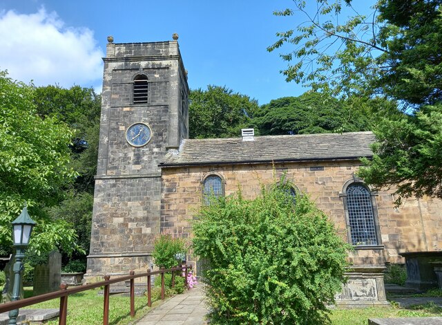
St James's Church
Getting here
53.77074, -1.66904
Visiting this summer
Seasonal nature notes and what to look for now
Visiting this summer
Seasonal nature notes and what to look for now
- 🌞Midsummer — early morning visits most comfortable; look for deer fawns in quieter clearings
- 🐕Early mornings are best for dog walks in summer — visit before 9am to avoid the heat and find quieter trails
- 🅿️Parking 186m away — 2 car parks within reach
🌤️ Visiting this summer
- 🌞Midsummer — early morning visits most comfortable; look for deer fawns in quieter clearings
- 🐕Early mornings are best for dog walks in summer — visit before 9am to avoid the heat and find quieter trails
- 🅿️Parking 186m away — 2 car parks within reach
Good to know
- £Free to visit — no entry charge
- 🐕Dogs welcome
Best for
Wildlife
Very strong match
Multi-group wildlife — Birds, Mammals; Multi-group wildlife — Birds, Mammals
Bird watching
Very strong match
Birds — Woodpigeon, Carrion Crow, Robin +62 more · last seen 2025; Birds — Woodpigeon, Carrion Crow, Robin +62 more · last seen 2025
Dog walks
Good match
Dogs allowed with public access
Foraging
Good match
Deciduous woodland — fungi, berries and wild garlic
Insect spotting
Good match
Insects — Red-legged Shieldbug, 7-spot Ladybird, Syrphus · last seen 2025; Insects — Red-legged Shieldbug, 7-spot Ladybird, Syrphus · last seen 2025
Seasonal nature
Good match
Plants — Fringed Bog-moss, Lustrous Bog-moss, Springy Turf-moss +3 more · last seen 2026; Plants — Fringed Bog-moss, Lustrous Bog-moss, Springy Turf-moss +3 more · last seen 2026
Trails nearby
Within roughly 5 km🚶Walking
5 signed routes nearby · 3 public paths nearby
Signed route nearbyPublic paths
Walking
Kirklees WayWalking route116 km
Bronte WayWalking route71 km
Calverley Millenium WayWalking route
Boundary walk around Calverley
Leeds Country WayWalking route
Airedale WayWalking route
🚴Cycling
27 signed routes nearby
Signed route nearby
Cycling
Route 66Cycling route
Cycle Superhighway 1Cycling route
Armley to Leeds City Centre Core Cycle RouteCycling route
Main RouteCycling route73 m
N/ACycling route1.5 km
Main RouteCycling route383 m
🐴Horse riding
1 public path nearby
Public paths
Horse riding
Keeper Lanebridleway · 655 m
Wildlife to spot
Photos
Weather for this location
Loading local forecast…
Nearby places
Useful places within 5 km
Own or manage this place?
Claim this listing to keep details accurate, add photos, and highlight what makes it special — free.
Claim this pageHow was your visit?
How useful was the information on this page?
id: 228f2b35-4088-4781-8165-b82d9273c415