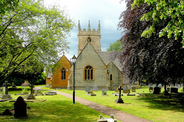
St James's Church
Getting here
52.08637, -1.89762
Visiting this summer
Seasonal nature notes and what to look for now
Visiting this summer
Seasonal nature notes and what to look for now
- 🌞Midsummer — early morning visits most comfortable; look for deer fawns in quieter clearings
- 🚴Start cycling visits early on summer days — trails are best before the heat builds via Route 41
- 🐕Dogs welcome — bring water in summer; the site has enough space to find shade on hot days
🌤️ Visiting this summer
- 🌞Midsummer — early morning visits most comfortable; look for deer fawns in quieter clearings
- 🚴Start cycling visits early on summer days — trails are best before the heat builds via Route 41
- 🐕Dogs welcome — bring water in summer; the site has enough space to find shade on hot days
Good to know
- £Free to visit — no entry charge
- 🐕Dogs welcome
Best for
Wildlife
Very strong match
Multi-group wildlife — Birds, Mammals; Multi-group wildlife — Birds, Mammals
Bird watching
Strong match
Birds — Woodpigeon, Jackdaw, Carrion Crow +45 more · last seen 2025; Birds — Woodpigeon, Jackdaw, Carrion Crow +45 more · last seen 2025
Cycling
Good match
Named cycling route nearby: Route 41
Dog walks
Good match
Dogs allowed with public access
Insect spotting
Good match
Insects — Migrant Hawker, Tortoise Bug, Common Red Soldier Beetle +11 more · last seen 2025; Insects — Migrant Hawker, Tortoise Bug, Common Red Soldier Beetle +11 more · last seen 2025
Heritage
Moderate match
Religious grounds — local heritage
Trails nearby
Within roughly 5 km🚶Walking
5 signed routes nearby · 22 public paths nearby
Signed route nearbyPublic paths
Walking
Shakespeare's Avon WayWalking route142 km
From the source at Naseby, Northamptonshire to the Severn at Tewkesbury
Donnington WayWalking route100 km
Middle Littleton Tithe Barn Walk, Middle LittletonWalking route9.9 km
Circular walk along the River Avon and field paths, country lanes with gates, stiles and bridges. Can be muddy when wet. Walking boots are recommended.
Wychavon WayWalking route67 km
A route from Holt Fleet on the River Severn to Winchcombe in the Cotswolds.
Isbourne WayWalking route
Monks Pathpublic footpath · 24 m
Monks Pathpublic footpath · 13 m
The Greenpublic footpath · 159 m
🚴Cycling
11 signed routes nearby
Signed route nearby
Cycling
Route 41Cycling route
Cotswold Line Cycle Route (under development)Cycling route
Cotswold Line Cycle RouteCycling route
Main RouteCycling route573 m
Main RouteCycling route1.4 km
Main RouteCycling route212 m
🐴Horse riding
1 public path nearby
Public paths
Horse riding
Sands Lanebridleway · 293 m
Wildlife to spot
Photos
Weather for this location
Loading local forecast…
Nearby places
Useful places within 5 km
Own or manage this place?
Claim this listing to keep details accurate, add photos, and highlight what makes it special — free.
Claim this pageHow was your visit?
How useful was the information on this page?
id: 8bae907e-06a7-42fb-87d2-1181840ed894