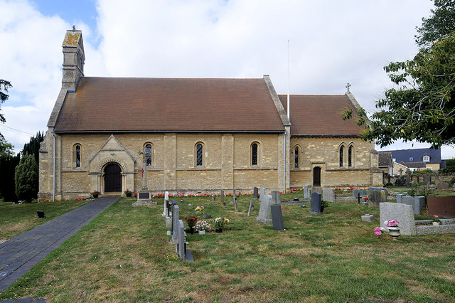
St John the Baptist's Church
Getting here
52.14672, -0.85404
Visiting this summer
Seasonal nature notes and what to look for now
Visiting this summer
Seasonal nature notes and what to look for now
- 🌞Midsummer — early morning visits most comfortable; look for deer fawns in quieter clearings
- 🐕Early mornings are best for dog walks in summer — visit before 9am to avoid the heat and find quieter trails
- 🅿️Parking 336m away — 2 car parks within reach
🌤️ Visiting this summer
- 🌞Midsummer — early morning visits most comfortable; look for deer fawns in quieter clearings
- 🐕Early mornings are best for dog walks in summer — visit before 9am to avoid the heat and find quieter trails
- 🅿️Parking 336m away — 2 car parks within reach
Good to know
- £Free to visit — no entry charge
- 🐕Dogs welcome
Best for
Wildlife
Very strong match
Multi-group wildlife — Amphibians, Birds, Mammals, Reptiles; Multi-group wildlife — Amphibians, Birds, Mammals, Reptiles
Bird watching
Very strong match
Birds — Carrion Crow, Woodpigeon, Blue Tit +52 more · last seen 2025; Birds — Carrion Crow, Woodpigeon, Blue Tit +52 more · last seen 2025
Insect spotting
Strong match
Insects — Eristalis pertinax, Marmalade Hoverfly, Rutpela maculata +118 more · last seen 2025; Insects — Eristalis pertinax, Marmalade Hoverfly, Rutpela maculata +118 more · last seen 2025
Seasonal nature
Strong match
Plants — Meadow Vetchling, Enchanter's-nightshade, Bush Vetch +59 more · last seen 2025; Plants — Meadow Vetchling, Enchanter's-nightshade, Bush Vetch +59 more · last seen 2025
Dog walks
Good match
Dogs allowed with public access
Cycling
Good match
Named cycling route nearby: Route 6
Trails nearby
Within roughly 5 km🚶Walking
6 signed routes nearby · 12 public paths nearby
Signed route nearbyPublic paths
Walking
Midshires WayWalking route370 km
Multi-use trail links the Ridgeway National Trail with the Trans Pennine Trail
Grand Union Canal WalkWalking route
Napton to Coy Carp section
Northamptonshire RoundWalking route
Milton Keynes Boundary WalkWalking route
Three Shires WayWalking route79 km
49 mile route liking the Swan's Way to the Grafham Water circular walk, which it now incorporates, made up largely of bridleways.
Forest Viewpublic footpath · 59 m
🚴Cycling
9 signed routes nearby
Signed route nearby
Cycling
Route 6Cycling route
Main RouteCycling route3.5 km
Main RouteCycling route2.2 km
Main RouteCycling route1.5 km
Main RouteCycling route2.3 km
Main RouteCycling route1.1 km
🐴Horse riding
4 public paths nearby
Public paths
Horse riding
No named routes yet. Public paths are shown on the map.
Wildlife to spot
Photos
Weather for this location
Loading local forecast…
Nearby places
Useful places within 5 km
Own or manage this place?
Claim this listing to keep details accurate, add photos, and highlight what makes it special — free.
Claim this pageHow was your visit?
How useful was the information on this page?
id: 503d2013-48e4-4aab-8a5d-f4587aa07a06