St John the Baptist's Church
Getting here
51.55309, -1.14821
Visiting this summer
Seasonal nature notes and what to look for now
Visiting this summer
Seasonal nature notes and what to look for now
- 🌞Midsummer — early morning visits most comfortable; look for deer fawns in quieter clearings
- 🥾Walking is best here in early morning in summer — quiet trails and good light before the heat — European walking route E2 west, UK, South East England passes nearby
- 🐕Dogs welcome — bring water in summer; the site has enough space to find shade on hot days
🌤️ Visiting this summer
- 🌞Midsummer — early morning visits most comfortable; look for deer fawns in quieter clearings
- 🥾Walking is best here in early morning in summer — quiet trails and good light before the heat — European walking route E2 west, UK, South East England passes nearby
- 🐕Dogs welcome — bring water in summer; the site has enough space to find shade on hot days
Good to know
- £Free to visit — no entry charge
- 🐕Dogs welcome
Best for
Wildlife
Very strong match
Multi-group wildlife — Amphibians, Birds, Mammals, Reptiles; Multi-group wildlife — Amphibians, Birds, Mammals, Reptiles
Bird watching
Very strong match
Birds — Blackbird, Chiffchaff, Woodpigeon +59 more · last seen 2026; Birds — Blackbird, Chiffchaff, Woodpigeon +59 more · last seen 2026
Insect spotting
Strong match
Insects — Glow-worm, Banded Demoiselle, Southern Hawker +281 more · last seen 2026; Insects — Glow-worm, Banded Demoiselle, Southern Hawker +281 more · last seen 2026
Hiking
Good match
Named hiking route nearby: European walking route E2 west, UK, South East England
Dog walks
Good match
Dogs allowed with public access
Seasonal nature
Good match
Plants — Dewberry, Wild Clary, Common Feather-moss +4 more · last seen 2025; Plants — Dewberry, Wild Clary, Common Feather-moss +4 more · last seen 2025
Trails nearby
Within roughly 5 km🚶Walking
9 signed routes nearby · 20 public paths nearby
Signed route nearbyPublic paths
Walking
The RidgewayWalking route140 km
The Chiltern Way Southern ExtensionWalking route
Long distance path
The Roman WayWalking route274.5 km
European walking route E2 west, UK, South East EnglandWalking route
Westroute: Stranraer (UK) - Birminhgham (UK) - Calais (FR) - Zoersel (BE) / Eastroute: Stranraer (UK) - Harwich (UK) - Rotterdam (NL) - Zoersel (BE) / Both Routes: Zoersel (BE) - Maastrich (NL) - Luxembourg (LUX) - Lake Geneva (CH) - Nice (FR)
West Berkshire Countryside Walk, Goring GapWalking route11.2 km
Enjoy this circular spanning Lardon Chase, the Holies & Lough Down. Explore a variety of landscapes, spot rare butterflies & admire views of the Chiltern Hills, North Wessex Downs & Goring Gap. Sections may be challenging for people with reduced mobility.
North Roadpublic footpath · 81 m
Willow Court Lanepublic footpath · 97 m
Willow Court Lanepublic footpath · 174 m
🚴Cycling
8 signed routes nearby
Signed route nearby
Cycling
National Cycle Network Route 5Cycling route
Round Berkshire Cycle RouteCycling route
Chilterns CyclewayCycling route
Main RouteCycling route131 m
Main RouteCycling route121 m
Main RouteCycling route86 m
🚵Mountain biking
2 signed routes nearby
Signed route nearby
Mountain biking
Judges' RideMountain bike route
King Alfred's WayMountain bike route
King Alfreds Way is 350km (220 miles) off road route designed to be ridden clockwise. It starts & ends in Winchester. It is suitable for gravel or cross-country bikes.
🐴Horse riding
2 public paths nearby
Public paths
Horse riding
No named routes yet. Public paths are shown on the map.
Wildlife to spot
Photos
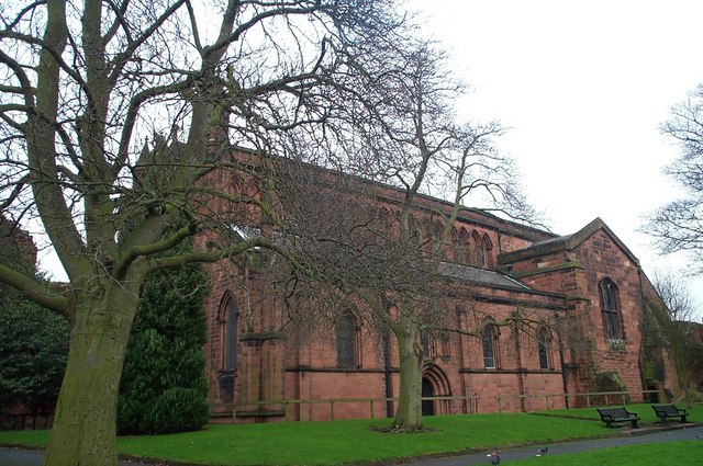
St John the Baptist's Church, Chester
Weather for this location
Loading local forecast…
Nearby places
Useful places within 5 km
Own or manage this place?
Claim this listing to keep details accurate, add photos, and highlight what makes it special — free.
Claim this pageHow was your visit?
How useful was the information on this page?
id: 765ab032-9091-44ca-ae08-d5b46a3ca1f4