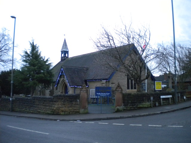
St John's Church
Getting here
53.02654, -1.33555
Visiting this summer
Seasonal nature notes and what to look for now
Visiting this summer
Seasonal nature notes and what to look for now
- 🐦76+ species recorded in this area — summer evenings are best for activity; watch for Robin and Great Tit
- 🐕Early mornings are best for dog walks in summer — visit before 9am to avoid the heat and find quieter trails
- 🅿️Parking 488m away — 4 car parks within reach
🌤️ Visiting this summer
- 🐦76+ species recorded in this area — summer evenings are best for activity; watch for Robin and Great Tit
- 🐕Early mornings are best for dog walks in summer — visit before 9am to avoid the heat and find quieter trails
- 🅿️Parking 488m away — 4 car parks within reach
Good to know
- £Free to visit — no entry charge
- 🐕Dogs welcome
Best for
Bird watching
Very strong match
Birds — Robin, Great Tit, Blackbird +73 more · last seen 2025; Birds — Robin, Great Tit, Blackbird +73 more · last seen 2025
Wildlife
Very strong match
Multi-group wildlife — Birds, Mammals; Multi-group wildlife — Birds, Mammals
Dog walks
Good match
Dogs allowed with public access
Insect spotting
Good match
Insects — Migrant Hawker · last seen 2025; Insects — Migrant Hawker · last seen 2025
Cycling
Good match
Named cycling route nearby: Broxtowe Country Trail
Seasonal nature
Good match
Plants — Bristly Oxtongue, Herb-Robert, Wild Teasel +1 more · last seen 2026; Plants — Bristly Oxtongue, Herb-Robert, Wild Teasel +1 more · last seen 2026
Trails nearby
Within roughly 5 km🚶Walking
17 signed routes nearby · 5 public paths nearby
Signed route nearbyPublic paths
Walking
6 of the best Circular WalkWalking route
Another 6 of the best Circular WalkWalking route
Amber Valley Routeway Walk 18Walking route
Amber Valley Routeway Walk 6Walking route
Erewash Circular Walk 11Walking route
🚴Cycling
17 signed routes nearby
Signed route nearby
Cycling
Broxtowe Country TrailCycling route
Bennerley Viaduct ViewpointCycling route
Ripley GreenwayCycling route
Bennerley ViaductCycling route
Route 67Cycling route
Erewash Valley TrailCycling route
🐴Horse riding
2 public paths nearby
Public paths
Horse riding
Stoney Lanerestricted byway · 114 m
Stoney Lanerestricted byway · 335 m
Wildlife to spot
Photos
Weather for this location
Loading local forecast…
Nearby places
Useful places within 5 km
Own or manage this place?
Claim this listing to keep details accurate, add photos, and highlight what makes it special — free.
Claim this pageHow was your visit?
How useful was the information on this page?
id: 3cb7e0e3-9628-4969-a32a-464b2bc8812e