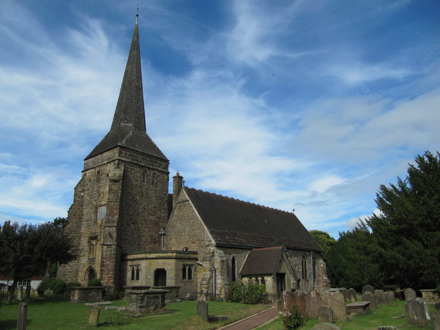
St Margaret's Church
Getting here
51.07601, -0.05491
Visiting this summer
Seasonal nature notes and what to look for now
Visiting this summer
Seasonal nature notes and what to look for now
- 🌞Midsummer — early morning visits most comfortable; look for deer fawns in quieter clearings
- 🌿Foraging is at its best in summer here
- ⛺Camping available here — summer nights at this site are worth planning around
🌤️ Visiting this summer
- 🌞Midsummer — early morning visits most comfortable; look for deer fawns in quieter clearings
- 🌿Foraging is at its best in summer here
- ⛺Camping available here — summer nights at this site are worth planning around
Good to know
- £Free to visit — no entry charge
- 🐕Dogs welcome
Best for
Wildlife
Very strong match
Multi-group wildlife — Amphibians, Birds, Mammals; Multi-group wildlife — Amphibians, Birds, Mammals
Bird watching
Very strong match
Birds — Moorhen, Blackbird, Robin +71 more · last seen 2025; Birds — Moorhen, Blackbird, Robin +71 more · last seen 2025
Foraging
Strong match
Plants — Hazel, Common Nettle, Beech +11 more foraging species; Deciduous woodland — fungi, berries and wild garlic
Picnic day out
Strong match
picnic area, car park
Seasonal nature
Strong match
Plants — Hazel, Creeping Thistle, Common Nettle +108 more · last seen 2025; Plants — Hazel, Creeping Thistle, Common Nettle +108 more · last seen 2025
Insect spotting
Strong match
Insects — Rhododendron Leafhopper, Nalassus laevioctostriatus, Marmalade Hoverfly +17 more · last seen 2025; Insects — Rhododendron Leafhopper, Nalassus laevioctostriatus, Marmalade Hoverfly +17 more · last seen 2025
Trails nearby
Within roughly 5 km🚶Walking
14 signed routes nearby · 25 public paths nearby
Signed route nearbyPublic paths
Walking
William Robinson Woodland TrailWalking route
Sussex Ouse Valley WayWalking route67 km
Worth WayWalking route
Standen TrailWalking route
Bluebell Walk at StandenWalking route4.8 km
This moderate walk takes in the whole Standen Estate & wider countryside. If you visit in April and early May, you'll see the carpet of bluebells and spring flowers in Rockinghill Wood. Hills, rough ground & one steep slope. Not suitable for wheels.
Sandy Lanepublic footpath · 96 m
Woodsidepublic footpath · 67 m
Garden Meadpublic footpath · 57 m
🚴Cycling
17 signed routes nearby
Signed route nearby
Cycling
Avenue Verte London ↔ ParisCycling route
English part of Avenue Verte London ↔ Paris, an international cycle route that connects the two capital cities
Route 21Cycling route
National Cycle Route 20 Crawley - Pyecombe (proposed)Cycling route
Main RouteCycling route26 m
Main RouteCycling route283 m
Main RouteCycling route585 m
🚵Mountain biking
1 signed route nearby
Signed route nearby
Mountain biking
Deers Leap Main TrailMountain bike route
🐴Horse riding
2 public paths nearby
Public paths
Horse riding
Hook Lanebridleway · 1.1 km
Wildlife to spot
Photos
Weather for this location
Loading local forecast…
Nearby places
Useful places within 5 km
Own or manage this place?
Claim this listing to keep details accurate, add photos, and highlight what makes it special — free.
Claim this pageHow was your visit?
How useful was the information on this page?
id: ed91f9a6-ea25-417c-af27-5854ebbdc123