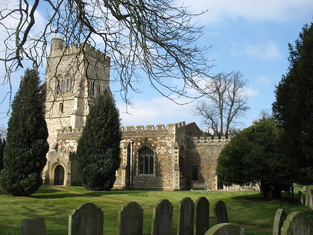
St Mary's Church
Getting here
52.03485, -0.28340
Visiting this summer
Seasonal nature notes and what to look for now
Visiting this summer
Seasonal nature notes and what to look for now
- 🐦65+ species recorded in this area — summer evenings are best for activity; watch for Jackdaw and Woodpigeon
- 🐕Early mornings are best for dog walks in summer — visit before 9am to avoid the heat and find quieter trails
- ⛺Camping available here — summer nights at this site are worth planning around
🌤️ Visiting this summer
- 🐦65+ species recorded in this area — summer evenings are best for activity; watch for Jackdaw and Woodpigeon
- 🐕Early mornings are best for dog walks in summer — visit before 9am to avoid the heat and find quieter trails
- ⛺Camping available here — summer nights at this site are worth planning around
Good to know
- £Free to visit — no entry charge
- 🐕Dogs welcome
Best for
Bird watching
Very strong match
Birds — Jackdaw, Woodpigeon, Rook +62 more · last seen 2025; Birds — Jackdaw, Woodpigeon, Rook +62 more · last seen 2025
Wildlife
Strong match
Deciduous woodland priority habitat; Birds — Jackdaw, Woodpigeon, Rook +62 more · last seen 2025
Dog walks
Good match
Dogs allowed with public access
Foraging
Good match
Deciduous woodland — fungi, berries and wild garlic
Hiking
Moderate match
Named hiking route nearby: Kingfisher Way
Heritage
Moderate match
Religious grounds — local heritage
Trails nearby
Within roughly 5 km🚶Walking
8 signed routes nearby · 22 public paths nearby
Signed route nearbyPublic paths
Walking
John Bunyan TrailWalking route
Kingfisher WayWalking route
Biggleswade Green WheelWalking route
Garden City 15Walking route
Letchworth GreenwayWalking route
13.6 mile (21.8km) walking route around Letchworth
Harrier Millpublic footpath · 158 m
Coach Roadpublic footpath · 235 m
Millenium Meadow Bridgepublic footpath · 3 m
🚴Cycling
32 signed routes nearby
Signed route nearby
Cycling
Greensand CyclewayCycling route59 km
Route 12Cycling route
Route 12Cycling route
Main RouteCycling route41 m
Main RouteCycling route134 m
Main RouteCycling route334 m
🐴Horse riding
7 public paths nearby
Public paths
Horse riding
No named routes yet. Public paths are shown on the map.
Wildlife to spot
Photos
Weather for this location
Loading local forecast…
Nearby places
Useful places within 5 km
Own or manage this place?
Claim this listing to keep details accurate, add photos, and highlight what makes it special — free.
Claim this pageHow was your visit?
How useful was the information on this page?
id: 31822163-fdcd-401b-bc0b-5ce765318cb0