🐦44+ species recorded in this area — summer evenings are best for activity; watch for Wigeon and Great Tit
☀️Summer family visits work well here — arrive early and plan for a longer stay
🐾Meadwell Farmshop on site — a good way to combine wildlife and an animal visit in the same trip
🌤️ Visiting this summer
🐦44+ species recorded in this area — summer evenings are best for activity; watch for Wigeon and Great Tit
☀️Summer family visits work well here — arrive early and plan for a longer stay
🐾Meadwell Farmshop on site — a good way to combine wildlife and an animal visit in the same trip
Good to know
£Free to visit — no entry charge
🐕Dogs welcome
🅿️Parking🛝Playground🐄Farm visit
Best for
10 activities
🦅
Bird watching
Very strong match
Birds — Wigeon, Great Tit, Woodpigeon +41 more · last seen 2026
Free
🦉
Wildlife
Strong match
Birds — Wigeon, Great Tit, Woodpigeon +41 more · last seen 2026
Free
🦋
Insect spotting
Strong match
Insects — Green Shieldbug, Southern Hawker, 7-spot Ladybird +167 more · last seen 2026
Free
🎠
Playgrounds
Strong match
playground, parking
Free
✦
Heritage
Strong match
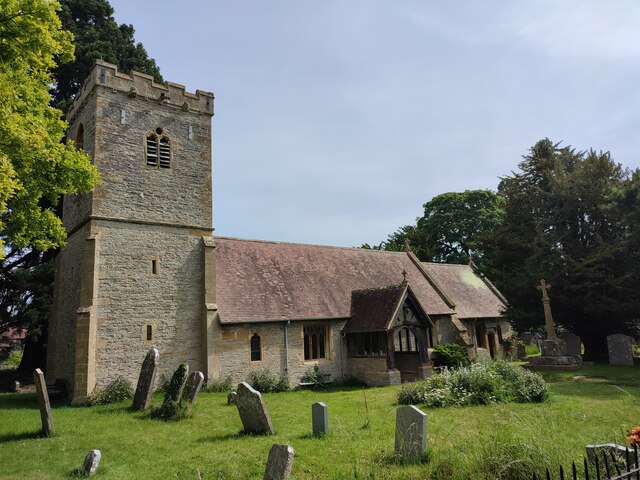
Grade II* listed building: CHURCH OF ST MICHAEL; Religious grounds — local heritage
Free
🛝
Family friendly
Strong match
playground
Free
Trails nearby
Within roughly 5 km
🚶
Walking
▾
6 signed routes nearby · 10 public paths nearby
Signed route nearbyPublic paths
Heart of England WayWalking route▾
Named routeListed length 161kmRegional walking route
Shakespeare's Avon WayWalking route142 km▾
From the source at Naseby, Northamptonshire to the Severn at Tewkesbury
Named routeRef SAWLength 142 kmRegional walking route
Middle Littleton Tithe Barn Walk, Middle LittletonWalking route9.9 km▾
Circular walk along the River Avon and field paths, country lanes with gates, stiles and bridges. Can be muddy when wet. Walking boots are recommended.
Named routeLength 9.9 kmDuration 04:00Round tripLocal walking route
Wychavon WayWalking route67 km▾
A route from Holt Fleet on the River Severn to Winchcombe in the Cotswolds.
Named routeRef WyWLength 67 kmRegional walking route
E2 hiking trail BirminghamWalking route▾
Named routeNational walking route
🚴
Cycling
▾
13 signed routes nearby
Signed route nearby
Route 41Cycling route▾
Named routeRef 41National Cycle Network
Cotswold Line Cycle RouteCycling route▾
Named routeRef 442National Cycle Network
Cotswold Line Cycle Route (under development)Cycling route▾
Named routeRef 442National Cycle Network
Main RouteCycling route573 m▾
Named routeRef 442Length 573 mNational Cycle NetworkOn-roadSurface asphalt
Main RouteCycling route1.4 km▾
Named routeRef 41Length 1.4 kmNational Cycle NetworkTraffic-freeSurface asphalt
Main RouteCycling route212 m▾
Named routeRef 41Length 212 mNational Cycle NetworkTraffic-freeSurface asphalt
🐴
Horse riding
▾
4 public paths nearby
Public paths
Church Lanebridleway · 83 m▾
Public pathbridlewayLength 83 mSurface asphaltPath type: unclassified