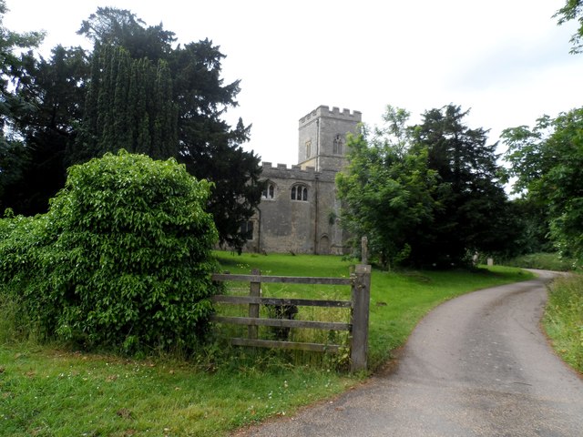
St Peter's Church
Getting here
52.11659, -0.61333
Visiting this summer
Seasonal nature notes and what to look for now
Visiting this summer
Seasonal nature notes and what to look for now
- 🐦75+ species recorded in this area — summer evenings are best for activity; watch for Blackbird and Woodpigeon
- 🐕Early mornings are best for dog walks in summer — visit before 9am to avoid the heat and find quieter trails
- 🅿️Parking 393m away — 2 car parks within reach
🌤️ Visiting this summer
- 🐦75+ species recorded in this area — summer evenings are best for activity; watch for Blackbird and Woodpigeon
- 🐕Early mornings are best for dog walks in summer — visit before 9am to avoid the heat and find quieter trails
- 🅿️Parking 393m away — 2 car parks within reach
Good to know
- £Free to visit — no entry charge
- 🐕Dogs welcome
Best for
Bird watching
Very strong match
Birds — Blackbird, Woodpigeon, Jackdaw +72 more · last seen 2025; Birds — Blackbird, Woodpigeon, Jackdaw +72 more · last seen 2025
Wildlife
Very strong match
Multi-group wildlife — Birds, Mammals; Multi-group wildlife — Birds, Mammals
Dog walks
Good match
Dogs allowed with public access
Hiking
Good match
Named hiking route nearby: Milton Keynes Boundary Walk
Insect spotting
Good match
Insects — Syritta pipiens, Corizus hyoscyami, Hairy Shieldbug · last seen 2025; Insects — Syritta pipiens, Corizus hyoscyami, Hairy Shieldbug · last seen 2025
Heritage
Moderate match
Religious grounds — local heritage
Trails nearby
Within roughly 5 km🚶Walking
8 signed routes nearby · 1 public path nearby
Signed route nearbyPublic paths
Walking
Clay WayWalking route
Milton Keynes Boundary WalkWalking route
Jubilee WalkWalking route10.5 km
Three Shires WayWalking route79 km
49 mile route liking the Swan's Way to the Grafham Water circular walk, which it now incorporates, made up largely of bridleways.
John Bunyan TrailWalking route
🚴Cycling
13 signed routes nearby
Signed route nearby
Cycling
NCN 51Cycling route
National Byway (Beds)Cycling route
Route 4Cycling route
Main RouteCycling route320 m
Main RouteCycling route1.3 km
Main RouteCycling route110 m
🐴Horse riding
1 public path nearby
Public paths
Horse riding
No named routes yet. Public paths are shown on the map.
Wildlife to spot
Photos
Weather for this location
Loading local forecast…
Nearby places
Useful places within 5 km
Own or manage this place?
Claim this listing to keep details accurate, add photos, and highlight what makes it special — free.
Claim this pageHow was your visit?
How useful was the information on this page?
id: 0fde6551-07db-4d4d-9464-0d9c7f1112c0